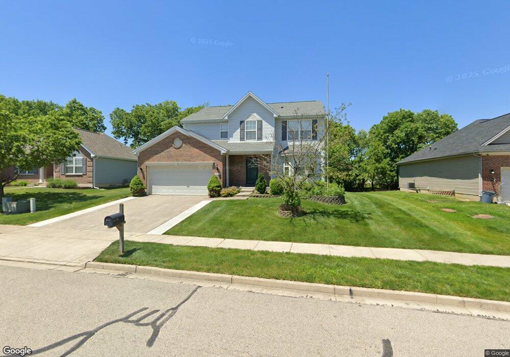
2289 Weston Dr Fairborn, OH 45324
Estimated Value: $344,639 - $366,000
4
Beds
3
Baths
1,991
Sq Ft
$180/Sq Ft
Est. Value
About This Home
This home is located at 2289 Weston Dr, Fairborn, OH 45324 and is currently estimated at $358,410, approximately $180 per square foot. 2289 Weston Dr is a home located in Greene County with nearby schools including Fairborn Primary School, Fairborn Intermediate School, and Fairborn Middle School.
Ownership History
Date
Name
Owned For
Owner Type
Purchase Details
Closed on
Apr 30, 2004
Sold by
Inverness Group Inc
Bought by
Fuhrman Thomas R
Current Estimated Value
Home Financials for this Owner
Home Financials are based on the most recent Mortgage that was taken out on this home.
Original Mortgage
$148,000
Outstanding Balance
$69,391
Interest Rate
5.5%
Mortgage Type
Unknown
Estimated Equity
$289,019
Purchase Details
Closed on
Nov 17, 2003
Sold by
Hills Land & Development Co
Bought by
Inverness Group Inc
Home Financials for this Owner
Home Financials are based on the most recent Mortgage that was taken out on this home.
Original Mortgage
$10,000,000
Interest Rate
6.01%
Mortgage Type
Credit Line Revolving
Create a Home Valuation Report for This Property
The Home Valuation Report is an in-depth analysis detailing your home's value as well as a comparison with similar homes in the area
Home Values in the Area
Average Home Value in this Area
Purchase History
| Date | Buyer | Sale Price | Title Company |
|---|---|---|---|
| Fuhrman Thomas R | $186,300 | -- | |
| Inverness Group Inc | $63,200 | -- |
Source: Public Records
Mortgage History
| Date | Status | Borrower | Loan Amount |
|---|---|---|---|
| Open | Fuhrman Thomas R | $148,000 | |
| Previous Owner | Inverness Group Inc | $10,000,000 | |
| Closed | Fuhrman Thomas R | $27,750 |
Source: Public Records
Tax History Compared to Growth
Tax History
| Year | Tax Paid | Tax Assessment Tax Assessment Total Assessment is a certain percentage of the fair market value that is determined by local assessors to be the total taxable value of land and additions on the property. | Land | Improvement |
|---|---|---|---|---|
| 2024 | $4,551 | $97,340 | $16,620 | $80,720 |
| 2023 | $4,551 | $97,340 | $16,620 | $80,720 |
| 2022 | $4,088 | $72,460 | $13,850 | $58,610 |
| 2021 | $4,150 | $72,460 | $13,850 | $58,610 |
| 2020 | $4,174 | $72,460 | $13,850 | $58,610 |
| 2019 | $3,568 | $61,940 | $12,290 | $49,650 |
| 2018 | $3,608 | $61,940 | $12,290 | $49,650 |
| 2017 | $3,546 | $61,940 | $12,290 | $49,650 |
| 2016 | $3,547 | $60,780 | $12,290 | $48,490 |
| 2015 | $3,383 | $60,780 | $12,290 | $48,490 |
| 2014 | $3,275 | $60,780 | $12,290 | $48,490 |
Source: Public Records
Map
Nearby Homes
- 1395 Brookstone Dr
- 1281 Whitetail Dr
- 3488 Byron Rd
- 1105 Windsong Trail
- 1788 Fawnwood Ct
- 00 Trebein Rd
- 1878 Spring Meadows Dr
- 1088 Brehm Blvd
- Lot 1 Trebein Rd
- 1309 Candlelite Ln
- 1506 Indigo Dr
- 631 Westwood Dr
- 1101 Arden Way
- DaVinci Plan at Arden Place - Maple Street Collection
- Danville Plan at Arden Place - Maple Street Collection
- Denali Plan at Arden Place - Maple Street Collection
- Jensen Plan at Arden Place - Maple Street Collection
- Breckenridge Plan at Arden Place - Maple Street Collection
- Greenbriar Plan at Arden Place - Maple Street Collection
- Fairfax Plan at Arden Place - Maple Street Collection
- 2283 Weston Dr
- 2295 Weston Dr
- 1412 Brookstone Dr
- 2275 Weston Dr
- 2303 Weston Dr
- 1406 Brookstone Dr
- 2288 Weston Dr
- 2294 Weston Dr
- 1427 Guardian Ct
- 1418 Brookstone Dr
- 1419 Guardian Ct
- 2267 Weston Dr
- 2280 Weston Dr
- 2300 Weston Dr
- 2311 Weston Dr
- 2272 Weston Dr
- 1420 Brookstone Dr
- 2308 Weston Dr
- 2300 Watchtower Ln
- 2259 Weston Dr