
Seller's Agent in 2025
Lula Cosby
Coldwell Banker Heritage
(937) 206-1836
59 in this area
73 Total Sales
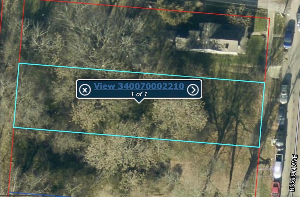
Prime vacant lot is loaded with mature trees. Measures 50x191. Near public transportation and shopping.
Last Agent to Sell the Property
Coldwell Banker Heritage License #413216 Listed on: 10/18/2024
| Date | Event | Price | List to Sale | Price per Sq Ft |
|---|---|---|---|---|
| 04/25/2025 04/25/25 | Sold | $3,500 | -36.4% | -- |
| 04/18/2025 04/18/25 | Pending | -- | -- | -- |
| 04/15/2025 04/15/25 | Price Changed | $5,500 | -26.7% | -- |
| 11/05/2024 11/05/24 | Price Changed | $7,500 | -6.3% | -- |
| 10/18/2024 10/18/24 | For Sale | $8,000 | -- | -- |
Seller's Agent in 2025
Lula Cosby
Coldwell Banker Heritage
(937) 206-1836
59 in this area
73 Total Sales
J
Buyer's Agent in 2025
John Michael Hart
Assist2Sell Your Home Listed/Sold
(937) 342-9092
46 in this area
49 Total Sales
Source: Western Regional Information Systems & Technology (WRIST)
MLS Number: 1035135
Disclaimer: Certain information contained herein is derived from information provided by parties other than Homes.com. All information provided is deemed reliable, but is not guaranteed to be accurate and should be independently verified.
![]() IDX information is provided exclusively for personal, non-commercial use, and may not be used for any purpose other than to identify prospective properties consumers may be interested in purchasing.
IDX information is provided exclusively for personal, non-commercial use, and may not be used for any purpose other than to identify prospective properties consumers may be interested in purchasing.
Ask me questions while you tour the home.