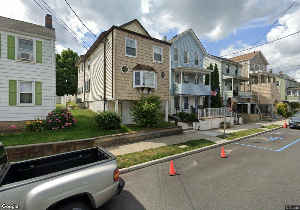
229 Catherine St South Amboy, NJ 08879
Estimated Value: $336,000 - $402,000
--
Bed
--
Bath
1,120
Sq Ft
$340/Sq Ft
Est. Value
About This Home
This home is located at 229 Catherine St, South Amboy, NJ 08879 and is currently estimated at $380,756, approximately $339 per square foot. 229 Catherine St is a home located in Middlesex County with nearby schools including South Amboy Elementary School, South Amboy Middle/High School, and St. Mary Elementary School.
Ownership History
Date
Name
Owned For
Owner Type
Purchase Details
Closed on
Sep 15, 2003
Sold by
Roth Robert W
Bought by
Roth David L and Roth Caryn
Current Estimated Value
Home Financials for this Owner
Home Financials are based on the most recent Mortgage that was taken out on this home.
Original Mortgage
$119,000
Interest Rate
5.81%
Purchase Details
Closed on
Feb 6, 2001
Sold by
Osmanski Martha
Bought by
Roth Robert and Roth David
Create a Home Valuation Report for This Property
The Home Valuation Report is an in-depth analysis detailing your home's value as well as a comparison with similar homes in the area
Home Values in the Area
Average Home Value in this Area
Purchase History
| Date | Buyer | Sale Price | Title Company |
|---|---|---|---|
| Roth David L | -- | -- | |
| Roth Robert | $90,000 | -- |
Source: Public Records
Mortgage History
| Date | Status | Borrower | Loan Amount |
|---|---|---|---|
| Previous Owner | Roth David L | $119,000 |
Source: Public Records
Tax History Compared to Growth
Tax History
| Year | Tax Paid | Tax Assessment Tax Assessment Total Assessment is a certain percentage of the fair market value that is determined by local assessors to be the total taxable value of land and additions on the property. | Land | Improvement |
|---|---|---|---|---|
| 2025 | $6,774 | $211,100 | $122,500 | $88,600 |
| 2024 | $6,519 | $211,100 | $122,500 | $88,600 |
| 2023 | $6,519 | $211,100 | $122,500 | $88,600 |
| 2022 | $6,194 | $211,100 | $122,500 | $88,600 |
| 2021 | $6,090 | $211,100 | $122,500 | $88,600 |
| 2020 | $5,947 | $211,100 | $122,500 | $88,600 |
| 2019 | $5,852 | $211,100 | $122,500 | $88,600 |
| 2018 | $5,803 | $211,100 | $122,500 | $88,600 |
| 2017 | $5,710 | $211,100 | $122,500 | $88,600 |
| 2016 | $5,567 | $211,100 | $122,500 | $88,600 |
| 2015 | $5,607 | $211,100 | $122,500 | $88,600 |
| 2014 | $5,415 | $211,100 | $122,500 | $88,600 |
Source: Public Records
Map
Nearby Homes
- 224 Gordon St
- 237 George St
- 223 Henry St
- 322 George St
- 123 S Stevens Ave
- 221 S Pine Ave
- 111 John St
- 101 N Stevens Ave
- 365 John St
- 112 N Broadway Unit C
- 326 David St
- 100 John T O Leary Blvd Unit 427
- 100 John T O Leary Blvd Unit 322
- 363 Portia St
- 92 S Shore Dr
- 3 Great Beds Way
- 251 Church St
- 433 Gordon St
- 6 Osprey Dr
- 442 Bordentown Ave
- 227 Catherine St
- 231 Catherine St
- 225 Catherine St
- 233 Catherine St
- 221 Catherine St
- 226 Gordon St
- 228 Gordon St
- 220 Gordon St
- 230 Gordon St
- 241 Catherine St
- 219 Catherine St
- 224 Catherine St
- 216 Gordon St
- 222 Catherine St
- 232 Gordon St
- 243 Catherine St
- 215 Catherine St
- 220 Catherine St
- 218 Catherine St
- 240 Gordon St