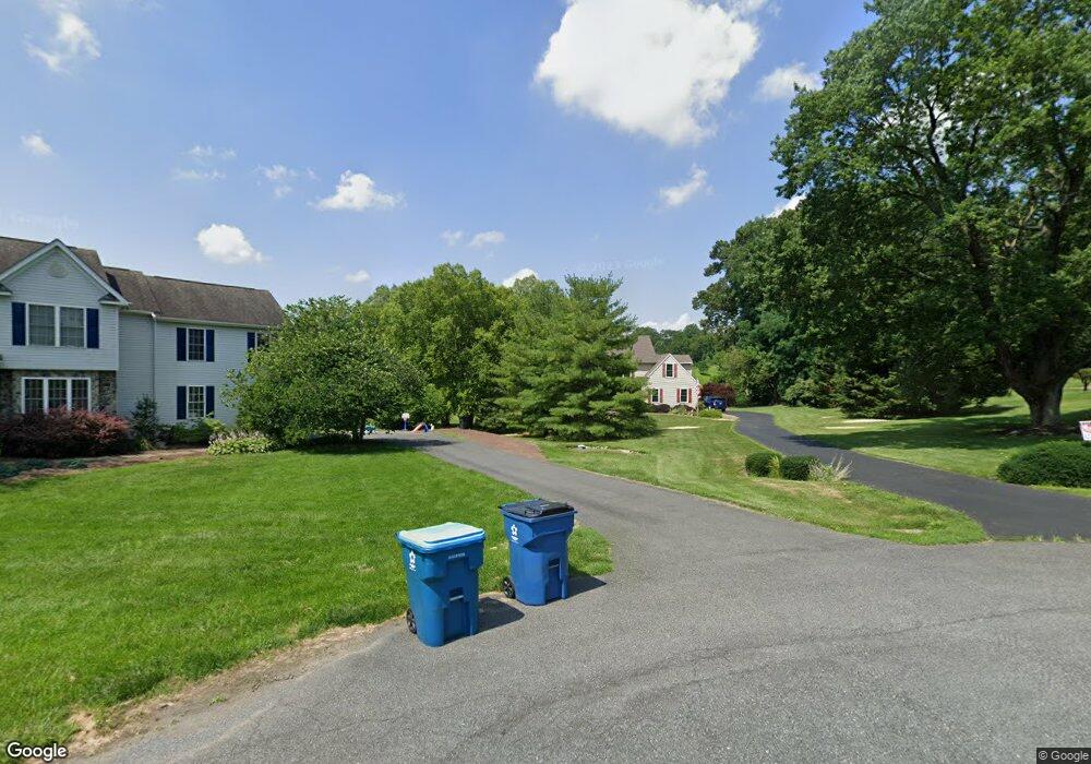
229 Cedar Crest Ln Kennett Square, PA 19348
Estimated Value: $656,000 - $916,000
4
Beds
3
Baths
2,851
Sq Ft
$273/Sq Ft
Est. Value
About This Home
This home is located at 229 Cedar Crest Ln, Kennett Square, PA 19348 and is currently estimated at $778,464, approximately $273 per square foot. 229 Cedar Crest Ln is a home located in Chester County with nearby schools including Kennett Middle School, Kennett High School, and St. Patrick School.
Ownership History
Date
Name
Owned For
Owner Type
Purchase Details
Closed on
Dec 20, 2002
Sold by
Kahn David S
Bought by
Nash James S and Nash Barbara A
Current Estimated Value
Home Financials for this Owner
Home Financials are based on the most recent Mortgage that was taken out on this home.
Original Mortgage
$250,000
Outstanding Balance
$106,923
Interest Rate
6.18%
Estimated Equity
$671,541
Purchase Details
Closed on
Apr 19, 2002
Sold by
Bonifacino Frederick H and Bonafacino Marie D
Bought by
Kahn David S
Create a Home Valuation Report for This Property
The Home Valuation Report is an in-depth analysis detailing your home's value as well as a comparison with similar homes in the area
Home Values in the Area
Average Home Value in this Area
Purchase History
| Date | Buyer | Sale Price | Title Company |
|---|---|---|---|
| Nash James S | $357,110 | -- | |
| Kahn David S | $53,500 | -- |
Source: Public Records
Mortgage History
| Date | Status | Borrower | Loan Amount |
|---|---|---|---|
| Open | Nash James S | $250,000 | |
| Closed | Nash James S | $70,000 |
Source: Public Records
Tax History Compared to Growth
Tax History
| Year | Tax Paid | Tax Assessment Tax Assessment Total Assessment is a certain percentage of the fair market value that is determined by local assessors to be the total taxable value of land and additions on the property. | Land | Improvement |
|---|---|---|---|---|
| 2025 | $8,747 | $218,400 | $51,890 | $166,510 |
| 2024 | $8,747 | $218,400 | $51,890 | $166,510 |
| 2023 | $8,454 | $218,400 | $51,890 | $166,510 |
| 2022 | $8,330 | $218,400 | $51,890 | $166,510 |
| 2021 | $8,246 | $218,400 | $51,890 | $166,510 |
| 2020 | $8,089 | $218,400 | $51,890 | $166,510 |
| 2019 | $7,980 | $218,400 | $51,890 | $166,510 |
| 2018 | $7,855 | $218,400 | $51,890 | $166,510 |
| 2017 | $7,694 | $218,400 | $51,890 | $166,510 |
| 2016 | $1,301 | $218,400 | $51,890 | $166,510 |
| 2015 | $1,301 | $218,400 | $51,890 | $166,510 |
| 2014 | $1,301 | $218,400 | $51,890 | $166,510 |
Source: Public Records
Map
Nearby Homes
- 250 Kestrel Ct
- 117 Deer Creek Crossing
- 13 Tullow Hill Dr
- 15 Tullow Hill Dr
- 9 Tullow Hill Dr
- 103 Foragers Ln
- 5 Tullow Hill Dr
- 107 Foragers Ln
- 156 Bancroft Rd Unit CARLTON
- 156 Bancroft Rd Unit SUTTON
- 156 Bancroft Rd Unit SGR
- 156 Bancroft Rd Unit CARLTON GRND
- 491 N Mill Rd
- 181 Penns Manor Dr
- 106 Penns Manor Dr
- 448 N Mill Rd
- 1265 W Baltimore Pike
- 105 Waywood Ln Unit 35
- 705 Potter Dr
- 631 Magnolia Ct
- 227 Cedar Crest Ln
- 245 Kestrel Ct
- 231 Cedar Crest Ln
- 247 Kestrel Ct
- 249 Kestrel Ct
- 251 Kestrel Ct
- 239 Kestrel Ct
- 237 Kestrel Ct
- 235 Kestrel Ct
- 257 Kestrel Ct
- 227 Kestrel Ct
- 261 Kestrel Ct
- 225 Kestrel Ct
- 263 Kestrel Ct
- 225 Cedar Crest Ln
- 233 Cedar Crest Ln
- 246 Kestrel Ct
- 248 Kestrel Ct
- 219 Kestrel Ct
- 269 Kestrel Ct