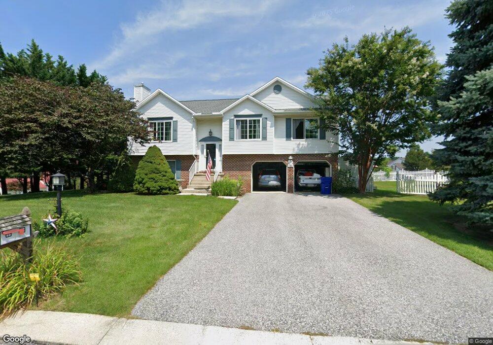
229 Clear Branch Dr Stewartstown, PA 17363
Estimated Value: $310,322 - $362,000
2
Beds
2
Baths
1,732
Sq Ft
$194/Sq Ft
Est. Value
About This Home
This home is located at 229 Clear Branch Dr, Stewartstown, PA 17363 and is currently estimated at $336,831, approximately $194 per square foot. 229 Clear Branch Dr is a home located in York County.
Ownership History
Date
Name
Owned For
Owner Type
Purchase Details
Closed on
Nov 5, 2004
Sold by
Stanley James W and Stanley Mary P
Bought by
Stanley James W and Stanley Mary P
Current Estimated Value
Purchase Details
Closed on
Aug 27, 2004
Sold by
Wilking William G and Wilking Stephanie
Bought by
Stanley James E and Stanley Mary P
Purchase Details
Closed on
Jan 9, 2003
Sold by
Wilking William and Brooks Stephanie
Bought by
Wilking William and Wilking Stephanie
Home Financials for this Owner
Home Financials are based on the most recent Mortgage that was taken out on this home.
Original Mortgage
$127,000
Interest Rate
6.11%
Mortgage Type
Purchase Money Mortgage
Purchase Details
Closed on
Jul 21, 1999
Sold by
Neisser John C and Neisser Linda M
Bought by
Wilking William and Brooks Stephanie
Home Financials for this Owner
Home Financials are based on the most recent Mortgage that was taken out on this home.
Original Mortgage
$131,575
Interest Rate
7.49%
Create a Home Valuation Report for This Property
The Home Valuation Report is an in-depth analysis detailing your home's value as well as a comparison with similar homes in the area
Home Values in the Area
Average Home Value in this Area
Purchase History
| Date | Buyer | Sale Price | Title Company |
|---|---|---|---|
| Stanley James W | -- | -- | |
| Stanley James E | $225,000 | -- | |
| Wilking William | -- | -- | |
| Wilking William | $139,500 | -- |
Source: Public Records
Mortgage History
| Date | Status | Borrower | Loan Amount |
|---|---|---|---|
| Previous Owner | Wilking William | $127,000 | |
| Previous Owner | Wilking William | $131,575 |
Source: Public Records
Tax History Compared to Growth
Tax History
| Year | Tax Paid | Tax Assessment Tax Assessment Total Assessment is a certain percentage of the fair market value that is determined by local assessors to be the total taxable value of land and additions on the property. | Land | Improvement |
|---|---|---|---|---|
| 2025 | $3,891 | $132,520 | $45,780 | $86,740 |
| 2024 | $3,891 | $132,520 | $45,780 | $86,740 |
| 2023 | $3,891 | $132,520 | $45,780 | $86,740 |
| 2022 | $3,891 | $132,520 | $45,780 | $86,740 |
| 2021 | $3,758 | $132,520 | $45,780 | $86,740 |
| 2020 | $3,758 | $132,520 | $45,780 | $86,740 |
| 2019 | $3,745 | $132,520 | $45,780 | $86,740 |
| 2018 | $3,745 | $132,520 | $45,780 | $86,740 |
| 2017 | $3,745 | $132,520 | $45,780 | $86,740 |
| 2016 | $0 | $132,520 | $45,780 | $86,740 |
| 2015 | -- | $132,520 | $45,780 | $86,740 |
| 2014 | -- | $132,520 | $45,780 | $86,740 |
Source: Public Records
Map
Nearby Homes
- 231 Cool Spring Ln
- 13 Baneberry St
- 4341 Forbes Dr
- 103 Hershey Cir
- 4303 Forbes Dr
- 9 W Pennsylvania Ave
- 17 Charles Ave
- 2 S Main St
- 82 Piston Ct
- 94 Piston Ct
- 150 Patterson Dr Unit 47
- 10 Black Oak Ct
- 160 Patterson Dr Unit 48
- 180 Patterson Dr Unit 50
- 18007 Dave Anne Cir
- 18010 Dave Anne Cir
- 18183 Piedmont Rd
- 0 Bridgeview Rd Unit PAYK2080146
- 2 Dutton Rd
- Lot #1 Bowman School Rd
- 230 Clear Branch Dr
- 232 Cool Spring Ln
- 221 Clear Branch Dr
- 226 Clear Branch Dr
- 222 Clear Branch Dr
- 234 Clear Branch Dr
- 228 Cool Spring Ln
- 217 Clear Branch Dr
- 218 Clear Branch Dr
- 238 Clear Branch Dr
- 241 Clear Branch Dr
- 4547 Bridgeview Rd
- 224 Cool Spring Ln
- 4567 Bridgeview Rd
- 227 Cool Spring Ln
- 4585 Bridgeview Rd
- 242 Clear Branch Dr
- 213 Clear Branch Dr
- 214 Clear Branch Dr