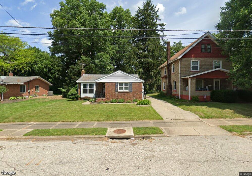
229 E Baird Ave Barberton, OH 44203
East Barberton NeighborhoodEstimated Value: $118,000 - $171,000
2
Beds
1
Bath
929
Sq Ft
$158/Sq Ft
Est. Value
About This Home
This home is located at 229 E Baird Ave, Barberton, OH 44203 and is currently estimated at $147,055, approximately $158 per square foot. 229 E Baird Ave is a home located in Summit County with nearby schools including Barberton Intermediate School 3-5, Barberton Middle School, and Barberton High School.
Ownership History
Date
Name
Owned For
Owner Type
Purchase Details
Closed on
Oct 19, 2006
Sold by
Beckle Bruce E and Beckle Elizabeth E
Bought by
Stump Jennifer L
Current Estimated Value
Home Financials for this Owner
Home Financials are based on the most recent Mortgage that was taken out on this home.
Original Mortgage
$99,000
Outstanding Balance
$59,206
Interest Rate
6.5%
Mortgage Type
Purchase Money Mortgage
Estimated Equity
$87,849
Purchase Details
Closed on
Jan 21, 2003
Sold by
Ceranko Anne E
Bought by
Beckle Bruce E and Beckle Elizabeth E
Create a Home Valuation Report for This Property
The Home Valuation Report is an in-depth analysis detailing your home's value as well as a comparison with similar homes in the area
Home Values in the Area
Average Home Value in this Area
Purchase History
| Date | Buyer | Sale Price | Title Company |
|---|---|---|---|
| Stump Jennifer L | $99,000 | Firstmerit Title Agency | |
| Beckle Bruce E | $69,500 | Approved Statewide Title Age |
Source: Public Records
Mortgage History
| Date | Status | Borrower | Loan Amount |
|---|---|---|---|
| Open | Stump Jennifer L | $99,000 |
Source: Public Records
Tax History
| Year | Tax Paid | Tax Assessment Tax Assessment Total Assessment is a certain percentage of the fair market value that is determined by local assessors to be the total taxable value of land and additions on the property. | Land | Improvement |
|---|---|---|---|---|
| 2024 | $1,720 | $34,419 | $7,826 | $26,593 |
| 2023 | $1,720 | $34,419 | $7,826 | $26,593 |
| 2022 | $1,496 | $25,953 | $5,842 | $20,111 |
| 2021 | $1,494 | $25,953 | $5,842 | $20,111 |
| 2020 | $1,462 | $25,950 | $5,840 | $20,110 |
| 2019 | $1,431 | $23,000 | $5,840 | $17,160 |
| 2018 | $1,409 | $23,000 | $5,840 | $17,160 |
| 2017 | $1,427 | $23,000 | $5,840 | $17,160 |
| 2016 | $1,430 | $23,000 | $5,840 | $17,160 |
| 2015 | $1,427 | $23,000 | $5,840 | $17,160 |
| 2014 | $1,420 | $23,000 | $5,840 | $17,160 |
| 2013 | $1,575 | $26,460 | $5,840 | $20,620 |
Source: Public Records
Map
Nearby Homes
- 279 E Baird Ave
- 194 E Baird Ave
- 298 E Ford Ave
- 304 E Tuscarawas Ave
- 163 E Ford Ave
- 175 2nd St NE Unit 177
- 25 S Van Buren Ave
- 43 S Van Buren Ave
- 349 E Hopocan Ave
- 507 E Ford Ave
- 46 Brown St
- 332 Lincoln Ave
- 492 E Hopocan Ave
- 240 1st St NW
- 398 Snyder Ave
- 337 Lucas St
- 311 George St
- 536 Austin Dr
- 341 6th St NE
- 526 Wooster Rd N
- 223 E Baird Ave
- 233 E Baird Ave
- 239 E Baird Ave
- 228 E Tuscarawas Ave
- 234 E Tuscarawas Ave
- 224 E Tuscarawas Ave
- 243 E Baird Ave
- 213 E Baird Ave
- 228 E Baird Ave
- 240 E Tuscarawas Ave
- 234 E Baird Ave
- 244 E Tuscarawas Ave
- 216 E Tuscarawas Ave
- 220 E Baird Ave
- 238 E Baird Ave
- 249 E Baird Ave
- 246 E Baird Ave
- 214 E Baird Ave
- 248 E Tuscarawas Ave
- 210 E Tuscarawas Ave
Your Personal Tour Guide
Ask me questions while you tour the home.