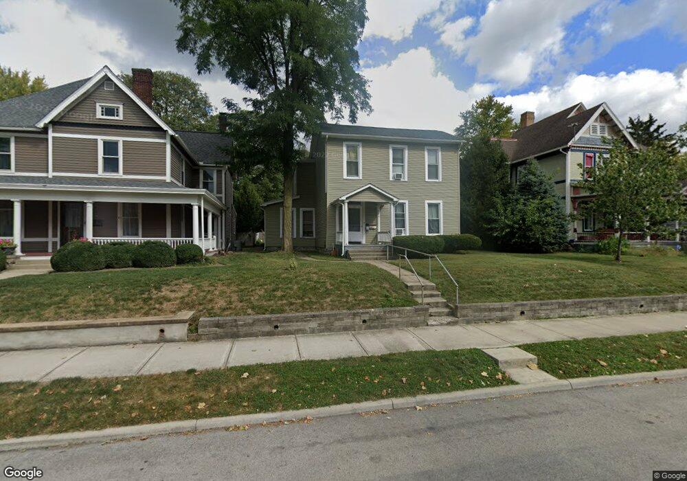
229 E Locust St Wilmington, OH 45177
Estimated Value: $197,000 - $251,000
4
Beds
3
Baths
2,584
Sq Ft
$84/Sq Ft
Est. Value
About This Home
This home is located at 229 E Locust St, Wilmington, OH 45177 and is currently estimated at $218,086, approximately $84 per square foot. 229 E Locust St is a home located in Clinton County with nearby schools including East End Elementary School, Denver Place Elementary School, and Roy E. Holmes Elementary School.
Ownership History
Date
Name
Owned For
Owner Type
Purchase Details
Closed on
Apr 29, 2020
Sold by
Prg Don Properties Llc
Bought by
Klaue Properties Llc
Current Estimated Value
Home Financials for this Owner
Home Financials are based on the most recent Mortgage that was taken out on this home.
Original Mortgage
$129,000
Outstanding Balance
$112,798
Interest Rate
3.3%
Mortgage Type
New Conventional
Estimated Equity
$105,288
Purchase Details
Closed on
Feb 22, 2018
Sold by
Wiseman Propety Holdings Llc
Bought by
Prg Don Prooerties Llc
Purchase Details
Closed on
Jan 1, 1990
Bought by
Wiseman Albert D and Wiseman Emily A
Create a Home Valuation Report for This Property
The Home Valuation Report is an in-depth analysis detailing your home's value as well as a comparison with similar homes in the area
Home Values in the Area
Average Home Value in this Area
Purchase History
| Date | Buyer | Sale Price | Title Company |
|---|---|---|---|
| Klaue Properties Llc | $172,000 | None Available | |
| Prg Don Prooerties Llc | $1,990,500 | None Available | |
| Wiseman Albert D | -- | -- |
Source: Public Records
Mortgage History
| Date | Status | Borrower | Loan Amount |
|---|---|---|---|
| Open | Klaue Properties Llc | $129,000 |
Source: Public Records
Tax History
| Year | Tax Paid | Tax Assessment Tax Assessment Total Assessment is a certain percentage of the fair market value that is determined by local assessors to be the total taxable value of land and additions on the property. | Land | Improvement |
|---|---|---|---|---|
| 2025 | $1,855 | $55,720 | $8,260 | $47,460 |
| 2024 | $1,855 | $55,720 | $8,260 | $47,460 |
| 2023 | $1,920 | $55,720 | $8,260 | $47,460 |
| 2022 | $1,265 | $34,560 | $6,480 | $28,080 |
| 2021 | $1,281 | $34,560 | $6,480 | $28,080 |
| 2020 | $1,205 | $34,560 | $6,480 | $28,080 |
| 2019 | $1,172 | $30,720 | $6,490 | $24,230 |
| 2018 | $1,184 | $30,720 | $6,490 | $24,230 |
| 2017 | $1,151 | $30,720 | $6,490 | $24,230 |
| 2016 | $1,011 | $26,650 | $7,820 | $18,830 |
| 2015 | $995 | $26,650 | $7,820 | $18,830 |
| 2013 | $1,036 | $27,420 | $7,820 | $19,600 |
Source: Public Records
Map
Nearby Homes
- 287 E Locust St
- 0 Prairie Rd Unit 1863689
- 0 Antioch Rd Unit 891198
- 170 N Wall St
- 0 St Rt 134 Unit 1607133
- 0 S US Rt 68 Unit 1527315
- 346 Virginia Cir
- 379 Virginia Cir
- 1.458 AC Prairie Ave
- 272 S Walnut St
- 731 Fife Ave
- 15 Meadow Run Trail Unit 6A
- 146 N Spring St
- 286 S South St
- 69 W Vine St
- 570 N Walnut St
- 277 N Spring St
- 302 Lorish Ave
- 51 N Wood St
- 0 N Wood St
- 229 E Locust St Unit 1&2
- 223 E Locust St
- 245 E Locust St
- 209 E Locust St
- 127 High St
- 201 E Locust St
- 265 E Locust St
- 133 High St
- 2601/2 E Locust St
- 114 High St
- 273 E Locust St
- 220 Columbus St
- 187 E Locust St
- 128 High St
- 238 E Locust St
- 208 Columbus St
- 242 Columbus St
- 222 E Locust St
- 240 E Locust St
- 208 E Locust St
Your Personal Tour Guide
Ask me questions while you tour the home.