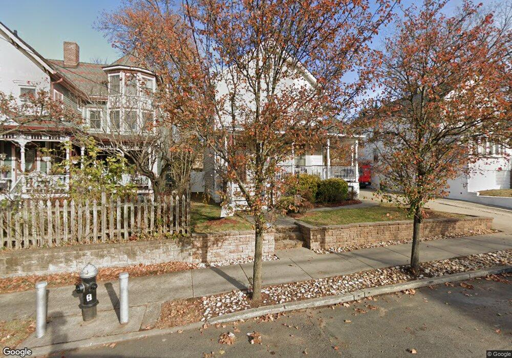
229 Fisher Ave Staten Island, NY 10307
Tottenville NeighborhoodEstimated Value: $567,000 - $946,000
4
Beds
3
Baths
1,612
Sq Ft
$508/Sq Ft
Est. Value
About This Home
This home is located at 229 Fisher Ave, Staten Island, NY 10307 and is currently estimated at $818,940, approximately $508 per square foot. 229 Fisher Ave is a home located in Richmond County with nearby schools including P.S. 1 Tottenville, Is 34 Tottenville, and Tottenville High School.
Ownership History
Date
Name
Owned For
Owner Type
Purchase Details
Closed on
Aug 19, 2004
Sold by
Ponce Carmen and Ponce Stacy Maria
Bought by
Wallen Daniel J and Wallen Jeanine
Current Estimated Value
Home Financials for this Owner
Home Financials are based on the most recent Mortgage that was taken out on this home.
Original Mortgage
$100,000
Interest Rate
5.68%
Mortgage Type
Credit Line Revolving
Purchase Details
Closed on
Feb 2, 2001
Sold by
Ponce Carmen
Bought by
Ponce Carmen and Ponce Stacy Maria
Create a Home Valuation Report for This Property
The Home Valuation Report is an in-depth analysis detailing your home's value as well as a comparison with similar homes in the area
Home Values in the Area
Average Home Value in this Area
Purchase History
| Date | Buyer | Sale Price | Title Company |
|---|---|---|---|
| Wallen Daniel J | $450,000 | -- | |
| Ponce Carmen | -- | The Title Guarantee Company |
Source: Public Records
Mortgage History
| Date | Status | Borrower | Loan Amount |
|---|---|---|---|
| Previous Owner | Wallen Daniel J | $100,000 | |
| Closed | Wallen Daniel J | $325,000 |
Source: Public Records
Tax History Compared to Growth
Tax History
| Year | Tax Paid | Tax Assessment Tax Assessment Total Assessment is a certain percentage of the fair market value that is determined by local assessors to be the total taxable value of land and additions on the property. | Land | Improvement |
|---|---|---|---|---|
| 2025 | $7,698 | $58,020 | $9,362 | $48,658 |
| 2024 | $7,710 | $59,640 | $8,593 | $51,047 |
| 2023 | $7,434 | $38,006 | $8,892 | $29,114 |
| 2022 | $7,042 | $49,980 | $12,900 | $37,080 |
| 2021 | $7,152 | $41,400 | $12,900 | $28,500 |
| 2020 | $7,132 | $38,400 | $12,900 | $25,500 |
| 2019 | $6,632 | $38,640 | $12,900 | $25,740 |
| 2018 | $6,159 | $31,672 | $9,431 | $22,241 |
| 2017 | $5,937 | $30,596 | $12,482 | $18,114 |
| 2016 | $5,592 | $29,521 | $11,477 | $18,044 |
| 2015 | $4,989 | $29,242 | $8,053 | $21,189 |
| 2014 | $4,989 | $27,588 | $9,111 | $18,477 |
Source: Public Records
Map
Nearby Homes
- 217-219 Fisher Ave
- 233 Fisher Ave
- 197 Craig Ave
- 147 Wood Ave
- 140 Craig Ave
- 133 Fisher Ave
- 21 Sprague Ave
- 69 Nashville St
- 5265 Arthur Kill Rd
- 46 Parker St
- 397 Ellis St
- 7 Parker St
- 112 Johnson Ave
- 24 Sapphire Ct
- 0 Minerva Ave Unit 495865
- 42 Girard St
- 30 Paradise Place
- 27 Honey Ln
- 7546 Amboy Rd
- 141 Butler Ave
- 223 Fisher Ave
- 237 Fisher Ave
- 217 Fisher Ave Unit 219
- 243 Fisher Ave
- 230 Barnard Ave
- 240 Barnard Ave
- 224 Barnard Ave
- 213-215 Fisher Ave
- 245 Fisher Ave
- 213 Fisher Ave Unit 215
- 244 Barnard Ave
- 216 Barnard Ave
- 252 Barnard Ave
- 240 Fisher Ave
- 249 Fisher Ave
- 209 Fisher Ave
- 212 Barnard Ave
- 207 Fisher Ave Unit 209
- 207 Fisher Ave
- 256 Barnard Ave