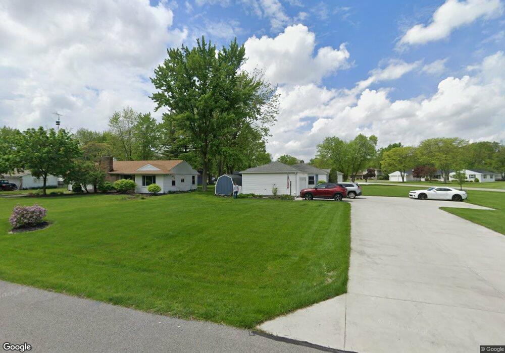
229 Johnson Cir Defiance, OH 43512
Estimated Value: $155,000 - $203,000
3
Beds
2
Baths
1,252
Sq Ft
$142/Sq Ft
Est. Value
About This Home
This home is located at 229 Johnson Cir, Defiance, OH 43512 and is currently estimated at $177,406, approximately $141 per square foot. 229 Johnson Cir is a home located in Defiance County with nearby schools including Defiance Elementary School, Defiance Middle School, and Defiance High School.
Ownership History
Date
Name
Owned For
Owner Type
Purchase Details
Closed on
Oct 7, 2005
Sold by
Brehe Melvin Louis and Brehe Mildred O
Bought by
Brown Timothy R and Bissell Susan D
Current Estimated Value
Home Financials for this Owner
Home Financials are based on the most recent Mortgage that was taken out on this home.
Original Mortgage
$89,900
Outstanding Balance
$54,300
Interest Rate
7.87%
Mortgage Type
Adjustable Rate Mortgage/ARM
Estimated Equity
$123,106
Create a Home Valuation Report for This Property
The Home Valuation Report is an in-depth analysis detailing your home's value as well as a comparison with similar homes in the area
Home Values in the Area
Average Home Value in this Area
Purchase History
| Date | Buyer | Sale Price | Title Company |
|---|---|---|---|
| Brown Timothy R | $67,425 | None Available |
Source: Public Records
Mortgage History
| Date | Status | Borrower | Loan Amount |
|---|---|---|---|
| Open | Brown Timothy R | $89,900 |
Source: Public Records
Tax History Compared to Growth
Tax History
| Year | Tax Paid | Tax Assessment Tax Assessment Total Assessment is a certain percentage of the fair market value that is determined by local assessors to be the total taxable value of land and additions on the property. | Land | Improvement |
|---|---|---|---|---|
| 2024 | $1,707 | $45,470 | $8,050 | $37,420 |
| 2023 | $1,707 | $45,470 | $8,050 | $37,420 |
| 2022 | $1,468 | $34,910 | $8,050 | $26,860 |
| 2021 | $1,468 | $34,910 | $8,050 | $26,860 |
| 2020 | $1,479 | $34,910 | $8,050 | $26,860 |
| 2019 | $1,386 | $32,000 | $8,050 | $23,950 |
| 2018 | $1,349 | $32,000 | $8,050 | $23,950 |
| 2017 | $1,324 | $31,993 | $8,046 | $23,947 |
| 2016 | $1,347 | $31,430 | $7,920 | $23,510 |
| 2015 | $648 | $31,430 | $7,920 | $23,510 |
| 2014 | $648 | $31,430 | $7,920 | $23,510 |
| 2013 | $648 | $31,430 | $7,920 | $23,510 |
| 2012 | $648 | $31,431 | $7,921 | $23,510 |
Source: Public Records
Map
Nearby Homes
- 230 Adams St
- 700 North St
- 202 Southworth St
- 734 E Front St
- 16 College Place
- 205 Stadium Dr
- 415 Fort St
- 305 W 1st St
- 319 East St
- 655 Burning Tree Dr
- 649 Burning Tree Dr
- 420 Highland St
- 673 Burning Tree Dr
- 679 Burning Tree Dr
- 600 Euclid St
- 1408 Heatherdowns Dr
- 411 Auglaize St
- 558 Gibson St
- 600 Tiedeman Ave
- 1365 Heatherdowns Dr
- 225 Johnson Cir
- 226 Maywinn Dr
- 230 Maywinn Dr
- 244 Johnson Cir
- 222 Maywinn Dr
- 221 Johnson Cir
- 236 Johnson Cir
- 240 Johnson Cir
- 232 Johnson Cir
- 300 Maywinn Dr
- 228 Johnson Cir
- 218 Maywinn Dr
- 214 Maywinn Dr
- 304 Maywinn Dr
- 213 Johnson Cir
- 229 Riverdale Dr
- 221 Maywinn Dr
- 221 Riverdale Dr
- 216 Johnson Cir
- 233 Riverdale Dr