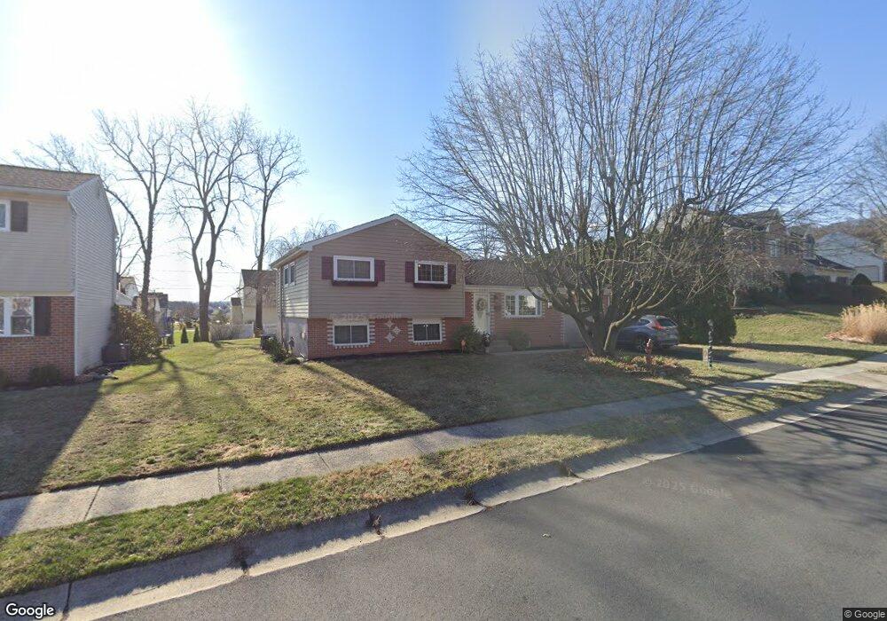
229 Keats Dr Reading, PA 19608
Estimated Value: $315,997 - $351,000
3
Beds
2
Baths
1,558
Sq Ft
$216/Sq Ft
Est. Value
About This Home
This home is located at 229 Keats Dr, Reading, PA 19608 and is currently estimated at $335,749, approximately $215 per square foot. 229 Keats Dr is a home located in Berks County with nearby schools including Cornwall Terrace Elementary School, Wilson Southern Middle School, and Wilson High School.
Ownership History
Date
Name
Owned For
Owner Type
Purchase Details
Closed on
Jun 15, 2007
Sold by
Barnett Matthew J and Barnett Terri L
Bought by
Barnett Matthew J and Barnett Terri L
Current Estimated Value
Purchase Details
Closed on
Mar 29, 2002
Sold by
Stoudt Alan E and Bigg Stoudt Cindy L
Bought by
Barnett Matthew J and Anton Terri L
Home Financials for this Owner
Home Financials are based on the most recent Mortgage that was taken out on this home.
Original Mortgage
$101,650
Outstanding Balance
$42,229
Interest Rate
6.84%
Estimated Equity
$293,520
Create a Home Valuation Report for This Property
The Home Valuation Report is an in-depth analysis detailing your home's value as well as a comparison with similar homes in the area
Home Values in the Area
Average Home Value in this Area
Purchase History
| Date | Buyer | Sale Price | Title Company |
|---|---|---|---|
| Barnett Matthew J | -- | None Available | |
| Barnett Matthew J | $107,000 | -- |
Source: Public Records
Mortgage History
| Date | Status | Borrower | Loan Amount |
|---|---|---|---|
| Open | Barnett Matthew J | $101,650 |
Source: Public Records
Tax History Compared to Growth
Tax History
| Year | Tax Paid | Tax Assessment Tax Assessment Total Assessment is a certain percentage of the fair market value that is determined by local assessors to be the total taxable value of land and additions on the property. | Land | Improvement |
|---|---|---|---|---|
| 2025 | $1,930 | $104,200 | $34,300 | $69,900 |
| 2024 | $4,458 | $104,200 | $34,300 | $69,900 |
| 2023 | $4,248 | $104,200 | $34,300 | $69,900 |
| 2022 | $4,144 | $104,200 | $34,300 | $69,900 |
| 2021 | $3,998 | $104,200 | $34,300 | $69,900 |
| 2020 | $3,998 | $104,200 | $34,300 | $69,900 |
| 2019 | $3,884 | $104,200 | $34,300 | $69,900 |
| 2018 | $3,851 | $104,200 | $34,300 | $69,900 |
| 2017 | $3,786 | $104,200 | $34,300 | $69,900 |
| 2016 | $1,336 | $104,200 | $34,300 | $69,900 |
| 2015 | $1,336 | $104,200 | $34,300 | $69,900 |
| 2014 | $1,336 | $104,200 | $34,300 | $69,900 |
Source: Public Records
Map
Nearby Homes
- 307 Bard Ave
- 2401 Goddard Ave
- 308 Spohn Rd
- 540 Hain Rd
- 140 Nicole Way
- 1334 W Wyomissing Ct Unit Q
- 211 Halsey Ave
- 1100 Old Fritztown Rd
- 719 W Wyomissing Blvd
- 608 W Wyomissing Blvd
- 2552 Garfield Ave
- 2214 Mckinley Ave
- 609 Lawn
- 3411 Penn Ave
- 3413 Penn Ave
- 2126 Lincoln Ave
- 342 Sioux Ct
- 11 Fiorino Way Unit 1
- 578 Old Lancaster Pike
- 1750 Gravel Hill Rd