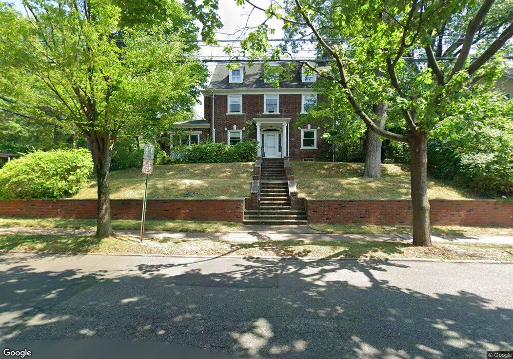
229 Larch Ave Teaneck, NJ 07666
Estimated Value: $809,000 - $877,000
--
Bed
--
Bath
2,507
Sq Ft
$335/Sq Ft
Est. Value
About This Home
This home is located at 229 Larch Ave, Teaneck, NJ 07666 and is currently estimated at $839,676, approximately $334 per square foot. 229 Larch Ave is a home located in Bergen County with nearby schools including Teaneck Senior High School, Teaneck Community Charter School, and Bergen County Christian Academy.
Ownership History
Date
Name
Owned For
Owner Type
Purchase Details
Closed on
Sep 21, 2000
Bought by
Bond George C
Current Estimated Value
Home Financials for this Owner
Home Financials are based on the most recent Mortgage that was taken out on this home.
Original Mortgage
$12,000
Interest Rate
7.81%
Purchase Details
Closed on
Oct 27, 1976
Bought by
Bond George and Bond Allison M
Create a Home Valuation Report for This Property
The Home Valuation Report is an in-depth analysis detailing your home's value as well as a comparison with similar homes in the area
Home Values in the Area
Average Home Value in this Area
Purchase History
| Date | Buyer | Sale Price | Title Company |
|---|---|---|---|
| Bond George C | -- | -- | |
| Bond George C | -- | -- | |
| Bond George | $50,000 | -- |
Source: Public Records
Mortgage History
| Date | Status | Borrower | Loan Amount |
|---|---|---|---|
| Previous Owner | Bond George C | $12,000 |
Source: Public Records
Tax History Compared to Growth
Tax History
| Year | Tax Paid | Tax Assessment Tax Assessment Total Assessment is a certain percentage of the fair market value that is determined by local assessors to be the total taxable value of land and additions on the property. | Land | Improvement |
|---|---|---|---|---|
| 2025 | $14,576 | $667,400 | $310,200 | $357,200 |
| 2024 | $14,007 | $667,400 | $310,200 | $357,200 |
| 2023 | $13,731 | $424,200 | $190,200 | $234,000 |
| 2022 | $13,731 | $424,200 | $190,200 | $234,000 |
| 2021 | $13,812 | $424,200 | $190,200 | $234,000 |
| 2020 | $13,719 | $424,200 | $190,200 | $234,000 |
| 2019 | $13,562 | $424,200 | $190,200 | $234,000 |
| 2018 | $13,460 | $424,200 | $190,200 | $234,000 |
| 2017 | $13,333 | $424,200 | $190,200 | $234,000 |
| 2016 | $13,133 | $424,200 | $190,200 | $234,000 |
| 2015 | $12,925 | $424,200 | $190,200 | $234,000 |
| 2014 | $12,657 | $492,300 | $264,000 | $228,300 |
Source: Public Records
Map
Nearby Homes
- 539 Kenwood Place
- 438 North St
- 735 Elm Ave Unit 4D
- 735 Elm Ave
- 735 Elm Ave Unit 2C
- 719 Catalpa Ave
- 620 Chestnut Ave
- 587 Kenwood Place
- 699 Kent Ave
- 489 Maple Ave
- 194 Elm Ave
- 605 Beverly Rd
- 857 Garrison Ave
- 619 Palisade Ave
- 64 Parkside Ln
- 63 Parkside Ln
- 128 Homestead Place
- 14 Parkside Ln
- 685 Sunset Rd
- 470 Linden Ave