Estimated Value: $230,000 - $270,000
3
Beds
2
Baths
1,176
Sq Ft
$209/Sq Ft
Est. Value
About This Home
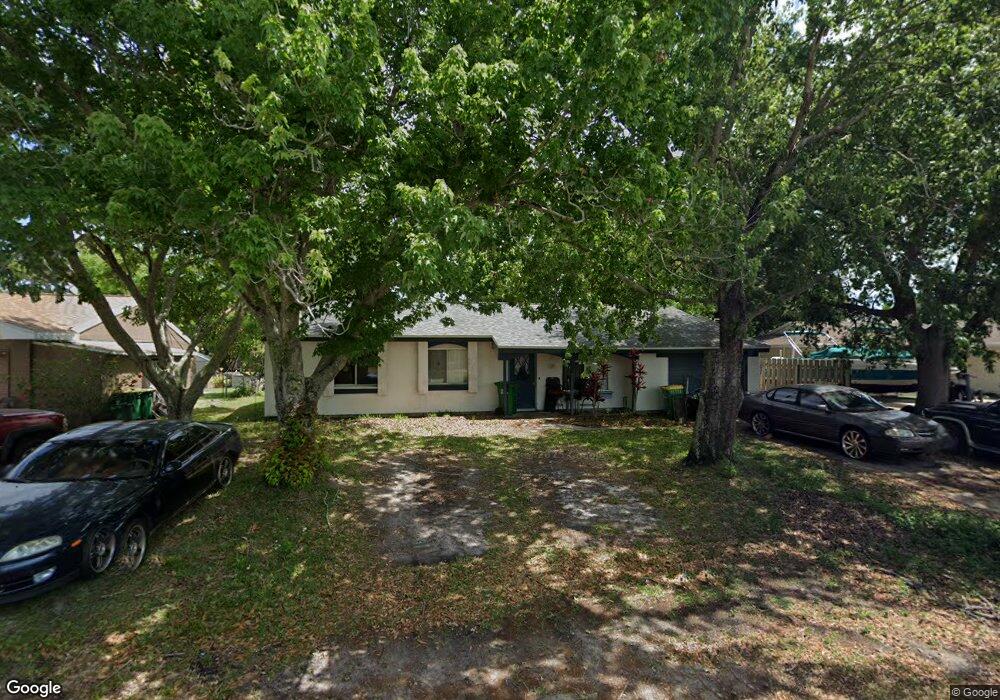
This home is located at 229 Manth Ave, Cocoa, FL 32927 and is currently estimated at $246,039, approximately $209 per square foot. 229 Manth Ave is a home located in Brevard County with nearby schools including Atlantis Elementary School, Space Coast Junior/Senior High School, and East Atlantic Prep of Brevard County.
Ownership History
Date
Name
Owned For
Owner Type
Purchase Details
Closed on
Jan 8, 2017
Sold by
Watson Christopher E and Mott Theresa J
Bought by
Watson Christopher E
Current Estimated Value
Purchase Details
Closed on
May 31, 2002
Sold by
Portz Stephen M and Portz Tracy A
Bought by
Watson Christopher E and Mott Theresa J
Home Financials for this Owner
Home Financials are based on the most recent Mortgage that was taken out on this home.
Original Mortgage
$80,363
Interest Rate
6.85%
Create a Home Valuation Report for This Property
The Home Valuation Report is an in-depth analysis detailing your home's value as well as a comparison with similar homes in the area
Home Values in the Area
Average Home Value in this Area
Purchase History
| Date | Buyer | Sale Price | Title Company |
|---|---|---|---|
| Watson Christopher E | $31,100 | Attorney | |
| Watson Christopher E | $81,000 | -- |
Source: Public Records
Mortgage History
| Date | Status | Borrower | Loan Amount |
|---|---|---|---|
| Previous Owner | Watson Christopher E | $80,363 |
Source: Public Records
Tax History
| Year | Tax Paid | Tax Assessment Tax Assessment Total Assessment is a certain percentage of the fair market value that is determined by local assessors to be the total taxable value of land and additions on the property. | Land | Improvement |
|---|---|---|---|---|
| 2025 | $995 | $69,890 | -- | -- |
| 2024 | $976 | $67,930 | -- | -- |
| 2023 | $976 | $65,960 | $0 | $0 |
| 2022 | $925 | $64,040 | $0 | $0 |
| 2021 | $926 | $62,180 | $0 | $0 |
| 2020 | $880 | $61,330 | $0 | $0 |
| 2019 | $1,985 | $110,660 | $35,000 | $75,660 |
| 2018 | $690 | $44,370 | $0 | $0 |
| 2017 | $678 | $43,460 | $0 | $0 |
| 2016 | $670 | $42,570 | $18,000 | $24,570 |
| 2015 | $666 | $42,280 | $15,000 | $27,280 |
| 2014 | $666 | $41,950 | $11,000 | $30,950 |
Source: Public Records
Map
Nearby Homes
- 985 Tope St
- 7350 N Highway 1 Unit 201
- 7330 N Highway 1 Unit 206
- 7310 N Highway 1 Unit 201
- 7300 N Highway 1 Unit 104
- 7400 N Highway 1 Unit 105
- 7470 N Highway 1 Unit 105
- 7240 N Highway 1 Unit 106
- 7170 N Highway 1 Unit 103
- 361 Payne Ave
- 1014 Illinois Rd
- 977 Poinsetta St
- 973 Poinsetta St
- 0 Kanawha St
- 1029 Illinois Rd
- 873 Dunbar St
- 7060 N Highway 1 Unit AA206
- 7060 N Highway 1 Unit 205
- 7060 N Highway 1 Unit AA102
- 865 Dunbar St
Your Personal Tour Guide
Ask me questions while you tour the home.