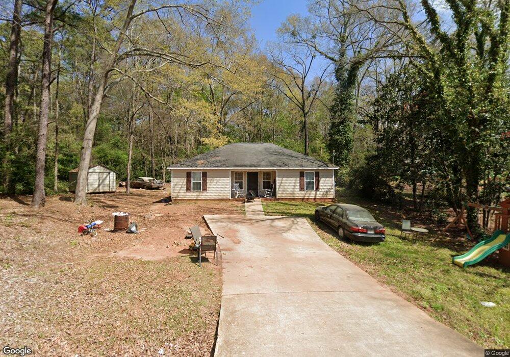
229 N Kight Dr Lagrange, GA 30240
Estimated Value: $114,211 - $190,000
4
Beds
2
Baths
1,242
Sq Ft
$127/Sq Ft
Est. Value
About This Home
This home is located at 229 N Kight Dr, Lagrange, GA 30240 and is currently estimated at $157,553, approximately $126 per square foot. 229 N Kight Dr is a home located in Troup County with nearby schools including Ethel W. Kight Elementary School, Hollis Hand Elementary School, and Franklin Forest Elementary School.
Ownership History
Date
Name
Owned For
Owner Type
Purchase Details
Closed on
Dec 10, 2009
Sold by
Imb Reo
Bought by
Mckeen Real
Current Estimated Value
Purchase Details
Closed on
Oct 6, 2009
Sold by
Cameron Bertha
Bought by
Onewest Bank
Purchase Details
Closed on
Oct 20, 2006
Sold by
Lambeth Scott
Bought by
Cameron Bertha
Home Financials for this Owner
Home Financials are based on the most recent Mortgage that was taken out on this home.
Original Mortgage
$65,800
Interest Rate
6.31%
Mortgage Type
New Conventional
Purchase Details
Closed on
Jul 26, 2006
Sold by
Cameron Roosevelt
Bought by
Lambeth Scott
Purchase Details
Closed on
Jan 1, 1970
Sold by
Ernest Lillian and Ernest Henderson
Bought by
Bertha Roosevelt and Bertha Cameron
Create a Home Valuation Report for This Property
The Home Valuation Report is an in-depth analysis detailing your home's value as well as a comparison with similar homes in the area
Purchase History
| Date | Buyer | Sale Price | Title Company |
|---|---|---|---|
| Mckeen Real | $52,900 | -- | |
| Mckeen Real | $52,900 | -- | |
| Onewest Bank | $59,025 | -- | |
| Onewest Bank | $59,025 | -- | |
| Cameron Bertha | $90,325 | -- | |
| Lambeth Scott | $9,000 | -- | |
| Bertha Roosevelt | $5,000 | -- |
Source: Public Records
Mortgage History
| Date | Status | Borrower | Loan Amount |
|---|---|---|---|
| Previous Owner | Cameron Bertha | $65,800 | |
| Previous Owner | Cameron Bertha | $20,000 |
Source: Public Records
Tax History
| Year | Tax Paid | Tax Assessment Tax Assessment Total Assessment is a certain percentage of the fair market value that is determined by local assessors to be the total taxable value of land and additions on the property. | Land | Improvement |
|---|---|---|---|---|
| 2025 | $851 | $31,200 | $1,240 | $29,960 |
| 2024 | $823 | $30,160 | $1,240 | $28,920 |
| 2023 | $741 | $27,160 | $1,240 | $25,920 |
| 2022 | $717 | $25,680 | $1,240 | $24,440 |
| 2021 | $573 | $19,000 | $1,240 | $17,760 |
| 2020 | $573 | $19,000 | $1,240 | $17,760 |
| 2019 | $606 | $20,080 | $960 | $19,120 |
| 2018 | $606 | $20,080 | $960 | $19,120 |
| 2017 | $606 | $20,080 | $960 | $19,120 |
| 2016 | $593 | $19,652 | $931 | $18,722 |
| 2015 | $615 | $20,346 | $931 | $19,415 |
| 2014 | $654 | $21,613 | $1,241 | $20,372 |
| 2013 | -- | $23,358 | $1,241 | $22,116 |
Source: Public Records
Map
Nearby Homes
- 101 Crown St Unit LOT 5
- 102 Crown St Unit LOT 1
- 120 Laurel Ridge Ave E
- 149 Laurel Ridge Ave E
- 205 Grady St
- 134 Laurel Ridge Ave E
- 167 S Kight Dr
- 1518 Brownwood Ave
- 608 Wilburn Ave
- 610 Wilburn Ave
- 202 Parker Ln
- 109 Garfield St
- 107 Clark St
- 211 Moores Hill
- 0 Moores Hill
- 507 S Lee St
- 503 S Lee St
- 517 Jefferson St
- 1304 Forrest Ave
- 1405 Forrest Ave
- 241 N Kight Dr
- 220 N Kight Dr
- 236 N Kight Dr
- 247 N Kight Dr
- N Kight St
- 242 N Kight Dr
- 257 N Kight Dr
- 254 N Kight Dr
- 246 N Kight Dr
- 267 N Kight Dr
- 266 N Kight Dr
- 804 Buchanan St
- 806 Buchanan St
- 808 Buchanan St
- 0 N Kight Dr Unit 10219701
- 0 N Kight Dr Unit 208341
- 276 N Kight Dr
- 802 Buchanan St
- 902 Buchanan St
- 816 Buchanan St
Your Personal Tour Guide
Ask me questions while you tour the home.