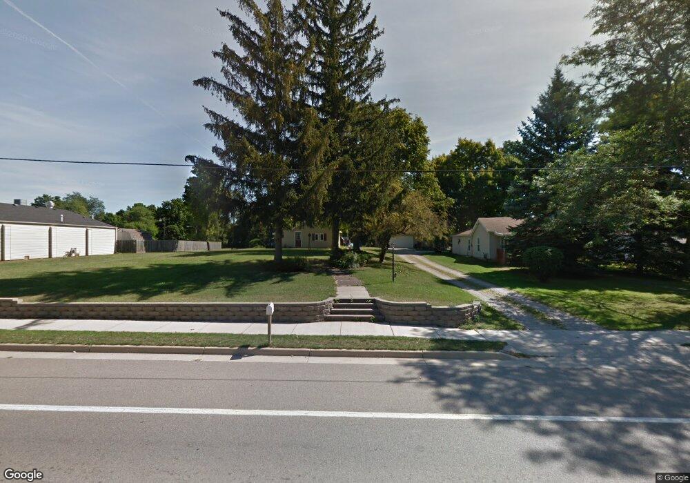
229 N Main St Reading, MI 49274
Estimated Value: $82,000
--
Bed
--
Bath
1,216
Sq Ft
$67/Sq Ft
Est. Value
About This Home
This home is located at 229 N Main St, Reading, MI 49274 and is currently priced at $82,000, approximately $67 per square foot. 229 N Main St is a home located in Hillsdale County with nearby schools including Reynolds Elementary School, Reading High School, and Cooper Amish School.
Ownership History
Date
Name
Owned For
Owner Type
Purchase Details
Closed on
Apr 9, 2008
Sold by
Tran David and Tran Marilyn
Bought by
Reading Tax Increment Finance Authority
Current Estimated Value
Purchase Details
Closed on
Jan 16, 2008
Sold by
Tran David and Tran Marilyn
Bought by
Michigan Department Of Transportation
Purchase Details
Closed on
Jul 21, 2004
Sold by
Mcmahon Darlene
Bought by
Tran David and Tran Marilyn
Home Financials for this Owner
Home Financials are based on the most recent Mortgage that was taken out on this home.
Original Mortgage
$14,000
Interest Rate
6.42%
Mortgage Type
Purchase Money Mortgage
Purchase Details
Closed on
Jul 17, 2000
Sold by
Tefft David A and Tefft Candace M
Bought by
Mcmahon Lawrence and Mcmahon Darlene
Create a Home Valuation Report for This Property
The Home Valuation Report is an in-depth analysis detailing your home's value as well as a comparison with similar homes in the area
Home Values in the Area
Average Home Value in this Area
Purchase History
| Date | Buyer | Sale Price | Title Company |
|---|---|---|---|
| Reading Tax Increment Finance Authority | $22,500 | First American Title Ins | |
| Michigan Department Of Transportation | $1,000 | None Available | |
| Tran David | $20,000 | -- | |
| Mcmahon Lawrence | $22,500 | -- |
Source: Public Records
Mortgage History
| Date | Status | Borrower | Loan Amount |
|---|---|---|---|
| Previous Owner | Tran David | $14,000 |
Source: Public Records
Tax History Compared to Growth
Tax History
| Year | Tax Paid | Tax Assessment Tax Assessment Total Assessment is a certain percentage of the fair market value that is determined by local assessors to be the total taxable value of land and additions on the property. | Land | Improvement |
|---|---|---|---|---|
| 2025 | -- | $0 | $0 | $0 |
| 2024 | -- | $0 | $0 | $0 |
| 2023 | -- | $13,100 | $13,100 | $0 |
| 2022 | -- | $11,804 | $11,804 | $0 |
| 2021 | $0 | $9,392 | $9,392 | $0 |
| 2020 | $0 | $9,392 | $9,392 | $0 |
| 2019 | $0 | $9,392 | $9,392 | $0 |
| 2018 | $0 | $0 | $0 | $0 |
| 2017 | -- | $0 | $0 | $0 |
| 2016 | -- | $0 | $0 | $0 |
| 2015 | -- | $0 | $0 | $0 |
| 2013 | -- | $0 | $0 | $0 |
| 2012 | -- | $0 | $0 | $0 |
Source: Public Records
Map
Nearby Homes
- 203 E Michigan St
- 108 Lynn St
- 309 S Main St
- 0 W Silver St Unit 25044322
- 5160 Quackenbush Rd
- 5411 Lilac Rd
- 5211 Long Lake Rd
- 4421 Carpenter Rd
- 7944 Gilmore Rd
- 4427 Carpenter Rd
- 3870 Rus Dic Dr
- 4111 Blair Rd
- 9949 Indian Trail
- 7841 Topinabee Dr
- 2520 S Sand Lake Rd
- 490 Kelley Rd
- 0 Dimmers Rd
- 4164 S Pleasant Dr
- 6524 W Montgomery Rd
- 2201 S Sand Lake Rd
- 225 N Main St
- 103 E Lincoln
- 213 N Main St
- 209 N Main St
- 235 N Main St
- 224 N Main St
- 225 Warner St
- 220 N Main St
- 228 N Main St
- 216 N Main St
- 232 N Main St
- 327 Warner St
- 0 Lincoln St Unit 18003144
- 0 Lincoln St Unit 5457804
- 0 Lincoln St Unit 16032528
- 108 E Lincoln
- 124 E State St
- 114 Lincoln St
- 305 N Main St
- 203 N Main St