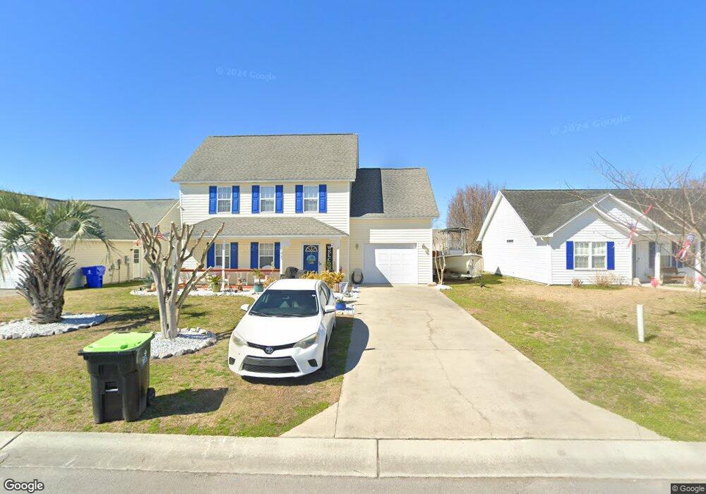
229 Rutledge Ave Beaufort, NC 28516
Estimated Value: $324,728 - $431,000
3
Beds
2
Baths
1,728
Sq Ft
$217/Sq Ft
Est. Value
About This Home
This home is located at 229 Rutledge Ave, Beaufort, NC 28516 and is currently estimated at $375,182, approximately $217 per square foot. 229 Rutledge Ave is a home located in Carteret County with nearby schools including Beaufort Elementary School, Beaufort Middle School, and East Carteret High School.
Ownership History
Date
Name
Owned For
Owner Type
Purchase Details
Closed on
Nov 23, 2004
Sold by
Atlantic Coast Builders Inc
Bought by
Johnson Alexander and Johnson Anna
Current Estimated Value
Home Financials for this Owner
Home Financials are based on the most recent Mortgage that was taken out on this home.
Original Mortgage
$90,900
Interest Rate
5.61%
Mortgage Type
Purchase Money Mortgage
Purchase Details
Closed on
Aug 19, 2004
Create a Home Valuation Report for This Property
The Home Valuation Report is an in-depth analysis detailing your home's value as well as a comparison with similar homes in the area
Home Values in the Area
Average Home Value in this Area
Purchase History
| Date | Buyer | Sale Price | Title Company |
|---|---|---|---|
| Johnson Alexander | $130,000 | None Available | |
| -- | -- | -- |
Source: Public Records
Mortgage History
| Date | Status | Borrower | Loan Amount |
|---|---|---|---|
| Previous Owner | Johnson Alexander | $90,900 |
Source: Public Records
Tax History Compared to Growth
Tax History
| Year | Tax Paid | Tax Assessment Tax Assessment Total Assessment is a certain percentage of the fair market value that is determined by local assessors to be the total taxable value of land and additions on the property. | Land | Improvement |
|---|---|---|---|---|
| 2025 | $2,038 | $336,611 | $68,585 | $268,026 |
| 2024 | $1,665 | $175,283 | $44,460 | $130,823 |
| 2023 | $1,570 | $175,283 | $44,460 | $130,823 |
| 2022 | $1,553 | $175,283 | $44,460 | $130,823 |
| 2021 | $1,553 | $175,283 | $44,460 | $130,823 |
| 2020 | $1,553 | $175,283 | $44,460 | $130,823 |
| 2019 | $1,403 | $161,443 | $23,940 | $137,503 |
| 2017 | $1,286 | $161,443 | $23,940 | $137,503 |
| 2016 | $1,213 | $161,443 | $23,940 | $137,503 |
| 2015 | $1,197 | $161,443 | $23,940 | $137,503 |
| 2014 | $1,300 | $188,938 | $47,760 | $141,178 |
Source: Public Records
Map
Nearby Homes
- 427 Meeting St
- 221 Rutledge Ave
- 413 Meeting St
- 3134 Highway 70 E
- 301 Courtyard E Unit 301
- 1202 Courtyard E
- 105 Palmetto Place Cir
- 103 Pirates Landing Dr
- 120 Eastbay Way
- 1103 Pirates Landing Dr
- 301 Pirates Landing Dr
- 702 Pirates Landing Dr
- 226 Cline Way Unit 132, 1809 Live
- 233 Cline Way Unit 106, 1809 Live
- 237 Cline Way Unit 108, 1809 Live
- 228 Cline Way Unit 131, 1809 Live
- 230 Cline Way Unit 130, 1809 Live
- 232 Cline Way Unit 129, 1809 Live
- The Harbour Plan at Towns at Live Oak
- The Lookout Plan at Towns at Live Oak
- 227 Rutledge Ave
- 231 Rutledge Ave
- 233 Rutledge Ave
- 225 Rutledge Ave
- 228 Rutledge Ave
- 226 Rutledge Ave
- 230 Rutledge Ave
- 235 Rutledge Ave
- 223 Rutledge Ave
- 224 Rutledge Ave
- 232 Rutledge Ave
- 234 Rutledge Ave
- 237 Rutledge Ave
- 222 Rutledge Ave
- 220 Rutledge Ave
- 421 Meeting St
- 239 Rutledge Ave
- 417 Meeting St
- 219 Rutledge Ave
- 238 Rutledge Ave