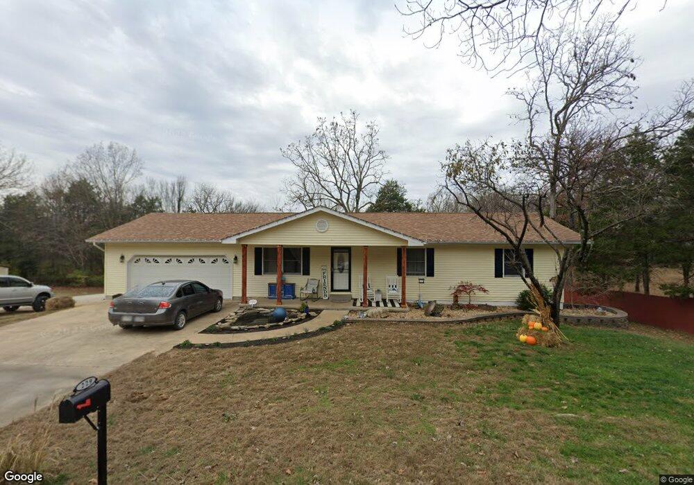
229 Saint Michael St Bonne Terre, MO 63628
Estimated Value: $209,839 - $231,000
3
Beds
2
Baths
1,316
Sq Ft
$169/Sq Ft
Est. Value
About This Home
This home is located at 229 Saint Michael St, Bonne Terre, MO 63628 and is currently estimated at $222,960, approximately $169 per square foot. 229 Saint Michael St is a home located in St. Francois County with nearby schools including North County Primary School, North County Parkside Elementary School, and North County Senior High School.
Ownership History
Date
Name
Owned For
Owner Type
Purchase Details
Closed on
Sep 1, 2020
Sold by
Kassabaum Frederick L and Kassabaum Gerald L
Bought by
Powell Elizabeth and Stout Cary
Current Estimated Value
Home Financials for this Owner
Home Financials are based on the most recent Mortgage that was taken out on this home.
Original Mortgage
$162,011
Outstanding Balance
$143,774
Interest Rate
2.9%
Mortgage Type
Construction
Estimated Equity
$79,186
Create a Home Valuation Report for This Property
The Home Valuation Report is an in-depth analysis detailing your home's value as well as a comparison with similar homes in the area
Home Values in the Area
Average Home Value in this Area
Purchase History
| Date | Buyer | Sale Price | Title Company |
|---|---|---|---|
| Powell Elizabeth | $163,631 | Htc |
Source: Public Records
Mortgage History
| Date | Status | Borrower | Loan Amount |
|---|---|---|---|
| Open | Powell Elizabeth | $162,011 |
Source: Public Records
Tax History Compared to Growth
Tax History
| Year | Tax Paid | Tax Assessment Tax Assessment Total Assessment is a certain percentage of the fair market value that is determined by local assessors to be the total taxable value of land and additions on the property. | Land | Improvement |
|---|---|---|---|---|
| 2024 | $848 | $15,690 | $2,280 | $13,410 |
| 2023 | $848 | $15,690 | $2,280 | $13,410 |
| 2022 | $850 | $15,690 | $2,280 | $13,410 |
| 2021 | $848 | $15,690 | $2,280 | $13,410 |
| 2020 | $853 | $15,690 | $2,280 | $13,410 |
| 2019 | $854 | $15,690 | $2,280 | $13,410 |
| 2018 | -- | $15,690 | $2,280 | $13,410 |
| 2017 | $858 | $15,690 | $2,280 | $13,410 |
| 2016 | $857 | $15,690 | $0 | $0 |
| 2015 | -- | $15,690 | $0 | $0 |
| 2014 | -- | $15,690 | $0 | $0 |
| 2013 | -- | $15,690 | $0 | $0 |
Source: Public Records
Map
Nearby Homes
- 233 Saint Michael St
- 819 Rue Dauphine Unit 817
- 1688 Notre Dame Dr
- 0 Rue de la Paix Unit 23067327
- 328 Saint Gerard St
- 0 Rue Marseilles Unit 22104522
- TBD Rue Marseille
- 0 Normandie Dr Unit MAR24037920
- 1591 Saint Francois Rd
- 243 Rue Marseilles
- 314 Mont Divier Dr
- 317 Rue Charlemagne
- 0 Rue Charlemagne Unit MIS25063524
- 277 Rue Terre Bonne
- 228 Rue Terre Bonne
- 0 N St Francois Rd Unit MIS25063422
- 0 N St Francois Rd Unit MIS25063814
- 419 Darcie Dr
- 1713 Rue Versailles
- 0 Bourbon Dr Unit MAR25008263
- 221 Saint Michael St
- 230 Saint Michael St
- 1628 Rue Monique
- 0Lot 2 Saint Michael St
- 0Lot 1 Saint Michael St
- 238 St Michael St
- 238 Saint Michael St
- 1740 Notre Dame Dr
- 1616 Rue Monique
- 1616 Rue Monique Unit none
- 246 Saint Michael St
- 214 Saint Michael St
- 316 Saint Michael St
- 10-17-1 Notre Dame
- 209 St Michael St
- 209 Saint Michael St
- 1R-3 Rue Monique
- 1745 Notre Dame Dr
- 1604 Rue Jeanette
- 218 Rue Denise