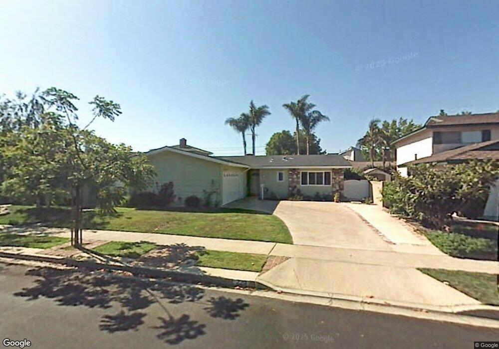
229 Stanford Ln Seal Beach, CA 90740
Estimated Value: $1,170,000 - $1,373,000
3
Beds
2
Baths
1,288
Sq Ft
$955/Sq Ft
Est. Value
About This Home
This home is located at 229 Stanford Ln, Seal Beach, CA 90740 and is currently estimated at $1,229,440, approximately $954 per square foot. 229 Stanford Ln is a home located in Orange County with nearby schools including Francis Hopkinson Elementary School, Jack L. Weaver Elementary School, and Oak Middle School.
Ownership History
Date
Name
Owned For
Owner Type
Purchase Details
Closed on
Dec 1, 2023
Sold by
Johnson Michael I and Johnson Linda
Bought by
Johnson Family Trust and Johnson
Current Estimated Value
Purchase Details
Closed on
Jun 21, 1999
Sold by
Shacklett Mike S and Shacklett Patricia
Bought by
Johnson Michael and Johnson Linda
Home Financials for this Owner
Home Financials are based on the most recent Mortgage that was taken out on this home.
Original Mortgage
$246,400
Interest Rate
4.5%
Create a Home Valuation Report for This Property
The Home Valuation Report is an in-depth analysis detailing your home's value as well as a comparison with similar homes in the area
Home Values in the Area
Average Home Value in this Area
Purchase History
| Date | Buyer | Sale Price | Title Company |
|---|---|---|---|
| Johnson Family Trust | -- | None Listed On Document | |
| Johnson Michael | $308,000 | Lawyers Title Company |
Source: Public Records
Mortgage History
| Date | Status | Borrower | Loan Amount |
|---|---|---|---|
| Previous Owner | Johnson Michael | $246,400 |
Source: Public Records
Tax History
| Year | Tax Paid | Tax Assessment Tax Assessment Total Assessment is a certain percentage of the fair market value that is determined by local assessors to be the total taxable value of land and additions on the property. | Land | Improvement |
|---|---|---|---|---|
| 2025 | $5,710 | $473,378 | $380,267 | $93,111 |
| 2024 | $5,710 | $464,097 | $372,811 | $91,286 |
| 2023 | $5,576 | $454,998 | $365,501 | $89,497 |
| 2022 | $5,545 | $446,077 | $358,334 | $87,743 |
| 2021 | $5,423 | $437,331 | $351,308 | $86,023 |
| 2020 | $5,434 | $432,847 | $347,706 | $85,141 |
| 2019 | $5,241 | $424,360 | $340,888 | $83,472 |
| 2018 | $4,996 | $416,040 | $334,204 | $81,836 |
| 2017 | $4,889 | $407,883 | $327,651 | $80,232 |
| 2016 | $4,794 | $399,886 | $321,227 | $78,659 |
| 2015 | $4,736 | $393,880 | $316,402 | $77,478 |
| 2014 | $4,572 | $386,165 | $310,204 | $75,961 |
Source: Public Records
Map
Nearby Homes
- 173 College Park Dr
- 2692 Salmon Dr
- 6911 E 10th St
- 105 Harvard Ln
- 6841 E Bacarro St
- 6976 E El Cedral St
- 12442 Christy Ln
- 13121 Oak Hills Dr Unit 233J
- 1075 Brookline Rd
- 1075 Brookline Rd Unit M9-220E
- 1220 Scioto Rd
- 1220 Northwood Rd Unit M9-230D
- 2671 Saint Albans Dr
- 13140 Nassau Dr
- 13140 Nassau Dr Unit 214B
- 13101 Oak Hills Dr
- 13101 Oak Hills Dr Unit 234F
- 13170 Southport Ln Unit 168-F
- 13170 Southport Ln Unit 168C
- 1541 Northwood Rd Unit 273D
- 233 Stanford Ln
- 225 Stanford Ln
- 279 College Park Dr
- 112 Princeton Cir
- 221 Stanford Ln
- 108 Princeton Cir
- 283 College Park Dr
- 265 College Park Dr
- 224 Stanford Ln
- 109 Princeton Cir
- 217 Stanford Ln
- 261 College Park Dr
- 287 College Park Dr
- 216 Stanford Ln
- 272 College Park Dr
- 276 College Park Dr
- 268 College Park Dr
- 280 College Park Dr
- 213 Stanford Ln
- 105 Princeton Cir
Your Personal Tour Guide
Ask me questions while you tour the home.