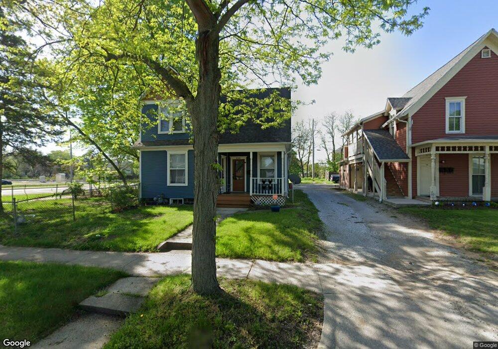
229 State St Elkhart, IN 46516
Estimated Value: $124,000 - $161,000
4
Beds
2
Baths
2,456
Sq Ft
$58/Sq Ft
Est. Value
About This Home
This home is located at 229 State St, Elkhart, IN 46516 and is currently estimated at $142,500, approximately $58 per square foot. 229 State St is a home located in Elkhart County with nearby schools including Riverview Elementary School, Pierre Moran Middle School, and Elkhart High School's Freshman Division.
Ownership History
Date
Name
Owned For
Owner Type
Purchase Details
Closed on
Jun 29, 2010
Sold by
Oreo Corp
Bought by
City Of Elkhart
Current Estimated Value
Purchase Details
Closed on
Jun 9, 2010
Sold by
Elkhart Housing Partnership Inc
Bought by
Oreo Corp
Purchase Details
Closed on
Dec 20, 2007
Sold by
Elkhart Neighborhoods Inc
Bought by
City Of Elkhart
Purchase Details
Closed on
Aug 18, 2003
Sold by
Department Of Redevelopment
Bought by
Elkhart Housing Partnership Inc
Purchase Details
Closed on
Jul 29, 2003
Sold by
Hud
Bought by
City Of Elkhart Redevelopment Commission
Purchase Details
Closed on
Sep 19, 2002
Sold by
Chase Manhattan Mtg Corp
Bought by
Hud
Purchase Details
Closed on
Sep 3, 2002
Sold by
Hunsberger Christopher G and Burk Mary E
Bought by
Chase Manhattan Mtg Corp
Create a Home Valuation Report for This Property
The Home Valuation Report is an in-depth analysis detailing your home's value as well as a comparison with similar homes in the area
Home Values in the Area
Average Home Value in this Area
Purchase History
| Date | Buyer | Sale Price | Title Company |
|---|---|---|---|
| City Of Elkhart | -- | Lawyers Title | |
| Oreo Corp | $65,225 | Lawyers Title | |
| City Of Elkhart | -- | None Available | |
| Elkhart Housing Partnership Inc | -- | Land Grant Title Group | |
| City Of Elkhart Redevelopment Commission | -- | Title Agency Ltd | |
| Hud | -- | -- | |
| Chase Manhattan Mtg Corp | $65,373 | -- |
Source: Public Records
Tax History Compared to Growth
Tax History
| Year | Tax Paid | Tax Assessment Tax Assessment Total Assessment is a certain percentage of the fair market value that is determined by local assessors to be the total taxable value of land and additions on the property. | Land | Improvement |
|---|---|---|---|---|
| 2024 | $15 | -- | -- | -- |
| 2022 | $15 | $0 | $0 | $0 |
| 2021 | $15 | $0 | $0 | $0 |
| 2020 | $15 | $0 | $0 | $0 |
| 2019 | $15 | $0 | $0 | $0 |
| 2018 | $0 | $0 | $0 | $0 |
| 2017 | $0 | $0 | $0 | $0 |
| 2016 | -- | $0 | $0 | $0 |
| 2014 | -- | $0 | $0 | $0 |
| 2013 | $9 | $0 | $0 | $0 |
Source: Public Records
Map
Nearby Homes
- 315 Division St
- 401 Middlebury St
- 529 S 2nd St
- 1011 Benham Ct
- 1308 Eden St
- 419 W High St
- 301 W Jackson Blvd
- 226/228 & 230 W Jackson St
- 302 W Jackson Blvd
- 207 N 2nd St
- 710 E Indiana Ave
- 607 W Marion St
- 1030 Middlebury St
- 1031 Middlebury St
- 225 W Washington St
- 950 E Jackson Blvd Unit 202
- 537 Gladstone Ave
- 311 Hillside Ct
- 960 E Jackson 302 Blvd
- 711 W Marion St