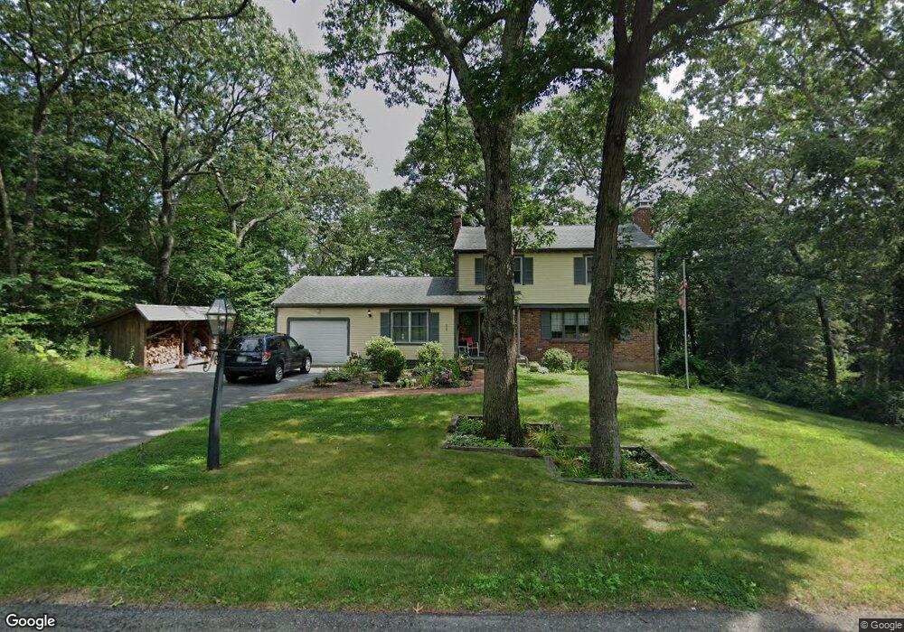
229 Summit Rd Abington, MA 02351
Estimated Value: $646,000 - $733,000
4
Beds
3
Baths
1,842
Sq Ft
$369/Sq Ft
Est. Value
About This Home
This home is located at 229 Summit Rd, Abington, MA 02351 and is currently estimated at $679,296, approximately $368 per square foot. 229 Summit Rd is a home located in Plymouth County with nearby schools including Beaver Brook Elementary School, Woodsdale School, and Abington Middle School.
Ownership History
Date
Name
Owned For
Owner Type
Purchase Details
Closed on
Jun 12, 2014
Sold by
Twomey William H and Twomey Karen W
Bought by
229 Summit Road Rt
Current Estimated Value
Purchase Details
Closed on
Nov 10, 2011
Sold by
Connolly John J
Bought by
Twomey William H and Twomey Karen W
Home Financials for this Owner
Home Financials are based on the most recent Mortgage that was taken out on this home.
Original Mortgage
$293,000
Interest Rate
4.01%
Mortgage Type
Purchase Money Mortgage
Purchase Details
Closed on
Mar 12, 1999
Sold by
First Baptist Church
Bought by
Connolly John J
Create a Home Valuation Report for This Property
The Home Valuation Report is an in-depth analysis detailing your home's value as well as a comparison with similar homes in the area
Home Values in the Area
Average Home Value in this Area
Purchase History
| Date | Buyer | Sale Price | Title Company |
|---|---|---|---|
| 229 Summit Road Rt | -- | -- | |
| Twomey William H | $366,250 | -- | |
| Connolly John J | $210,000 | -- |
Source: Public Records
Mortgage History
| Date | Status | Borrower | Loan Amount |
|---|---|---|---|
| Previous Owner | Twomey William H | $293,000 | |
| Previous Owner | Connolly John J | $293,000 | |
| Previous Owner | Connolly John J | $164,300 | |
| Previous Owner | Connolly John J | $57,000 | |
| Previous Owner | Connolly John J | $25,000 |
Source: Public Records
Tax History
| Year | Tax Paid | Tax Assessment Tax Assessment Total Assessment is a certain percentage of the fair market value that is determined by local assessors to be the total taxable value of land and additions on the property. | Land | Improvement |
|---|---|---|---|---|
| 2025 | $8,032 | $615,000 | $267,300 | $347,700 |
| 2024 | $7,778 | $581,300 | $243,400 | $337,900 |
| 2023 | $7,422 | $522,300 | $221,700 | $300,600 |
| 2022 | $7,248 | $476,200 | $185,400 | $290,800 |
| 2021 | $6,678 | $405,200 | $169,300 | $235,900 |
| 2020 | $6,807 | $400,400 | $170,500 | $229,900 |
| 2019 | $6,815 | $391,900 | $163,600 | $228,300 |
| 2018 | $6,536 | $366,800 | $163,600 | $203,200 |
| 2017 | $6,514 | $355,000 | $163,600 | $191,400 |
| 2016 | $5,958 | $332,300 | $149,400 | $182,900 |
| 2015 | $5,520 | $324,700 | $149,400 | $175,300 |
Source: Public Records
Map
Nearby Homes
- 1077 Bedford St
- 120 Temple St
- 590 Adams St
- 56 Townsend St Unit D26
- 338 Adams St
- 1353 Washington St
- 337 Randolph St
- 120 Glen St
- 0 Bedford St
- 66 Coleman St
- 189 Sheri Ln
- 14 Jamieson St
- 1639 Main St
- 44 Old Forge Rd
- 73 Monroe St
- 22 Kingswood Dr Unit 6F
- 451 Lincoln St
- 720 Hancock St
- 40 Fir Rd Unit 386
- 17 Birch St Unit 135
- 241 Summit Rd
- 215 Summit Rd
- 222 Summit Rd
- 60 Oakland Cir
- 238 Summit Rd
- 208 Summit Rd
- 255 Summit Rd
- 203 Summit Rd
- 41 Oakland Cir
- 30 Oakland Cir
- 252 Summit Rd
- 194 Summit Rd
- 271 Summit Rd
- 189 Summit Rd
- 25 Oakland Cir
- 167 Mountain Laurel Ln
- 193 Mountain Laurel Ln
- 157 Mountain Laurel Ln
- 270 Summit Rd
- 21 Oakland Cir
Your Personal Tour Guide
Ask me questions while you tour the home.