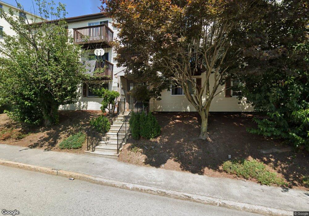
229 Vernon St Unit 7 Worcester, MA 01607
Vernon Hill NeighborhoodEstimated Value: $223,000 - $240,000
2
Beds
1
Bath
728
Sq Ft
$314/Sq Ft
Est. Value
About This Home
This home is located at 229 Vernon St Unit 7, Worcester, MA 01607 and is currently estimated at $228,245, approximately $313 per square foot. 229 Vernon St Unit 7 is a home located in Worcester County with nearby schools including Vernon Hill Elementary School, Jacob Hiatt Magnet School, and Chandler Magnet.
Ownership History
Date
Name
Owned For
Owner Type
Purchase Details
Closed on
Jun 28, 2017
Sold by
Yeboah Grace
Bought by
Yeboah Grace and Yeboah Hayford
Current Estimated Value
Purchase Details
Closed on
Mar 1, 2006
Sold by
Fordjo Dorcas
Bought by
Osrah Grace
Home Financials for this Owner
Home Financials are based on the most recent Mortgage that was taken out on this home.
Original Mortgage
$100,000
Interest Rate
6.16%
Mortgage Type
Purchase Money Mortgage
Create a Home Valuation Report for This Property
The Home Valuation Report is an in-depth analysis detailing your home's value as well as a comparison with similar homes in the area
Home Values in the Area
Average Home Value in this Area
Purchase History
We collect this data history from publicly available records. To have your information removed, we recommend requesting removal directly through your county’s website.
| Date | Buyer | Sale Price | Title Company |
|---|---|---|---|
| Yeboah Grace | -- | -- | |
| Osrah Grace | $125,000 | -- |
Source: Public Records
Mortgage History
We collect this data history from publicly available records. To have your information removed, we recommend requesting removal directly through your county’s website.
| Date | Status | Borrower | Loan Amount |
|---|---|---|---|
| Previous Owner | Osrah Grace | $100,000 |
Source: Public Records
Tax History
| Year | Tax Paid | Tax Assessment Tax Assessment Total Assessment is a certain percentage of the fair market value that is determined by local assessors to be the total taxable value of land and additions on the property. | Land | Improvement |
|---|---|---|---|---|
| 2025 | $2,459 | $186,400 | $0 | $186,400 |
| 2024 | $2,349 | $170,800 | $0 | $170,800 |
| 2023 | $2,094 | $146,000 | $0 | $146,000 |
| 2022 | $1,390 | $91,400 | $0 | $91,400 |
| 2021 | $1,271 | $78,100 | $0 | $78,100 |
| 2020 | $1,233 | $72,500 | $0 | $72,500 |
| 2019 | $1,262 | $70,100 | $0 | $70,100 |
| 2018 | $1,386 | $73,300 | $0 | $73,300 |
| 2017 | $1,380 | $71,800 | $0 | $71,800 |
| 2016 | $1,047 | $50,800 | $0 | $50,800 |
| 2015 | $1,020 | $50,800 | $0 | $50,800 |
| 2014 | $971 | $49,700 | $0 | $49,700 |
Source: Public Records
Map
Nearby Homes
- 3 Gloucester Rd
- 00 Gloucester Rd
- 26 Maxwell St
- 605 Millbury St
- 17 Fairbanks St
- 3A Gediminas St
- 85 Harlem St
- 7 Gibbs St Unit 10
- 7A Gibbs St Unit 4
- 7A Gibbs St Unit 3
- 7A Gibbs St Unit 7
- 21 Falmouth St
- 36C Gibbs St Unit 29
- 19 Reeves St
- 7 Ekman St
- 10 Hillside St
- 4 Stockholm St
- 21 Sterling St
- 81 Ward St
- 15 Steele St
- 7 Gloucester Rd
- 1 Gloucester Rd
- 37 Esther St
- 35 Esther St
- 9 Gloucester Rd
- 31 Esther St
- 31 Esther St Unit 2
- 31 Esther St Unit 3
- 39 Esther St
- 39 Esther St Unit 2
- 229 Vernon St Unit 12
- 229 Vernon St Unit 11
- 229 Vernon St Unit 10
- 229 Vernon St Unit 9
- 229 Vernon St Unit 8
- 229 Vernon St Unit 6
- 229 Vernon St Unit 5
- 229 Vernon St Unit 4
- 229 Vernon St Unit 3
- 229 Vernon St Unit 2
Your Personal Tour Guide
Ask me questions while you tour the home.