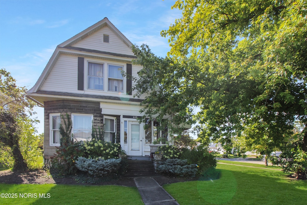
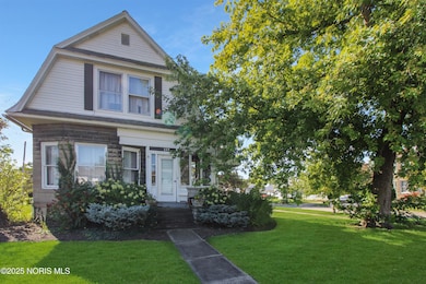
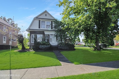
229 W 4th St Port Clinton, OH 43452
Estimated payment $1,138/month
About This Home
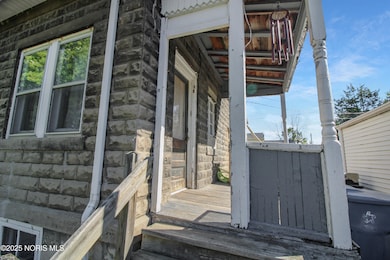
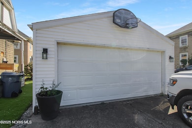
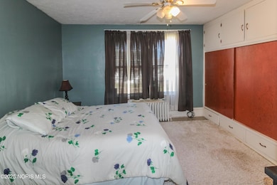
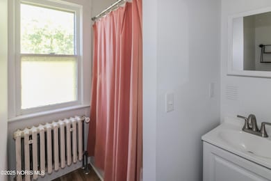
Historic stone charmer located centrally in Port Clinton. Large living room and dining room create a perfect space to entertain or simply relax. The 3 bedrooms and full bathroom are located on the second floor with extra attic space. The bathroom was recently remodeled too! 1/2 bath located on the first floor so your company doesn't have to use the stairs. 2 car detached garage with off street parking. Call today to take a look!
Listing Agent
Weichert-Morgan Realty Grp License #2007005635 Listed on: 10/17/2025

Home Details
Home Type
- Single Family
Est. Annual Taxes
- $1,671
Year Built
- Built in 1912
Lot Details
- 6,098 Sq Ft Lot
- Lot Dimensions are 60x100
Parking
- 2 Car Garage
Home Design
- Asphalt Roof
- Vinyl Siding
Interior Spaces
- 1,552 Sq Ft Home
- 2-Story Property
- Basement
Bedrooms and Bathrooms
- 3 Bedrooms
Laundry
- Dryer
- Washer
Schools
- Bataan Elementary School
- Port Clinton High School
Utilities
- No Cooling
- Heating System Uses Natural Gas
Listing and Financial Details
- Assessor Parcel Number 021-17026-22972-000
Map
Home Values in the Area
Average Home Value in this Area
Tax History
| Year | Tax Paid | Tax Assessment Tax Assessment Total Assessment is a certain percentage of the fair market value that is determined by local assessors to be the total taxable value of land and additions on the property. | Land | Improvement |
|---|---|---|---|---|
| 2024 | $1,671 | $47,041 | $8,733 | $38,308 |
| 2023 | $1,671 | $37,398 | $6,874 | $30,524 |
| 2022 | $1,486 | $37,398 | $6,874 | $30,524 |
| 2021 | $1,485 | $37,390 | $6,870 | $30,520 |
| 2020 | $1,219 | $32,070 | $5,290 | $26,780 |
| 2019 | $1,207 | $32,070 | $5,290 | $26,780 |
| 2018 | $1,205 | $32,070 | $5,290 | $26,780 |
| 2017 | $1,090 | $28,570 | $5,290 | $23,280 |
| 2016 | $1,093 | $28,570 | $5,290 | $23,280 |
| 2015 | $1,097 | $28,570 | $5,290 | $23,280 |
| 2014 | $553 | $28,570 | $5,290 | $23,280 |
| 2013 | $1,110 | $28,570 | $5,290 | $23,280 |
Property History
| Date | Event | Price | List to Sale | Price per Sq Ft |
|---|---|---|---|---|
| 10/24/2025 10/24/25 | Price Changed | $189,900 | -5.0% | $122 / Sq Ft |
| 10/17/2025 10/17/25 | For Sale | $199,900 | -- | $129 / Sq Ft |
Purchase History
| Date | Type | Sale Price | Title Company |
|---|---|---|---|
| Fiduciary Deed | $77,500 | Hartung Title | |
| Deed | -- | -- |
Mortgage History
| Date | Status | Loan Amount | Loan Type |
|---|---|---|---|
| Open | $79,081 | New Conventional |
Source: Northwest Ohio Real Estate Information Service (NORIS)
MLS Number: 10000248
APN: 021-1702622972000
Disclaimer: Certain information contained herein is derived from information provided by parties other than Homes.com. All information provided is deemed reliable, but is not guaranteed to be accurate and should be independently verified.
![]() IDX information is provided exclusively for personal, non-commercial use, and may not be used for any purpose other than to identify prospective properties consumers may be interested in purchasing. Information is deemed reliable but not guaranteed. ©2025 NORIS. All rights reserved.
IDX information is provided exclusively for personal, non-commercial use, and may not be used for any purpose other than to identify prospective properties consumers may be interested in purchasing. Information is deemed reliable but not guaranteed. ©2025 NORIS. All rights reserved.
- 424 Monroe St
- 413 W 3rd St
- 612 Harrison St
- 516 Jefferson St
- 721 Monroe St
- 807 Harrison St
- 2621 N Peachtree Lane # Sublot 1
- 2453 N Peachtree Lane # Sublot 7
- 2481 N Peachtree Lane # Sublot 6
- 2565 N Peachtree Lane # Sublot 3
- 0 Mouse Island Unit 20252634
- 2369 N Peachtree Lane # Sublot 10
- 2397 N Peachtree Lane # Sublot 9
- 2509 N Peachtree Lane # Sublot 5
- 0 Mouse Island Unit 5139279
- 2425 N Peachtree Lane # Sublot 8
- 123 E 10th St
- 439 Erie Ct
- 611 Alice St
- 423 Fulton St
- 1016 Ottawa Dr
- 206 W Lakeshore Dr Unit 206 Lakeshore Unit C
- 214 Fulton St Unit B
- 415 Short St Unit ID1061032P
- 729 E State St Unit ID1061034P
- 700 S Clyde St
- 4591 S Memorial Shoreway Dr
- 410 E Main St
- 401 W Shoreline Dr Unit 202
- 401 W Shoreline Dr
- 401 W Shoreline Dr
- 401 W Shoreline Dr
- 401 W Shoreline Dr
- 515 W Washington St Unit 3
- 156 Columbus Ave
- 1309 Stone St
- 238 Columbus Ave
- 1603 Shelby St
- 158-158 E Market St
- 246 E Market St