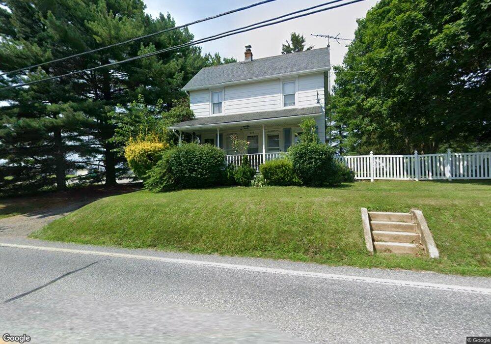
229 W Main St Fawn Grove, PA 17321
Estimated Value: $134,000 - $265,000
2
Beds
1
Bath
944
Sq Ft
$212/Sq Ft
Est. Value
About This Home
This home is located at 229 W Main St, Fawn Grove, PA 17321 and is currently estimated at $199,943, approximately $211 per square foot. 229 W Main St is a home located in York County with nearby schools including South Eastern Intermediate School, South Eastern Middle School, and Kennard-Dale High School.
Ownership History
Date
Name
Owned For
Owner Type
Purchase Details
Closed on
May 17, 2012
Sold by
Mcguigan Danielle N and Morrison Danielle N
Bought by
Mcguigan Danielle and Mcguigan Brian M
Current Estimated Value
Home Financials for this Owner
Home Financials are based on the most recent Mortgage that was taken out on this home.
Original Mortgage
$101,000
Outstanding Balance
$69,912
Interest Rate
3.88%
Mortgage Type
New Conventional
Estimated Equity
$130,031
Purchase Details
Closed on
Mar 31, 2005
Sold by
Giesey Amanda G
Bought by
Morrison Danielle N
Home Financials for this Owner
Home Financials are based on the most recent Mortgage that was taken out on this home.
Original Mortgage
$104,000
Interest Rate
5.61%
Mortgage Type
Fannie Mae Freddie Mac
Create a Home Valuation Report for This Property
The Home Valuation Report is an in-depth analysis detailing your home's value as well as a comparison with similar homes in the area
Home Values in the Area
Average Home Value in this Area
Purchase History
| Date | Buyer | Sale Price | Title Company |
|---|---|---|---|
| Mcguigan Danielle | -- | None Available | |
| Morrison Danielle N | $130,000 | -- |
Source: Public Records
Mortgage History
| Date | Status | Borrower | Loan Amount |
|---|---|---|---|
| Open | Mcguigan Danielle | $101,000 | |
| Closed | Morrison Danielle N | $104,000 |
Source: Public Records
Tax History Compared to Growth
Tax History
| Year | Tax Paid | Tax Assessment Tax Assessment Total Assessment is a certain percentage of the fair market value that is determined by local assessors to be the total taxable value of land and additions on the property. | Land | Improvement |
|---|---|---|---|---|
| 2025 | $2,398 | $76,990 | $23,410 | $53,580 |
| 2024 | $2,398 | $76,990 | $23,410 | $53,580 |
| 2023 | $2,398 | $76,990 | $23,410 | $53,580 |
| 2022 | $2,398 | $76,990 | $23,410 | $53,580 |
| 2021 | $2,321 | $76,990 | $23,410 | $53,580 |
| 2020 | $2,321 | $76,990 | $23,410 | $53,580 |
| 2019 | $2,314 | $76,990 | $23,410 | $53,580 |
| 2018 | $2,314 | $76,990 | $23,410 | $53,580 |
| 2017 | $2,314 | $76,990 | $23,410 | $53,580 |
| 2016 | $0 | $76,990 | $23,410 | $53,580 |
| 2015 | -- | $76,990 | $23,410 | $53,580 |
| 2014 | -- | $76,990 | $23,410 | $53,580 |
Source: Public Records
Map
Nearby Homes
- 31 N Market St
- 1701 Scott Rd
- 2131 Channel Rd
- 387 Garvine Mill Rd
- 20 Carea Rd
- 257 Wiley Mill Rd
- 54 Mitchell Rd
- 238 Mitchell Rd
- 194 Cook Rd
- 2913 Whiteford Rd
- 267 Cook Rd
- 4816 Amos Rd
- 397 Marsteller Rd
- 101 Saint Marys Rd
- 0 Lutz Rd Unit PAYK2091350
- 5403 New Park Rd
- 2623 Urey Rd
- 5121 Meadowview Dr
- 415 Saint Marys Rd
- 216 Meadow Trail