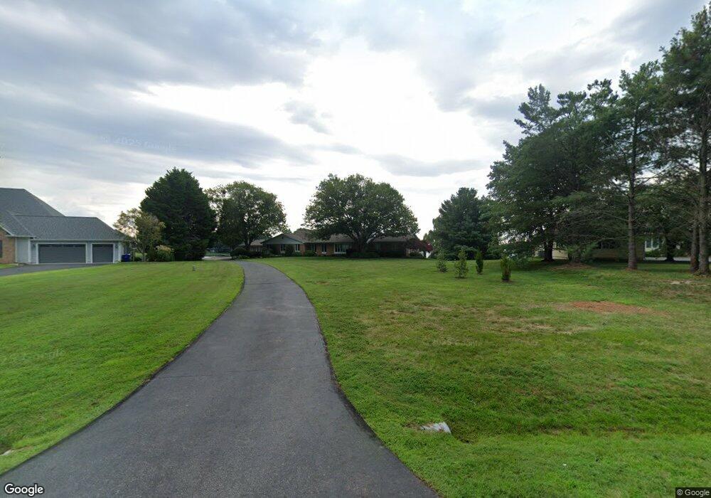
229 Wineland Way Stevensville, MD 21666
Estimated Value: $1,395,000 - $1,751,000
--
Bed
6
Baths
3,998
Sq Ft
$403/Sq Ft
Est. Value
About This Home
This home is located at 229 Wineland Way, Stevensville, MD 21666 and is currently estimated at $1,610,677, approximately $402 per square foot. 229 Wineland Way is a home located in Queen Anne's County with nearby schools including Matapeake Elementary School, Matapeake Middle School, and Kent Island High School.
Ownership History
Date
Name
Owned For
Owner Type
Purchase Details
Closed on
Dec 19, 2013
Sold by
Wauters Ronald P and Wauters Mary Ann
Bought by
Wauters Ronald P and Wauters Mary Ann
Current Estimated Value
Purchase Details
Closed on
Jun 22, 2005
Sold by
Mucha Evelyn F
Bought by
Wauters Ronald P and Mary Ann Trustees
Home Financials for this Owner
Home Financials are based on the most recent Mortgage that was taken out on this home.
Original Mortgage
$861,000
Outstanding Balance
$447,467
Interest Rate
5.69%
Mortgage Type
New Conventional
Estimated Equity
$1,163,210
Purchase Details
Closed on
Jun 2, 1986
Sold by
Wineland Robert K and Wineland Helen S
Bought by
Mucha Frank A and Mucha Evelyn F
Create a Home Valuation Report for This Property
The Home Valuation Report is an in-depth analysis detailing your home's value as well as a comparison with similar homes in the area
Home Values in the Area
Average Home Value in this Area
Purchase History
| Date | Buyer | Sale Price | Title Company |
|---|---|---|---|
| Wauters Ronald P | -- | None Available | |
| Wauters Ronald P | $1,230,000 | -- | |
| Mucha Frank A | $105,000 | -- |
Source: Public Records
Mortgage History
| Date | Status | Borrower | Loan Amount |
|---|---|---|---|
| Open | Wauters Ronald P | $861,000 |
Source: Public Records
Tax History Compared to Growth
Tax History
| Year | Tax Paid | Tax Assessment Tax Assessment Total Assessment is a certain percentage of the fair market value that is determined by local assessors to be the total taxable value of land and additions on the property. | Land | Improvement |
|---|---|---|---|---|
| 2025 | $11,915 | $1,336,000 | $0 | $0 |
| 2024 | $11,307 | $1,234,000 | $0 | $0 |
| 2023 | $10,723 | $1,132,000 | $510,700 | $621,300 |
| 2022 | $10,723 | $1,132,000 | $510,700 | $621,300 |
| 2021 | $11,358 | $1,132,000 | $510,700 | $621,300 |
| 2020 | $11,358 | $1,245,100 | $658,600 | $586,500 |
| 2019 | $10,798 | $1,166,700 | $0 | $0 |
| 2018 | $10,262 | $1,088,300 | $0 | $0 |
| 2017 | $9,746 | $1,009,900 | $0 | $0 |
| 2016 | -- | $1,009,900 | $0 | $0 |
| 2015 | $4,098 | $1,009,900 | $0 | $0 |
| 2014 | $4,098 | $1,150,800 | $0 | $0 |
Source: Public Records
Map
Nearby Homes
- 114 Queens Colony High Rd
- 122 Mallard Dr
- 116 Mallard Dr
- 303 Queens Colony High Rd
- 0 Reynolds Ave
- 312 Queens Colony High Rd
- 0 Allen Ave
- 124 Eareckson Ln
- 410 5 Farms Dr
- 206 Columbia Ln
- 100 Eareckson Ln
- 412 Five Farms Dr
- 303 Queen Anne Club Dr
- Lot 7 Maple Rd
- 103 Chesapeake Estates Dr
- 0 Chesapeake Estates Dr
- 114 Birch Rd
- 107 Bay Dr
- 534 Talbot Rd
- 104 Bay Dr
- 227 Wineland Way
- 231 Wineland Way
- 225 Wineland Way
- 233 Wineland Way
- 223 Wineland Way
- 214 Wineland Way
- 212 Wineland Way
- 216 Wineland Way
- 210 Wineland Way
- 221 Wineland Way
- 208 Wineland Way
- 219 Wineland Way
- 206 Wineland Way
- 300 Shipping Creek Dr
- 304 Butlers Landing
- 404 Butlers Landing
- 400 Butlers Landing
- 408 Butlers Landing
- 108 Indian Spring Ct
- 215 Wineland Way
