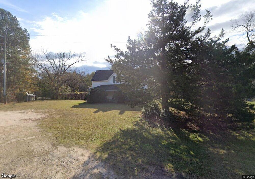
2291 Washington Hwy Union Point, GA 30669
Estimated Value: $213,644 - $273,000
--
Bed
2
Baths
2,240
Sq Ft
$104/Sq Ft
Est. Value
About This Home
This home is located at 2291 Washington Hwy, Union Point, GA 30669 and is currently estimated at $233,161, approximately $104 per square foot. 2291 Washington Hwy is a home located in Greene County with nearby schools including Greene County High School.
Ownership History
Date
Name
Owned For
Owner Type
Purchase Details
Closed on
Nov 15, 2011
Sold by
Newell D K Overton
Bought by
Newell D K Overton -Life Estate
Current Estimated Value
Purchase Details
Closed on
Aug 22, 1997
Sold by
Overton Richard J Mrs
Bought by
Newell D K Overton
Purchase Details
Closed on
Jan 1, 1939
Sold by
Overton Richard J Mrs
Bought by
Overton Richard J Mrs
Purchase Details
Closed on
Jan 1, 1923
Sold by
Overton Richard J Mrs
Bought by
Overton Richard J Mrs
Purchase Details
Closed on
Jan 1, 1905
Bought by
Overton Richard J Mrs
Create a Home Valuation Report for This Property
The Home Valuation Report is an in-depth analysis detailing your home's value as well as a comparison with similar homes in the area
Home Values in the Area
Average Home Value in this Area
Purchase History
| Date | Buyer | Sale Price | Title Company |
|---|---|---|---|
| Newell D K Overton -Life Estate | -- | -- | |
| Newell D K Overton | -- | -- | |
| Overton Richard J Mrs | -- | -- | |
| Overton Richard J Mrs | -- | -- | |
| Overton Richard J Mrs | -- | -- |
Source: Public Records
Tax History Compared to Growth
Tax History
| Year | Tax Paid | Tax Assessment Tax Assessment Total Assessment is a certain percentage of the fair market value that is determined by local assessors to be the total taxable value of land and additions on the property. | Land | Improvement |
|---|---|---|---|---|
| 2025 | $1,633 | $97,720 | $5,160 | $92,560 |
| 2024 | $1,701 | $92,560 | $5,160 | $87,400 |
| 2023 | $1,615 | $87,720 | $3,920 | $83,800 |
| 2022 | $1,232 | $59,320 | $3,000 | $56,320 |
| 2021 | $1,187 | $53,160 | $3,000 | $50,160 |
| 2020 | $579 | $19,480 | $2,480 | $17,000 |
| 2019 | $593 | $19,480 | $2,480 | $17,000 |
| 2018 | $571 | $19,480 | $2,480 | $17,000 |
| 2017 | $543 | $19,522 | $2,498 | $17,024 |
| 2016 | $559 | $20,294 | $2,498 | $17,796 |
| 2015 | $533 | $20,294 | $2,498 | $17,796 |
| 2014 | $444 | $15,498 | $2,498 | $13,000 |
Source: Public Records
Map
Nearby Homes
- 1860 Washington Hwy
- 0 Woodland Ct Unit 10543600
- 112 Hendry St
- 324 N Rhodes St
- 202 Veazey St
- 5401 Union Point Hwy
- 1201 Buffalo Lick Rd
- 0 Buffalo Lick Rd Unit 10551234
- 0 Buffalo Lick Rd Unit 10551325
- 215 Hunter St
- 1041 Hillcrest Dr
- 0 S Rhodes St Unit 10618488
- 0 Washington Hwy Unit 7276060
- 1241 Old Siloam Rd
- 1581 Highway 77 S
- 1581 Highway 77 S Hwy
- 1251 Adams Rd
- 1110 Woodland Ln
- 1110 Woodland Way
- 0 Old Union Point Rd Unit 1 10557753
- 2251 Washington Hwy
- 2211 Washington Hwy
- 2161 Washington Hwy
- 2520 Washington Hwy
- 2021 Washington Hwy
- 1960 Washington Hwy
- 1990 Washington Hwy
- 1920 Washington Hwy
- 2661 Washington Hwy
- 2241 Washington Hwy
- 1770 Jacksonville Rd
- 2740 Washington Hwy
- 1750 Jacksonville Rd
- 2761 Washington Hwy
- 2750 Washington Hwy
- 2791 Washington Hwy
- 2800 Washington Hwy Unit 20
- 2800 Washington Hwy
- 2801 Washington Hwy
- 1661 N Rhodes St