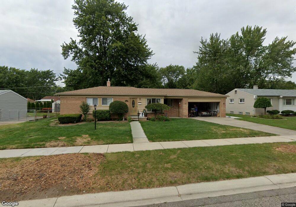
22959 Dale Allen St Clinton Township, MI 48035
Estimated Value: $261,895 - $282,000
3
Beds
2
Baths
1,500
Sq Ft
$183/Sq Ft
Est. Value
About This Home
This home is located at 22959 Dale Allen St, Clinton Township, MI 48035 and is currently estimated at $274,974, approximately $183 per square foot. 22959 Dale Allen St is a home located in Macomb County with nearby schools including Mount Clemens High School, Mt. Clemens Montessori Academy, and Faith Christian School.
Ownership History
Date
Name
Owned For
Owner Type
Purchase Details
Closed on
Feb 16, 2023
Sold by
Higbee I Charles Louis
Bought by
Cole Stephanie Sue
Current Estimated Value
Purchase Details
Closed on
Jan 3, 1995
Sold by
David L Wilde
Bought by
Higbee Charles L and Higbee Connie S
Home Financials for this Owner
Home Financials are based on the most recent Mortgage that was taken out on this home.
Original Mortgage
$75,000
Interest Rate
9.23%
Mortgage Type
New Conventional
Create a Home Valuation Report for This Property
The Home Valuation Report is an in-depth analysis detailing your home's value as well as a comparison with similar homes in the area
Home Values in the Area
Average Home Value in this Area
Purchase History
| Date | Buyer | Sale Price | Title Company |
|---|---|---|---|
| Cole Stephanie Sue | -- | -- | |
| Higbee Charles L | $100,000 | -- |
Source: Public Records
Mortgage History
| Date | Status | Borrower | Loan Amount |
|---|---|---|---|
| Previous Owner | Higbee Charles L | $75,000 |
Source: Public Records
Tax History Compared to Growth
Tax History
| Year | Tax Paid | Tax Assessment Tax Assessment Total Assessment is a certain percentage of the fair market value that is determined by local assessors to be the total taxable value of land and additions on the property. | Land | Improvement |
|---|---|---|---|---|
| 2025 | $2,812 | $120,000 | $0 | $0 |
| 2024 | $1,753 | $108,000 | $0 | $0 |
| 2023 | $1,669 | $96,900 | $0 | $0 |
| 2022 | $2,545 | $86,700 | $0 | $0 |
| 2021 | $2,476 | $81,700 | $0 | $0 |
| 2020 | $1,493 | $77,600 | $0 | $0 |
| 2019 | $2,229 | $68,800 | $0 | $0 |
| 2018 | $2,193 | $60,800 | $0 | $0 |
| 2017 | $2,180 | $51,200 | $8,500 | $42,700 |
| 2016 | $2,172 | $51,200 | $0 | $0 |
| 2015 | -- | $45,100 | $0 | $0 |
| 2014 | -- | $42,800 | $0 | $0 |
| 2011 | -- | $52,200 | $16,600 | $35,600 |
Source: Public Records
Map
Nearby Homes
- 22948 E Schafer St
- 23207 Dale Allen St
- 23346 Demley Dr
- 22317 E Schafer St
- 23571 Demley Dr
- 22459 Katzman St
- 22311 Spitzley St
- 22252 Dale Allen St
- 23636 Whitley Dr
- 23661 Demley Dr
- 23528 King Dr
- 23786 Thornton St
- 23614 King Dr
- 22771 Ulrich St
- 23608 Glenwood St
- 21934 S Nunneley Rd
- 21903 Elmway St
- 23844 Indianwood St
- 21885 N Nunneley Rd
- 37466 Stonegate Cir Unit 116
- 22943 Dale Allen St
- 23011 Dale Allen St
- 23000 E Schafer St
- 23016 E Schafer St
- 22954 Dale Allen St
- 23000 Dale Allen St
- 22927 Dale Allen St
- 23027 Dale Allen St
- 23032 E Schafer St
- 22932 E Schafer St
- 22938 Dale Allen St
- 23018 Dale Allen St
- 23048 E Schafer St
- 22920 Dale Allen St
- 22911 Dale Allen St
- 23036 Dale Allen St
- 23043 Dale Allen St
- 23001 E Schafer St
- 23025 Linne St
- 23043 Linne St