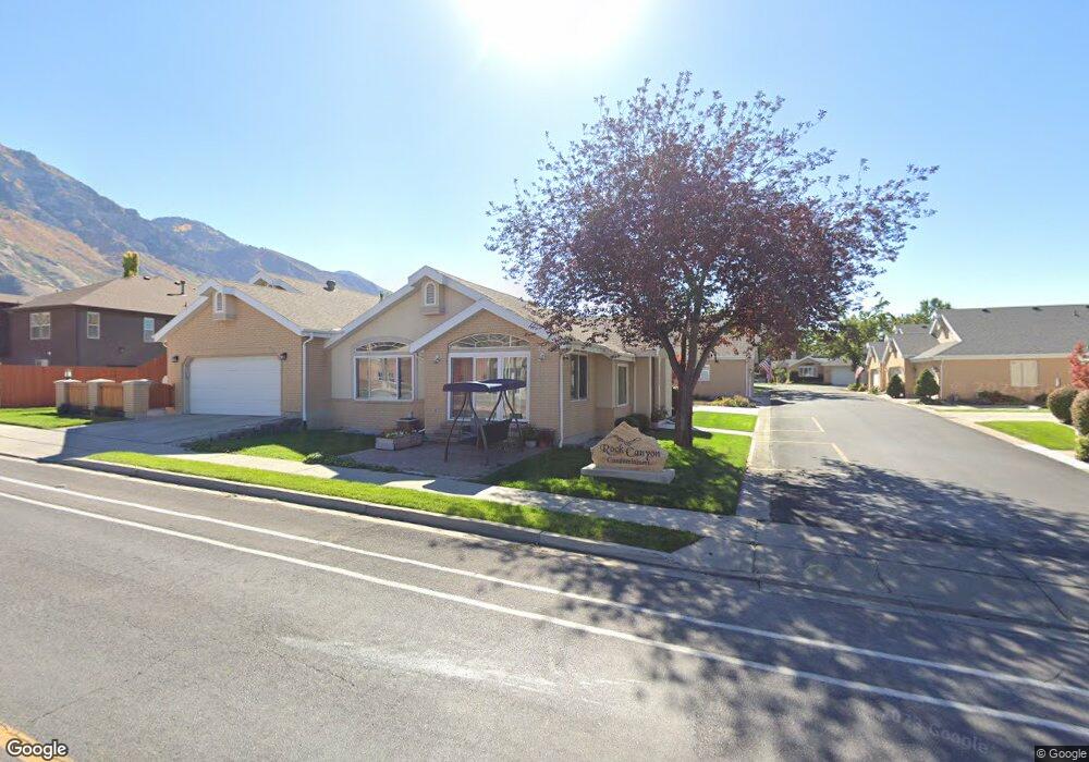
2296 N 470 E Provo, UT 84604
Rock Canyon NeighborhoodEstimated Value: $519,000 - $597,000
3
Beds
3
Baths
3,000
Sq Ft
$188/Sq Ft
Est. Value
About This Home
This home is located at 2296 N 470 E, Provo, UT 84604 and is currently estimated at $563,236, approximately $187 per square foot. 2296 N 470 E is a home located in Utah County with nearby schools including Rock Canyon Elementary School, Centennial Middle School, and Timpview High School.
Ownership History
Date
Name
Owned For
Owner Type
Purchase Details
Closed on
Apr 18, 2022
Sold by
Lee Clark Perry and Lee Anne L
Bought by
Zamme Ventures Llc
Current Estimated Value
Purchase Details
Closed on
Nov 22, 2021
Sold by
Perry Clark
Bought by
Clark Perry Lee and Clark Anne L
Home Financials for this Owner
Home Financials are based on the most recent Mortgage that was taken out on this home.
Original Mortgage
$315,000
Interest Rate
2.99%
Mortgage Type
New Conventional
Purchase Details
Closed on
Oct 6, 2021
Sold by
Dnp Genral Llc
Bought by
Clark Perry
Home Financials for this Owner
Home Financials are based on the most recent Mortgage that was taken out on this home.
Original Mortgage
$315,000
Interest Rate
2.99%
Mortgage Type
New Conventional
Purchase Details
Closed on
May 5, 2021
Sold by
Clark Daine
Bought by
Dnp General Llc
Purchase Details
Closed on
Mar 5, 2021
Sold by
Mcclurg John E and Mcclurg Jennifer J
Bought by
Clark Daine
Home Financials for this Owner
Home Financials are based on the most recent Mortgage that was taken out on this home.
Original Mortgage
$339,000
Interest Rate
2.7%
Mortgage Type
Unknown
Purchase Details
Closed on
Jan 15, 2014
Sold by
Mcclurg John E and Mcclurg Jennifer J
Bought by
John And Jennifer Mcclurg Family Trust
Purchase Details
Closed on
Jul 16, 2008
Sold by
Marilyn B Richards Family Lp
Bought by
Mcclurg John E and Mcclurg Jennifer J
Home Financials for this Owner
Home Financials are based on the most recent Mortgage that was taken out on this home.
Original Mortgage
$240,000
Interest Rate
6.31%
Mortgage Type
Purchase Money Mortgage
Purchase Details
Closed on
May 21, 2005
Sold by
Richards Marilyn Rae
Bought by
Marilyn B Richards Family Lp
Purchase Details
Closed on
May 8, 2002
Sold by
Marilyn B Richards Family Ltd Prtnrshp
Bought by
Richards Marilyn Rae
Home Financials for this Owner
Home Financials are based on the most recent Mortgage that was taken out on this home.
Original Mortgage
$78,200
Interest Rate
7.13%
Purchase Details
Closed on
Jul 13, 1999
Sold by
Forbes Eva W
Bought by
Richards Marilyn Rae Bagnall and Richards Marilyn Rae
Create a Home Valuation Report for This Property
The Home Valuation Report is an in-depth analysis detailing your home's value as well as a comparison with similar homes in the area
Home Values in the Area
Average Home Value in this Area
Purchase History
| Date | Buyer | Sale Price | Title Company |
|---|---|---|---|
| Zamme Ventures Llc | -- | Liberty Title | |
| Clark Perry Lee | -- | Real Advantage Title | |
| Clark Perry | -- | Accommodation | |
| Dnp General Llc | -- | 1St Liberty Title Llc | |
| Clark Daine | -- | 1St Liberty Title Llc | |
| John And Jennifer Mcclurg Family Trust | -- | None Available | |
| Mcclurg John E | -- | Title West Title Company | |
| Marilyn B Richards Family Lp | -- | -- | |
| Richards Marilyn Rae | -- | First American Title Co | |
| Richards Marilyn Rae Bagnall | -- | Century Title |
Source: Public Records
Mortgage History
| Date | Status | Borrower | Loan Amount |
|---|---|---|---|
| Previous Owner | Clark Perry Lee | $315,000 | |
| Previous Owner | Clark Daine | $339,000 | |
| Previous Owner | Mcclurg John E | $240,000 | |
| Previous Owner | Richards Marilyn Rae | $78,200 | |
| Closed | Clark Perry | $0 |
Source: Public Records
Tax History
| Year | Tax Paid | Tax Assessment Tax Assessment Total Assessment is a certain percentage of the fair market value that is determined by local assessors to be the total taxable value of land and additions on the property. | Land | Improvement |
|---|---|---|---|---|
| 2025 | $2,724 | $255,915 | -- | -- |
| 2024 | $2,724 | $268,180 | $0 | $0 |
| 2023 | $2,823 | $273,955 | $0 | $0 |
| 2022 | $2,699 | $264,110 | $0 | $0 |
| 2021 | $2,269 | $387,300 | $46,500 | $340,800 |
| 2020 | $2,238 | $358,100 | $43,000 | $315,100 |
| 2019 | $1,947 | $324,000 | $43,000 | $281,000 |
| 2018 | $1,777 | $299,900 | $36,000 | $263,900 |
| 2017 | $1,640 | $152,075 | $0 | $0 |
| 2016 | $1,629 | $140,800 | $0 | $0 |
| 2015 | $1,466 | $128,095 | $0 | $0 |
| 2014 | $1,407 | $128,095 | $0 | $0 |
Source: Public Records
Map
Nearby Homes
- 240 E 2230 N Unit 7
- 186 E 2100 N
- 1960 N Canyon Rd
- 788 E 2680 N
- 360 Sumac Ln
- 1801 N 650 E
- 2774 N 370 E
- 2735 N Country Club Dr
- 223 W 2230 N Unit 14
- 241 W 2230 N Unit 16
- 758 E 3030 N
- 3025 N 250 E
- 2025 Oak Ln
- 3043 Bannock Dr
- 3013 N 100 W
- 2939 N Marrcrest Dr W
- 2999 N Marrcrest West Dr
- 3057 N 100 W
- 264 W 1625 N
- 3129 Cherokee Ln
- 482 E 2320 N
- 2288 N 470 E
- 2282 N 470 E
- 446 E 2320 N
- 2299 Rock Canyon Cir
- 2299 Rock Canyon Cir Unit TVC 1A
- 2268 N 470 E
- 2281 N 470 E
- 2273 N 470 E
- 2262 N 470 E
- 2277 Rock Canyon Cir
- 2277 Rock Canyon Cir
- 453 E 2260 N
- 440 E 2320 N
- 439 E 2260 N
- 432 E 2320 N
- 433 E 2260 N
- 478 E 2260 N
- 484 E 2260 N
- 464 E 2260 N
Your Personal Tour Guide
Ask me questions while you tour the home.