Estimated Value: $861,000 - $968,000
4
Beds
5
Baths
3,293
Sq Ft
$276/Sq Ft
Est. Value
About This Home
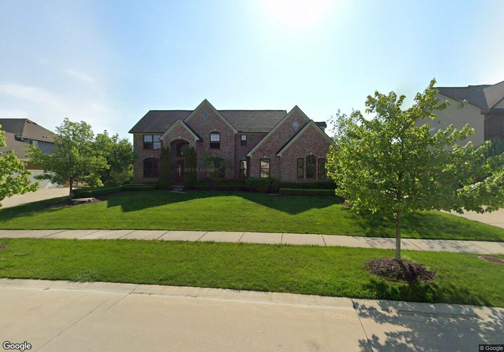
This home is located at 22962 Fremont Dr, Lyon, MI 48178 and is currently estimated at $909,987, approximately $276 per square foot. 22962 Fremont Dr is a home located in Oakland County with nearby schools including Salem Elementary School, Centennial Middle School, and South Lyon East High School.
Ownership History
Date
Name
Owned For
Owner Type
Purchase Details
Closed on
Sep 25, 2014
Sold by
Healy Homes Llc
Bought by
Benjamin Lee and Benjamin Carolyn
Current Estimated Value
Purchase Details
Closed on
Jun 19, 2012
Sold by
Healy Homes Llc
Bought by
Lyon Ridge Development #2 Llc
Purchase Details
Closed on
Jan 14, 2011
Sold by
Lyon Ridge Investment Company Llc
Bought by
Healy Homes L L C
Purchase Details
Closed on
Oct 25, 2010
Sold by
Meisner Andrew E
Bought by
Healy Homes
Create a Home Valuation Report for This Property
The Home Valuation Report is an in-depth analysis detailing your home's value as well as a comparison with similar homes in the area
Home Values in the Area
Average Home Value in this Area
Purchase History
| Date | Buyer | Sale Price | Title Company |
|---|---|---|---|
| Benjamin Lee | $604,387 | First American Title Ins Co | |
| Healy Homes Llc | -- | First American Title Ins Co | |
| Lyon Ridge Development #2 Llc | -- | None Available | |
| Healy Homes L L C | -- | None Available | |
| Healy Homes | $426 | None Available |
Source: Public Records
Tax History Compared to Growth
Tax History
| Year | Tax Paid | Tax Assessment Tax Assessment Total Assessment is a certain percentage of the fair market value that is determined by local assessors to be the total taxable value of land and additions on the property. | Land | Improvement |
|---|---|---|---|---|
| 2024 | $6,779 | $367,700 | $0 | $0 |
| 2023 | $6,466 | $330,620 | $0 | $0 |
| 2022 | $8,843 | $292,720 | $0 | $0 |
| 2021 | $8,078 | $292,940 | $0 | $0 |
| 2020 | $5,945 | $296,370 | $0 | $0 |
| 2019 | $8,437 | $285,050 | $0 | $0 |
| 2018 | $8,302 | $278,790 | $0 | $0 |
| 2017 | $8,037 | $275,330 | $0 | $0 |
| 2016 | $8,051 | $266,010 | $0 | $0 |
| 2015 | -- | $248,930 | $0 | $0 |
| 2014 | -- | $28,340 | $0 | $0 |
| 2011 | -- | $6,480 | $0 | $0 |
Source: Public Records
Map
Nearby Homes
- 23275 Chubb Rd
- 22550 Chubb Rd
- 22721 Arcadia Bluffs
- 52095 Pierce Dr
- 23063 Kirkland Ct
- 52909 10 Mile Rd
- 21317 Stone Meadow Dr
- 24400 Johns Rd
- 22858 Saint George Cir
- 51693 Turnburry Dr
- 23710 Spy Glass Hill N
- 24530 Pinnacle Cir Unit 25
- 21140 Chubb Rd
- 52044 Barnstaple Dr
- 21008 Torbay Dr
- 49588 Villa Dr
- 9540 Chubb Rd
- 49646 Villa Dr
- 0000 Johns Rd
- 24600 Johns Rd
- 22962 Fremont Dr N
- 22930 Fremont Dr
- 22930 Fremont Dr N
- 22996 Fremont Dr N
- 52708 Aspen
- 52688 Aspen
- 52688 Aspen Dr
- 23030 Fremont Dr N
- 22965 Fremont Dr N
- 22931 Fremont
- 22931 Fremont Dr N
- 52693 Fremont Dr E
- 52693 Fremont Dr
- 52590 Aspen Dr
- 52619 Fremont Dr E
- 52619 Fremont Dr E
- 52725 Aspen Dr
- 22865 Fremont
- 52761 Aspen Dr
- 52761 Aspen