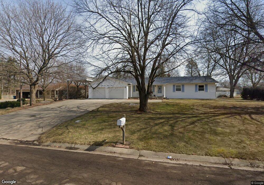
2297 MacScott Ct Swartz Creek, MI 48473
Estimated Value: $234,525 - $282,000
--
Bed
1
Bath
1,824
Sq Ft
$146/Sq Ft
Est. Value
About This Home
This home is located at 2297 MacScott Ct, Swartz Creek, MI 48473 and is currently estimated at $265,881, approximately $145 per square foot. 2297 MacScott Ct is a home located in Genesee County with nearby schools including Elms Road Elementary School, Syring Elementary School, and Dieck Elementary School.
Ownership History
Date
Name
Owned For
Owner Type
Purchase Details
Closed on
Dec 21, 2012
Sold by
Herrick Donald F and Herrick Steven F
Bought by
Herrick Steven F
Current Estimated Value
Purchase Details
Closed on
May 1, 2003
Sold by
Herrick Donald F
Bought by
Herrick Donald F and Herrick Steven F
Create a Home Valuation Report for This Property
The Home Valuation Report is an in-depth analysis detailing your home's value as well as a comparison with similar homes in the area
Home Values in the Area
Average Home Value in this Area
Purchase History
| Date | Buyer | Sale Price | Title Company |
|---|---|---|---|
| Herrick Steven F | -- | None Available | |
| Herrick Donald F | -- | -- |
Source: Public Records
Tax History Compared to Growth
Tax History
| Year | Tax Paid | Tax Assessment Tax Assessment Total Assessment is a certain percentage of the fair market value that is determined by local assessors to be the total taxable value of land and additions on the property. | Land | Improvement |
|---|---|---|---|---|
| 2025 | $2,564 | $122,900 | $0 | $0 |
| 2024 | $736 | $113,400 | $0 | $0 |
| 2023 | $702 | $99,500 | $0 | $0 |
| 2022 | $2,259 | $89,000 | $0 | $0 |
| 2021 | $2,240 | $87,500 | $0 | $0 |
| 2020 | $642 | $84,300 | $0 | $0 |
| 2019 | $632 | $86,300 | $0 | $0 |
| 2018 | $1,841 | $70,400 | $0 | $0 |
| 2017 | $1,774 | $70,400 | $0 | $0 |
| 2016 | $1,729 | $69,500 | $0 | $0 |
| 2015 | $1,565 | $67,200 | $0 | $0 |
| 2014 | $583 | $59,900 | $0 | $0 |
| 2012 | -- | $48,700 | $48,700 | $0 |
Source: Public Records
Map
Nearby Homes
- 7070 Aldredge Dr
- 7062 S Fork Dr
- 7094 Crosswinds Dr
- 6507 Corunna Rd Unit 6493 Corunna Rd.
- 7042 Corunna Rd
- 00 Corunna Rd
- 6456 W Court St
- 000 Corunna Rd
- 4076 S Morrish Rd
- 7075 Saratoga Dr
- 7091 Saratoga Dr
- 7035 Saratoga Dr
- 6079 Lennon Rd
- 7184 Saratoga Dr
- 1208 Citation Dr
- 7136 Saratoga Dr
- 7176 Saratoga Dr
- 3295 Pine Run Dr
- 1191 Derby Blvd
- 7030 Saratoga Dr
- 7080 Aldredge Dr
- 2287 MacScott Ct
- 7092 Aldredge Dr
- 2277 MacScott Dr
- 2277 MacScott Ct
- 2296 MacScott Ct
- 2306 MacScott Ct
- 2286 MacScott Ct
- 7112 Aldredge Dr
- 2276 MacScott Ct
- 7060 Aldredge Dr
- 7087 Aldredge Dr
- 7099 Aldredge Dr
- 7073 Aldredge Dr
- 7109 Aldredge Dr Unit Bldg-Unit
- 7109 Aldredge Dr
- 7190 S Fork Dr
- 7200 S Fork Dr
- 7180 S Fork Dr
- 7057 Aldredge Dr