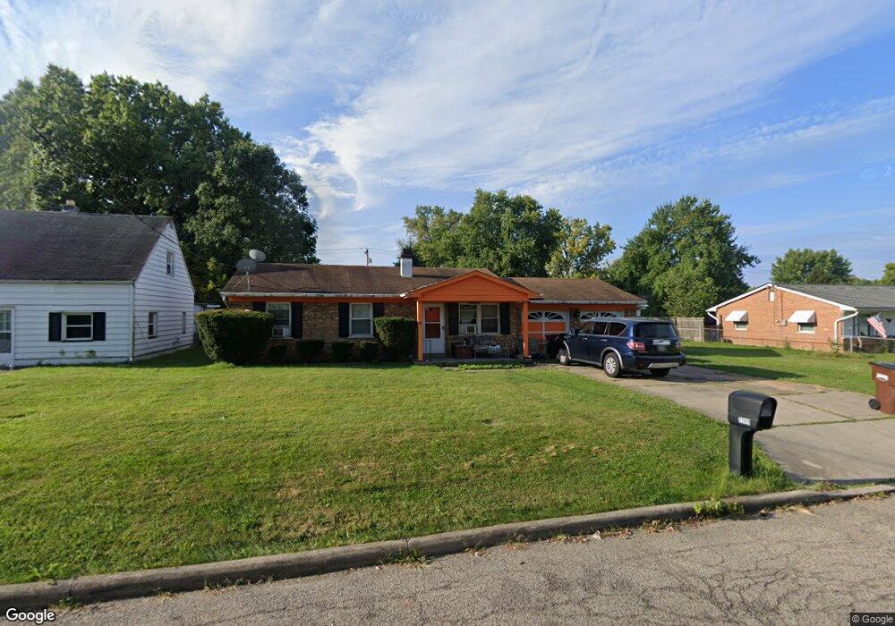
2299 Grant Ave Cincinnati, OH 45231
Mount Healthy Heights NeighborhoodEstimated Value: $132,000 - $182,000
3
Beds
1
Bath
999
Sq Ft
$167/Sq Ft
Est. Value
About This Home
This home is located at 2299 Grant Ave, Cincinnati, OH 45231 and is currently estimated at $167,020, approximately $167 per square foot. 2299 Grant Ave is a home located in Hamilton County with nearby schools including Pleasant Run Elementary School, Taylor Elementary School, and Pleasant Run Middle School.
Ownership History
Date
Name
Owned For
Owner Type
Purchase Details
Closed on
Apr 14, 1997
Sold by
Guthrie Donald R and Guthrie Julie A
Bought by
Lenguadoro James D and Lenguadoro Carol B
Current Estimated Value
Home Financials for this Owner
Home Financials are based on the most recent Mortgage that was taken out on this home.
Original Mortgage
$63,977
Outstanding Balance
$8,301
Interest Rate
7.93%
Mortgage Type
FHA
Estimated Equity
$158,719
Create a Home Valuation Report for This Property
The Home Valuation Report is an in-depth analysis detailing your home's value as well as a comparison with similar homes in the area
Home Values in the Area
Average Home Value in this Area
Purchase History
| Date | Buyer | Sale Price | Title Company |
|---|---|---|---|
| Lenguadoro James D | $63,500 | -- |
Source: Public Records
Mortgage History
| Date | Status | Borrower | Loan Amount |
|---|---|---|---|
| Open | Lenguadoro James D | $63,977 |
Source: Public Records
Tax History Compared to Growth
Tax History
| Year | Tax Paid | Tax Assessment Tax Assessment Total Assessment is a certain percentage of the fair market value that is determined by local assessors to be the total taxable value of land and additions on the property. | Land | Improvement |
|---|---|---|---|---|
| 2024 | $2,360 | $38,577 | $6,230 | $32,347 |
| 2023 | $2,203 | $38,577 | $6,230 | $32,347 |
| 2022 | $1,599 | $20,146 | $5,481 | $14,665 |
| 2021 | $1,591 | $20,146 | $5,481 | $14,665 |
| 2020 | $1,571 | $20,146 | $5,481 | $14,665 |
| 2019 | $1,538 | $18,316 | $4,984 | $13,332 |
| 2018 | $1,546 | $18,316 | $4,984 | $13,332 |
| 2017 | $1,490 | $18,316 | $4,984 | $13,332 |
| 2016 | $1,785 | $21,403 | $5,793 | $15,610 |
| 2015 | $1,770 | $21,403 | $5,793 | $15,610 |
| 2014 | $1,759 | $21,403 | $5,793 | $15,610 |
| 2013 | $2,072 | $25,785 | $6,979 | $18,806 |
Source: Public Records
Map
Nearby Homes
- 2465 Wilson Ave
- 2508 Wilson Ave
- 10804 Sprucehill Dr
- 2696 Washington Ave
- 10762 Pippin Rd
- 2776 Klondike Ct
- 2845 Wilson Ave
- 10908 Tangleberry Ct
- 2882 Wilson Ave
- 2717 Merrittview Ln
- 1890 Lotushill Dr
- 2936 Butterwick Dr
- 10443 Burlington Rd
- 2000 Struble Rd
- 2504 Houston Rd
- 2504 Houston Rd Unit 1
- 2502 Houston Rd
- 2502 Houston Rd Unit 2
- 10359 Hawkhurst Dr
- 2474 Houston Rd
- 2309 Grant Ave
- 2313 Grant Ave
- 2281 Grant Ave
- 2294 Roosevelt Ave
- 2316 Roosevelt Ave
- 2296 Grant Ave
- 2308 Grant Ave
- 2273 Grant Ave
- 2318 Roosevelt Ave
- 2290 Grant Ave
- 2312 Grant Ave
- 2331 Grant Ave
- 2322 Roosevelt Ave
- 2265 Grant Ave
- 2328 Roosevelt Ave
- 2335 Grant Ave
- 2295 Roosevelt Ave
- 2295 Wilson Ave
- 2311 Roosevelt Ave
- 2305 Wilson Ave