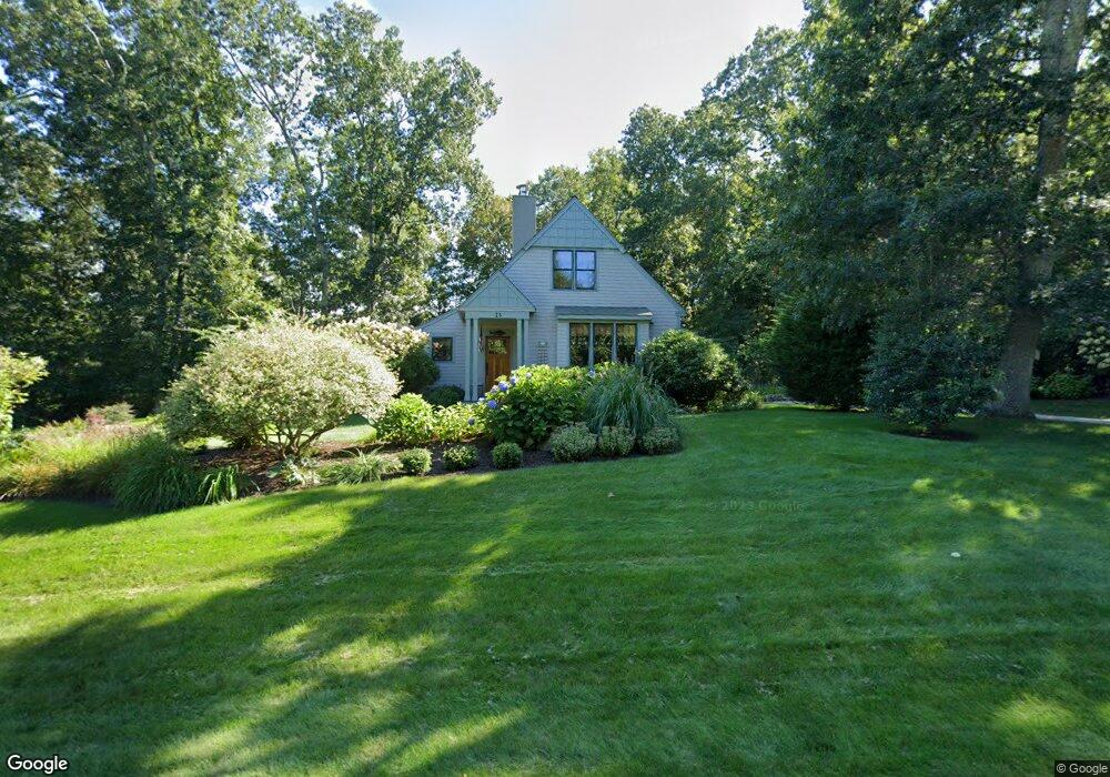
23 Abel Hart Ln Tiverton, RI 02878
Four Corners NeighborhoodEstimated Value: $642,000 - $979,000
3
Beds
3
Baths
1,574
Sq Ft
$494/Sq Ft
Est. Value
About This Home
This home is located at 23 Abel Hart Ln, Tiverton, RI 02878 and is currently estimated at $777,710, approximately $494 per square foot. 23 Abel Hart Ln is a home located in Newport County with nearby schools including Tiverton High School.
Ownership History
Date
Name
Owned For
Owner Type
Purchase Details
Closed on
May 13, 2021
Sold by
Roberti Marilyn A
Bought by
Marilyn A Roberti Lt
Current Estimated Value
Purchase Details
Closed on
Oct 21, 2003
Sold by
Abel Hart Commons Inc
Bought by
Robert Marilyn
Home Financials for this Owner
Home Financials are based on the most recent Mortgage that was taken out on this home.
Original Mortgage
$289,000
Interest Rate
6.43%
Create a Home Valuation Report for This Property
The Home Valuation Report is an in-depth analysis detailing your home's value as well as a comparison with similar homes in the area
Home Values in the Area
Average Home Value in this Area
Purchase History
| Date | Buyer | Sale Price | Title Company |
|---|---|---|---|
| Marilyn A Roberti Lt | -- | None Available | |
| Robert Marilyn | $100,000 | -- |
Source: Public Records
Mortgage History
| Date | Status | Borrower | Loan Amount |
|---|---|---|---|
| Previous Owner | Robert Marilyn | $270,000 | |
| Previous Owner | Robert Marilyn | $276,000 | |
| Previous Owner | Robert Marilyn | $289,000 |
Source: Public Records
Tax History Compared to Growth
Tax History
| Year | Tax Paid | Tax Assessment Tax Assessment Total Assessment is a certain percentage of the fair market value that is determined by local assessors to be the total taxable value of land and additions on the property. | Land | Improvement |
|---|---|---|---|---|
| 2025 | $7,013 | $634,700 | $246,600 | $388,100 |
| 2024 | $7,013 | $634,700 | $246,600 | $388,100 |
| 2023 | $6,665 | $447,300 | $176,100 | $271,200 |
| 2022 | $6,544 | $447,300 | $176,100 | $271,200 |
| 2021 | $6,607 | $463,000 | $176,100 | $286,900 |
| 2020 | $5,550 | $342,800 | $119,500 | $223,300 |
| 2019 | $5,413 | $342,800 | $119,500 | $223,300 |
| 2018 | $5,618 | $342,800 | $119,500 | $223,300 |
| 2017 | $5,995 | $314,700 | $116,700 | $198,000 |
| 2016 | $6,023 | $314,700 | $116,700 | $198,000 |
| 2015 | $6,023 | $314,700 | $116,700 | $198,000 |
| 2014 | $6,058 | $313,900 | $116,700 | $197,200 |
Source: Public Records
Map
Nearby Homes
- 184 Field Stone Ln
- 0 S Lake Rd Unit 73361665
- 0 S Lake Rd Unit 1382842
- 0 S Lake Rd Unit 1400795
- 90 Two Rod Rd
- 17 Quail Trail
- 116 Amy Hart Path
- 83 Long Hwy
- 978 Sodom Rd
- 101 Adamsville Rd
- 3622 Main Rd
- 15 Village Way
- 8 Village Way
- 7 Village Way
- 837 Main Road & Lot 2
- 837 Main Rd
- 24 Peaceful Way
- 245 John Dyer Rd
- 308 Robert St
- 374 Crandall Rd
- 7 Abel Hart Ln
- 43 Abel Hart Ln
- 1633 Crandall Rd
- 36 Abel Hart Ln
- 1677 Crandall Rd
- 61 Abel Hart Ln
- 1633 Old Crandall Rd
- 58 Abel Hart Ln
- 73 Abel Hart Ln
- 1613 Crandall Rd
- 0 Abel Hart Ln
- Lot #2 Abel Hart Ln
- 87 Abel Hart Ln
- 82 Abel Hart Ln
- LOT 23C Crandall Rd
- 1713 Crandall Rd
- 3 Abel Hart Ln
- 6 Abel Hart Ln
- 14 S Commons Rd
- 1598 Crandall Rd