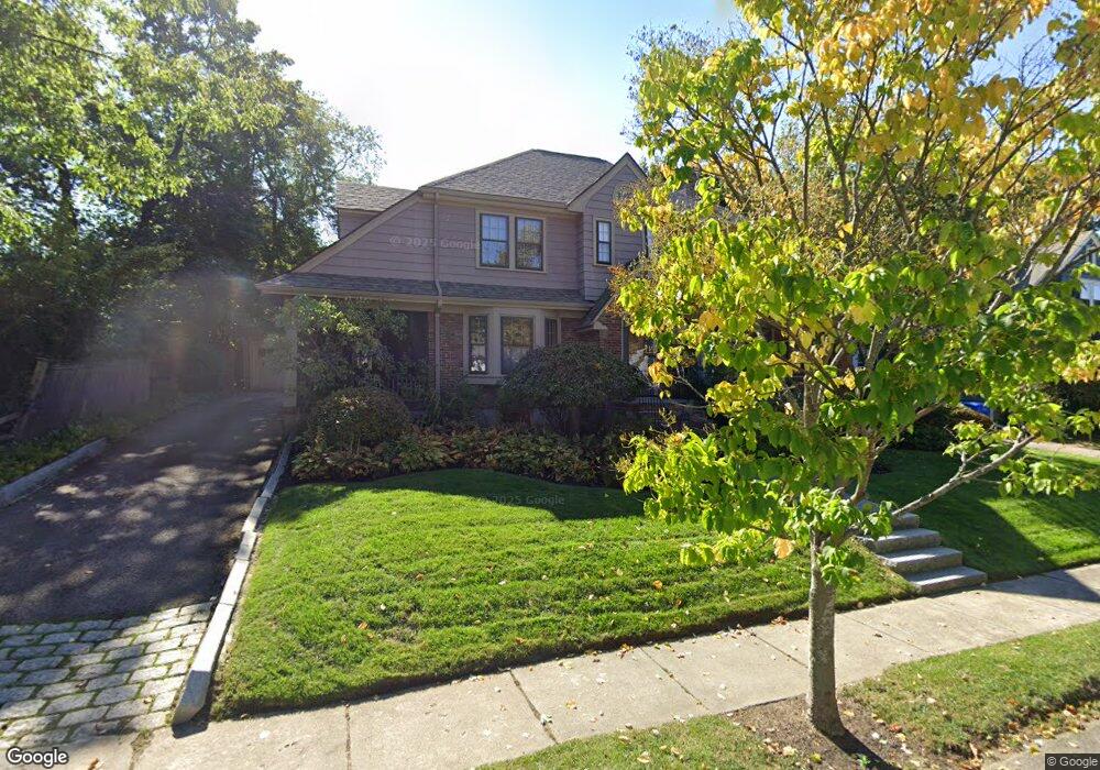
23 Adams St Belmont, MA 02478
Belmont Center NeighborhoodEstimated Value: $1,940,000 - $2,226,000
3
Beds
3
Baths
2,373
Sq Ft
$864/Sq Ft
Est. Value
About This Home
This home is located at 23 Adams St, Belmont, MA 02478 and is currently estimated at $2,050,245, approximately $863 per square foot. 23 Adams St is a home located in Middlesex County with nearby schools including Mary Lee Burbank Elementary School, Winthrop L Chenery Middle School, and Belmont High School.
Ownership History
Date
Name
Owned For
Owner Type
Purchase Details
Closed on
Dec 7, 2015
Sold by
Mcartor Colleen
Bought by
Colleen M Mcartor T
Current Estimated Value
Purchase Details
Closed on
Jan 10, 1997
Sold by
Cf Gh and Cf Getchell T
Bought by
Thompson Scott D
Create a Home Valuation Report for This Property
The Home Valuation Report is an in-depth analysis detailing your home's value as well as a comparison with similar homes in the area
Home Values in the Area
Average Home Value in this Area
Purchase History
| Date | Buyer | Sale Price | Title Company |
|---|---|---|---|
| Colleen M Mcartor T | -- | -- | |
| Scott D Thompson T | -- | -- | |
| Thompson Scott D | -- | -- | |
| Thompson Scott D | $425,000 | -- |
Source: Public Records
Mortgage History
| Date | Status | Borrower | Loan Amount |
|---|---|---|---|
| Previous Owner | Thompson Scott D | $350,000 | |
| Previous Owner | Thompson Scott D | $350,000 | |
| Previous Owner | Thompson Scott D | $363,000 |
Source: Public Records
Tax History Compared to Growth
Tax History
| Year | Tax Paid | Tax Assessment Tax Assessment Total Assessment is a certain percentage of the fair market value that is determined by local assessors to be the total taxable value of land and additions on the property. | Land | Improvement |
|---|---|---|---|---|
| 2025 | $21,595 | $1,896,000 | $981,000 | $915,000 |
| 2024 | $19,958 | $1,890,000 | $1,223,000 | $667,000 |
| 2023 | $17,849 | $1,588,000 | $933,000 | $655,000 |
| 2022 | $16,664 | $1,465,000 | $854,000 | $611,000 |
| 2021 | $16,664 | $1,444,000 | $934,000 | $510,000 |
| 2020 | $16,456 | $1,496,000 | $996,000 | $500,000 |
| 2019 | $14,681 | $1,258,000 | $777,000 | $481,000 |
| 2018 | $5,126 | $1,109,000 | $628,000 | $481,000 |
| 2017 | $13,413 | $1,057,000 | $576,000 | $481,000 |
| 2016 | $13,226 | $1,053,000 | $576,000 | $477,000 |
| 2015 | $12,500 | $969,000 | $492,000 | $477,000 |
Source: Public Records
Map
Nearby Homes
- 36 Madison St
- 105 Watson Rd
- 38 Myrtle St
- 263 Common St
- 48 Concord Ave
- 118 Blanchard Rd
- 1 Spinney Terrace
- 48 Hamilton Rd
- 46 Hamilton Rd
- 4 Merrill Ave
- 69 Horace Rd
- 73 Trowbridge St Unit 73A
- 73 Trowbridge St Unit 73B
- 15 Sunset Rd
- 125 Trapelo Rd Unit 21
- 125 Trapelo Rd Unit 23
- 73 Foster Rd Unit 2
- 59-61 Gilbert Rd
- 93 Griswold St Unit 93
- 95 Griswold St Unit 95