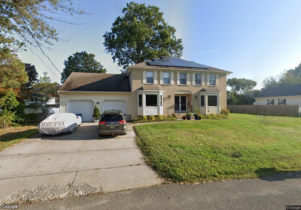
23 Algonquin Ave Oceanport, NJ 07757
Estimated Value: $859,000 - $1,166,000
4
Beds
3
Baths
3,200
Sq Ft
$333/Sq Ft
Est. Value
About This Home
This home is located at 23 Algonquin Ave, Oceanport, NJ 07757 and is currently estimated at $1,065,386, approximately $332 per square foot. 23 Algonquin Ave is a home located in Monmouth County with nearby schools including Wolf Hill Elementary School, Maple Place Elementary and Middle School, and Shore Regional High School.
Ownership History
Date
Name
Owned For
Owner Type
Purchase Details
Closed on
Oct 18, 2023
Sold by
Saliski Gary
Bought by
Ibdc Property Llc
Current Estimated Value
Purchase Details
Closed on
Feb 23, 2022
Sold by
Remedios and Maria
Bought by
Pessoa Marcos Lucio
Purchase Details
Closed on
Nov 5, 2008
Sold by
Saliski Amelia Lombardo and Lombardo Amelia N
Bought by
Saliski Amelia Lombardo and Saliski Richard M
Purchase Details
Closed on
Aug 9, 1994
Sold by
Lombardo Amelia
Bought by
Pontecorvo Helen
Create a Home Valuation Report for This Property
The Home Valuation Report is an in-depth analysis detailing your home's value as well as a comparison with similar homes in the area
Home Values in the Area
Average Home Value in this Area
Purchase History
| Date | Buyer | Sale Price | Title Company |
|---|---|---|---|
| Ibdc Property Llc | $700,000 | Stewart Title | |
| Ibdc Property Llc | $700,000 | Stewart Title | |
| Pessoa Marcos Lucio | $530,000 | New Title Company Name | |
| Pessoa Marcos Lucio | $530,000 | New Title Company Name | |
| Pessoa Marcos Lucio | $530,000 | New Title Company Name | |
| Saliski Amelia Lombardo | -- | None Available | |
| Pontecorvo Helen | $90,000 | -- |
Source: Public Records
Tax History Compared to Growth
Tax History
| Year | Tax Paid | Tax Assessment Tax Assessment Total Assessment is a certain percentage of the fair market value that is determined by local assessors to be the total taxable value of land and additions on the property. | Land | Improvement |
|---|---|---|---|---|
| 2025 | $13,038 | $938,000 | $542,000 | $396,000 |
| 2024 | $12,735 | $825,700 | $419,000 | $406,700 |
| 2023 | $12,735 | $765,300 | $379,000 | $386,300 |
| 2022 | $10,772 | $689,100 | $349,000 | $340,100 |
| 2021 | $10,772 | $658,200 | $334,000 | $324,200 |
| 2020 | $11,564 | $632,600 | $314,000 | $318,600 |
| 2019 | $11,013 | $611,500 | $304,000 | $307,500 |
| 2018 | $10,874 | $607,800 | $304,000 | $303,800 |
| 2017 | $10,298 | $477,400 | $194,000 | $283,400 |
| 2016 | $10,136 | $473,000 | $195,000 | $278,000 |
| 2015 | $9,559 | $460,900 | $190,000 | $270,900 |
| 2014 | $10,194 | $498,500 | $240,000 | $258,500 |
Source: Public Records
Map
Nearby Homes
- 8 Pocahontas Ave
- 15 Signal Ave
- 580 Patten Ave Unit 48
- 580 Patten Ave Unit 62
- 580 Patten Ave Unit 86
- 580 Patten Ave Unit 31
- 28 Patten Ln
- 66 Shrewsbury Ave
- 16 Shore Dr
- 165 Kingsley St
- 164 Airsdale Ave
- 13 Morris Place
- 15 Airsdale Ave
- 392 Florence Ave
- 3 Foggia Way
- 154 Atlantic Ave
- 8 Mann Ct
- 323 Florence Ave
- 7 Manahassett Park Dr
- 10 Asbury Ave
- 20 Wyandotte Ave
- 19 Algonquin Ave
- 29 Algonquin Ave
- 24 Algonquin Ave
- 24 Wyandotte Ave
- 26 Algonquin Ave
- 14 Wyandotte Ave
- 20 Algonquin Ave
- 30 Algonquin Ave
- 35 Algonquin Ave
- 15 Algonquin Ave
- 19 Wyandotte Ave
- 16 Algonquin Ave
- 25 Hiawatha Ave
- 30 Wyandotte Ave
- 29 Hiawatha Ave
- 23 Hiawatha Ave
- 25 Wyandotte Ave
- 12 Wyandotte Ave
- 15 Wyandotte Ave