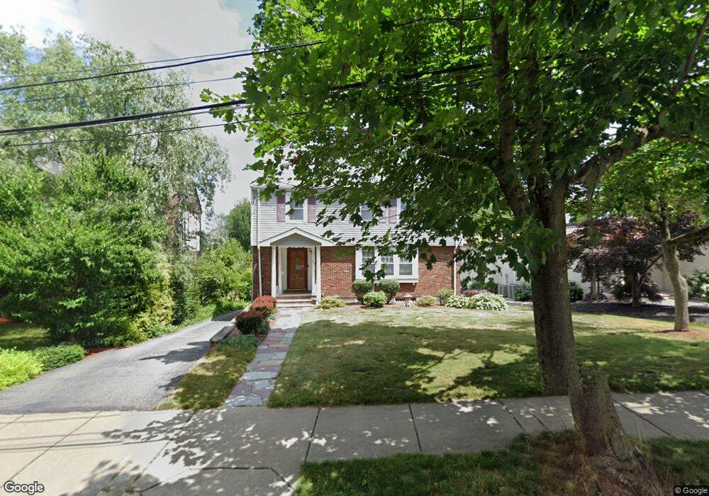
23 Algonquin Rd Chestnut Hill, MA 02467
Chestnut Hill NeighborhoodEstimated Value: $1,551,475 - $2,037,000
4
Beds
3
Baths
1,934
Sq Ft
$926/Sq Ft
Est. Value
About This Home
This home is located at 23 Algonquin Rd, Chestnut Hill, MA 02467 and is currently estimated at $1,790,369, approximately $925 per square foot. 23 Algonquin Rd is a home located in Middlesex County with nearby schools including Ward Elementary School, Bigelow Middle School, and Newton North High School.
Ownership History
Date
Name
Owned For
Owner Type
Purchase Details
Closed on
May 1, 1996
Sold by
Cassady George and Cassady June R
Bought by
Luke Kenneth W and Luke Susan M
Current Estimated Value
Purchase Details
Closed on
Aug 5, 1993
Sold by
Brodsky Stuart L
Bought by
Cassady George and Cassady June R
Purchase Details
Closed on
Jul 16, 1992
Sold by
Roth Larry
Bought by
Brodsky Stuart L
Create a Home Valuation Report for This Property
The Home Valuation Report is an in-depth analysis detailing your home's value as well as a comparison with similar homes in the area
Home Values in the Area
Average Home Value in this Area
Purchase History
| Date | Buyer | Sale Price | Title Company |
|---|---|---|---|
| Luke Kenneth W | $418,000 | -- | |
| Cassady George | $380,000 | -- | |
| Brodsky Stuart L | $350,000 | -- |
Source: Public Records
Mortgage History
| Date | Status | Borrower | Loan Amount |
|---|---|---|---|
| Open | Brodsky Stuart L | $226,000 | |
| Closed | Brodsky Stuart L | $289,000 |
Source: Public Records
Tax History
| Year | Tax Paid | Tax Assessment Tax Assessment Total Assessment is a certain percentage of the fair market value that is determined by local assessors to be the total taxable value of land and additions on the property. | Land | Improvement |
|---|---|---|---|---|
| 2025 | $14,337 | $1,463,000 | $1,298,000 | $165,000 |
| 2024 | $13,863 | $1,420,400 | $1,260,200 | $160,200 |
| 2023 | $13,247 | $1,301,300 | $959,300 | $342,000 |
| 2022 | $12,676 | $1,204,900 | $888,200 | $316,700 |
| 2021 | $12,231 | $1,136,700 | $837,900 | $298,800 |
| 2020 | $11,867 | $1,136,700 | $837,900 | $298,800 |
| 2019 | $11,533 | $1,103,600 | $813,500 | $290,100 |
| 2018 | $11,024 | $1,018,900 | $738,500 | $280,400 |
| 2017 | $10,689 | $961,200 | $696,700 | $264,500 |
| 2016 | $10,223 | $898,300 | $651,100 | $247,200 |
| 2015 | $9,747 | $839,500 | $608,500 | $231,000 |
Source: Public Records
Map
Nearby Homes
- 39 Commonwealth Ave Unit 31
- 27-29 Commonwealth Ave Unit 9
- 116 Lake Shore Rd Unit 4
- 55 Woodlawn Dr
- 61 Woodlawn Dr
- 32-34 Larch St
- 32 Larch St Unit 34
- 34 Larch St Unit 34
- 27 S Crescent Circuit Crescent
- 19 Crescent Circuit Crescent S
- 2021 Commonwealth Ave Unit B
- 12 Mina Way
- 96 Brayton Rd
- 6-8 Cenacle Rd
- 46 Acacia Ave
- 18 Breck Ave Unit 18
- 85 Gate House Rd
- 15 Farlow Rd
- 1945 Commonwealth Ave Unit 4
- 571-575 Washington St
- 17 Algonquin Rd Unit 2
- 27 Algonquin Rd
- 15 Algonquin Rd
- 15 Algonquin Rd Unit B
- 31 Algonquin Rd
- 28 Algonquin Rd
- 53 Commonwealth Ave
- 53 Commonwealth Ave Unit Commonwealth Ave 7A
- 53 Commonwealth Ave
- 53 Commonwealth Ave Unit 6D
- 53 Commonwealth Ave
- 19 Waban Hill Rd
- 37 Algonquin Rd
- 37 Algonquin Rd Unit 37
- 35 Algonquin Rd Unit 37
- 35 Algonquin Rd Unit 35
- 35 Algonquin Rd Unit 1
- 71 Commonwealth Ave
- 36 Algonquin Rd
- 27 Waban Hill Rd
Your Personal Tour Guide
Ask me questions while you tour the home.