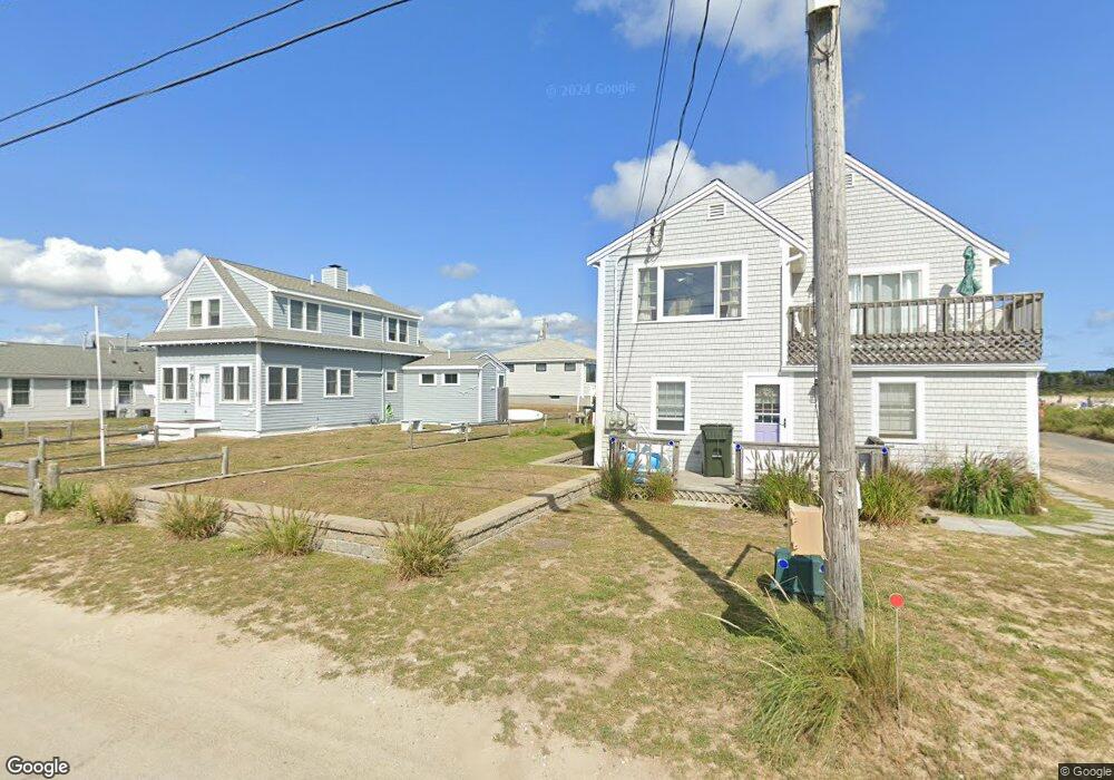
23 Baker Way West Dennis, MA 02670
West Dennis NeighborhoodEstimated Value: $1,031,000 - $1,513,000
4
Beds
2
Baths
1,201
Sq Ft
$1,010/Sq Ft
Est. Value
About This Home
This home is located at 23 Baker Way, West Dennis, MA 02670 and is currently estimated at $1,212,716, approximately $1,009 per square foot. 23 Baker Way is a home located in Barnstable County with nearby schools including Dennis-Yarmouth Regional High School and St. Pius X. School.
Ownership History
Date
Name
Owned For
Owner Type
Purchase Details
Closed on
Mar 15, 2002
Sold by
23-25 Baker Way Rt and White
Bought by
Ferraro Peter
Current Estimated Value
Home Financials for this Owner
Home Financials are based on the most recent Mortgage that was taken out on this home.
Original Mortgage
$350,000
Outstanding Balance
$145,998
Interest Rate
7.04%
Mortgage Type
Purchase Money Mortgage
Estimated Equity
$1,066,718
Purchase Details
Closed on
Mar 28, 2001
Sold by
Mcmullen Terry L
Bought by
23-25 Baker Way Rt and White
Home Financials for this Owner
Home Financials are based on the most recent Mortgage that was taken out on this home.
Original Mortgage
$351,000
Interest Rate
6.96%
Mortgage Type
Purchase Money Mortgage
Create a Home Valuation Report for This Property
The Home Valuation Report is an in-depth analysis detailing your home's value as well as a comparison with similar homes in the area
Home Values in the Area
Average Home Value in this Area
Purchase History
| Date | Buyer | Sale Price | Title Company |
|---|---|---|---|
| Ferraro Peter | $452,500 | -- | |
| Ferraro Peter | $452,500 | -- | |
| 23-25 Baker Way Rt | $390,000 | -- | |
| 23-25 Baker Way Rt | $390,000 | -- |
Source: Public Records
Mortgage History
| Date | Status | Borrower | Loan Amount |
|---|---|---|---|
| Open | Ferraro Peter | $350,000 | |
| Closed | 23-25 Baker Way Rt | $350,000 | |
| Previous Owner | 23-25 Baker Way Rt | $351,000 |
Source: Public Records
Tax History Compared to Growth
Tax History
| Year | Tax Paid | Tax Assessment Tax Assessment Total Assessment is a certain percentage of the fair market value that is determined by local assessors to be the total taxable value of land and additions on the property. | Land | Improvement |
|---|---|---|---|---|
| 2025 | $4,324 | $998,500 | $566,800 | $431,700 |
| 2024 | $4,079 | $929,100 | $545,000 | $384,100 |
| 2023 | $3,945 | $844,700 | $495,500 | $349,200 |
| 2022 | $3,656 | $652,900 | $446,300 | $206,600 |
| 2021 | $3,151 | $535,700 | $352,200 | $183,500 |
| 2020 | $3,225 | $528,700 | $352,200 | $176,500 |
| 2019 | $3,457 | $560,300 | $376,700 | $183,600 |
| 2018 | $2,646 | $541,900 | $398,400 | $143,500 |
| 2017 | $3,333 | $542,000 | $398,500 | $143,500 |
| 2016 | $3,394 | $519,700 | $398,500 | $121,200 |
| 2015 | $3,326 | $519,700 | $398,500 | $121,200 |
| 2014 | $3,047 | $479,800 | $358,600 | $121,200 |
Source: Public Records
Map
Nearby Homes
- 6 Baker Way
- 6 Elliot Dr
- 21 Bayberry Ln
- 24 Regan Rd
- 61 Trotters Ln
- 75 Susan Ruth Rd
- 5 Polly Fisk Ln Unit 5
- 19 Ocean Dr Unit 2
- 64 Beaten Rd
- 112 Old Wharf Rd Unit U-E6
- 112 Old Wharf Rd Unit E6
- 112 Old Wharf Rd Unit E4
- 113 Old Wharf Rd Unit 7
- 120 Old Wharf Rd Unit 11
- 178 School St
- 15 Glendon Rd
- 401 Main St Unit 201
- 401 Main St Unit 101
- 62 Teal Cir
- 102 Cornell Dr
- 9 Chapman Rd
- 19 Spring Rd
- 36 S Village Rd
- 2 Spring Rd
- 2 Spring Rd Unit 1
- 3 Chapman Rd Unit 3-5
- 3 Chapman Rd
- 4 Spring Rd Unit 2
- 28 S Village Rd
- 10 Chapman Rd
- 42 S Village Rd
- 27 S Village Rd
- 29 Beach Rd
- 44 S Village Rd
- 7 Baker Way
- 7-9 Baker Way
- 41 S Village Rd Unit 2
- 41 S Village Rd Unit 1
- 41 S Village Rd Unit B
- 41 S Village Rd