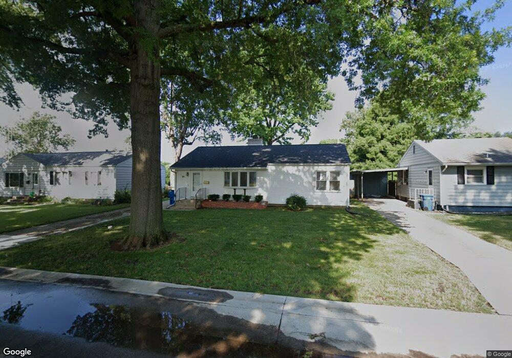
23 Bob o Link Dr Springfield, IL 62702
Estimated Value: $81,591 - $154,000
Studio
--
Bath
--
Sq Ft
6,229
Sq Ft Lot
About This Home
This home is located at 23 Bob o Link Dr, Springfield, IL 62702 and is currently estimated at $123,898. 23 Bob o Link Dr is a home located in Sangamon County with nearby schools including Jane Addams Elementary School, U.S. Grant Middle School, and Springfield High School.
Ownership History
Date
Name
Owned For
Owner Type
Purchase Details
Closed on
Nov 17, 2022
Sold by
Filipiak Margaret A
Bought by
Jakewill Properties Llc
Current Estimated Value
Home Financials for this Owner
Home Financials are based on the most recent Mortgage that was taken out on this home.
Original Mortgage
$45,000
Outstanding Balance
$41,741
Interest Rate
6.94%
Mortgage Type
New Conventional
Estimated Equity
$82,157
Purchase Details
Closed on
Mar 27, 1996
Create a Home Valuation Report for This Property
The Home Valuation Report is an in-depth analysis detailing your home's value as well as a comparison with similar homes in the area
Purchase History
| Date | Buyer | Sale Price | Title Company |
|---|---|---|---|
| Jakewill Properties Llc | $50,000 | Illinois Real Estate Title | |
| -- | -- | -- |
Source: Public Records
Mortgage History
| Date | Status | Borrower | Loan Amount |
|---|---|---|---|
| Open | Jakewill Properties Llc | $45,000 |
Source: Public Records
Tax History
| Year | Tax Paid | Tax Assessment Tax Assessment Total Assessment is a certain percentage of the fair market value that is determined by local assessors to be the total taxable value of land and additions on the property. | Land | Improvement |
|---|---|---|---|---|
| 2024 | $3,185 | $37,914 | $7,715 | $30,199 |
| 2023 | $3,062 | $34,631 | $7,047 | $27,584 |
| 2022 | $2,406 | $32,851 | $6,685 | $26,166 |
| 2021 | $2,306 | $31,621 | $6,435 | $25,186 |
| 2020 | $2,261 | $31,669 | $6,445 | $25,224 |
| 2019 | $2,217 | $31,559 | $6,423 | $25,136 |
| 2018 | $2,277 | $32,946 | $6,392 | $26,554 |
| 2017 | $2,223 | $32,520 | $6,309 | $26,211 |
| 2016 | $2,172 | $32,046 | $6,217 | $25,829 |
| 2015 | $2,145 | $31,663 | $6,143 | $25,520 |
| 2014 | $2,010 | $31,458 | $6,103 | $25,355 |
| 2013 | $1,965 | $30,251 | $6,104 | $24,147 |
Source: Public Records
Map
Nearby Homes
- 2011 W Jefferson St
- 66 Dawn Dr
- 2102 W Jefferson St
- 2001 W Calhoun Ave
- 1921 Jeanette Ln Unit 2
- 1913 Jeanette Ln Unit 8
- 1914 Jeanette Ln Unit 6
- 24 Wenzel Ln
- 2510 & 2518 W Jefferson St
- 904 Diane Ct
- 29 N Oxford Rd
- 107 Collier Dr
- 160 S Durkin Dr Unit 4
- 243 S Durkin Dr Unit 24
- 1531 W Monroe St
- 6 Redwood Ln
- 2309 W Lawrence Ave
- 804 Fairfax Ct
- 116 Shennadoh Dr
- 27 Skyview Dr
- 19 Bob o Link Dr
- 27 Bob o Link Dr
- 27 Bob-O-link Dr
- 31 Bob o Link Dr
- 42 Meadowlark Ln
- 15 Bob o Link Dr
- 38 Meadowlark Ln
- 32 Bob o Link Dr
- 46 Meadowlark Ln
- 28 Bob o Link Dr
- 35 Bob o Link Dr
- 34 Meadowlark Ln
- 24 Bob o Link Dr
- 50 Meadowlark Ln
- 11 Bob o Link Dr
- 30 Meadowlark Ln
- 40 Bob o Link Dr
- 40 Bob-O-link Dr
- 20 Bob o Link Dr
- 44 Bob o Link Dr
Your Personal Tour Guide
Ask me questions while you tour the home.