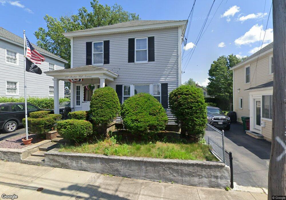
23 Bunker Hill Ave Lowell, MA 01850
Centralville NeighborhoodEstimated Value: $505,598 - $589,000
5
Beds
2
Baths
1,936
Sq Ft
$285/Sq Ft
Est. Value
About This Home
This home is located at 23 Bunker Hill Ave, Lowell, MA 01850 and is currently estimated at $551,900, approximately $285 per square foot. 23 Bunker Hill Ave is a home located in Middlesex County with nearby schools including Greenhalge Elementary School, S. Christa McAuliffe Elementary School, and Moody Elementary School.
Ownership History
Date
Name
Owned For
Owner Type
Purchase Details
Closed on
Dec 21, 2001
Sold by
Est Fauvel Jeannette and Fauvel Leo J
Bought by
Marshall John S and Marshall Pamela S
Current Estimated Value
Home Financials for this Owner
Home Financials are based on the most recent Mortgage that was taken out on this home.
Original Mortgage
$161,000
Outstanding Balance
$62,771
Interest Rate
6.54%
Mortgage Type
Purchase Money Mortgage
Estimated Equity
$489,129
Create a Home Valuation Report for This Property
The Home Valuation Report is an in-depth analysis detailing your home's value as well as a comparison with similar homes in the area
Home Values in the Area
Average Home Value in this Area
Purchase History
| Date | Buyer | Sale Price | Title Company |
|---|---|---|---|
| Marshall John S | $201,250 | -- | |
| Marshall John S | $201,250 | -- |
Source: Public Records
Mortgage History
| Date | Status | Borrower | Loan Amount |
|---|---|---|---|
| Open | Marshall John S | $161,000 | |
| Closed | Marshall John S | $161,000 |
Source: Public Records
Tax History Compared to Growth
Tax History
| Year | Tax Paid | Tax Assessment Tax Assessment Total Assessment is a certain percentage of the fair market value that is determined by local assessors to be the total taxable value of land and additions on the property. | Land | Improvement |
|---|---|---|---|---|
| 2025 | $5,065 | $441,200 | $128,100 | $313,100 |
| 2024 | $4,812 | $404,000 | $127,200 | $276,800 |
| 2023 | $4,466 | $359,600 | $110,700 | $248,900 |
| 2022 | $4,133 | $325,700 | $100,600 | $225,100 |
| 2021 | $3,832 | $284,700 | $87,500 | $197,200 |
| 2020 | $3,391 | $253,800 | $71,900 | $181,900 |
| 2019 | $3,128 | $222,800 | $57,700 | $165,100 |
| 2018 | $2,920 | $202,900 | $55,000 | $147,900 |
| 2017 | $2,883 | $193,200 | $43,100 | $150,100 |
| 2016 | $2,977 | $196,400 | $46,300 | $150,100 |
| 2015 | $2,745 | $177,300 | $46,300 | $131,000 |
| 2013 | $2,594 | $172,800 | $61,900 | $110,900 |
Source: Public Records
Map
Nearby Homes
- 317 Lakeview Ave
- 41 W L St
- 12 L St
- 49 Coburn St
- 52 Lawrence Dr Unit 607
- 52 Lawrence Dr Unit 408
- 52 Lawrence Dr Unit 509
- 76 W 3rd St
- 35 Riverwalk Way Unit 203
- 62 W 6th St
- 190 Ennell St
- 45 W 4th St
- 27 W 5th St
- 57 Lakeview Ave
- 130 John St Unit G01
- 87 Exeter St
- 935 Bridge St
- 15 10th St
- 972 Bridge St
- 18 May St
- 31 Bunker Hill Ave
- 19 Bunker Hill Ave
- 35 Bunker Hill Ave
- 26 Delard St
- 3 Carolyn St
- 34 Delard St
- 22 Delard St
- 41 Bunker Hill Ave
- 36 Bunker Hill Ave
- 38 Delard St
- 18 Delard St
- 13 Bunker Hill Ave
- 40 Bunker Hill Ave
- 45 Bunker Hill Ave
- 9 Bunker Hill Ave
- 11 Carolyn St Unit 58
- 11 Carolyn St
- 14 Bunker Hill Ave
- 42 Delard St
- 14 Delard St