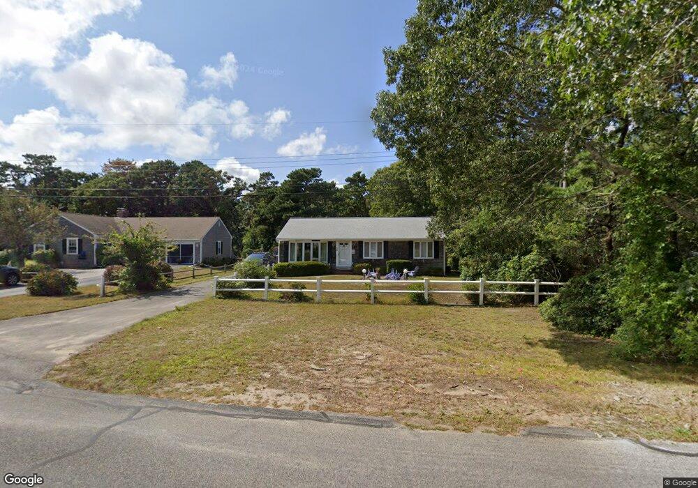
23 Captain Chase Rd Dennis Port, MA 02639
Dennis Port NeighborhoodEstimated Value: $559,000 - $684,810
3
Beds
3
Baths
1,232
Sq Ft
$517/Sq Ft
Est. Value
About This Home
This home is located at 23 Captain Chase Rd, Dennis Port, MA 02639 and is currently estimated at $637,453, approximately $517 per square foot. 23 Captain Chase Rd is a home located in Barnstable County with nearby schools including Dennis-Yarmouth Regional High School and St. Pius X. School.
Ownership History
Date
Name
Owned For
Owner Type
Purchase Details
Closed on
Dec 23, 2013
Sold by
Est Dimauro Michael J and Ashmankas Margaret M
Bought by
Ashmankas Cristin
Current Estimated Value
Home Financials for this Owner
Home Financials are based on the most recent Mortgage that was taken out on this home.
Original Mortgage
$137,000
Outstanding Balance
$102,155
Interest Rate
4.15%
Mortgage Type
New Conventional
Estimated Equity
$535,298
Create a Home Valuation Report for This Property
The Home Valuation Report is an in-depth analysis detailing your home's value as well as a comparison with similar homes in the area
Home Values in the Area
Average Home Value in this Area
Purchase History
| Date | Buyer | Sale Price | Title Company |
|---|---|---|---|
| Ashmankas Cristin | $280,000 | -- | |
| Ashmankas Cristin | $280,000 | -- |
Source: Public Records
Mortgage History
| Date | Status | Borrower | Loan Amount |
|---|---|---|---|
| Open | Ashmankas Cristin | $137,000 | |
| Closed | Ashmankas Cristin | $137,000 |
Source: Public Records
Tax History Compared to Growth
Tax History
| Year | Tax Paid | Tax Assessment Tax Assessment Total Assessment is a certain percentage of the fair market value that is determined by local assessors to be the total taxable value of land and additions on the property. | Land | Improvement |
|---|---|---|---|---|
| 2025 | $2,550 | $589,000 | $197,000 | $392,000 |
| 2024 | $2,406 | $548,000 | $189,500 | $358,500 |
| 2023 | $2,326 | $498,100 | $172,200 | $325,900 |
| 2022 | $2,225 | $397,300 | $155,100 | $242,200 |
| 2021 | $2,268 | $376,100 | $173,800 | $202,300 |
| 2020 | $2,048 | $335,800 | $152,100 | $183,700 |
| 2019 | $9,617 | $315,000 | $149,100 | $165,900 |
| 2018 | $1,859 | $293,200 | $142,000 | $151,200 |
| 2017 | $1,773 | $288,300 | $131,800 | $156,500 |
| 2016 | $1,781 | $272,700 | $142,000 | $130,700 |
| 2015 | $1,745 | $272,700 | $142,000 | $130,700 |
| 2014 | $1,603 | $252,400 | $121,700 | $130,700 |
Source: Public Records
Map
Nearby Homes
- 31 Easy St
- 22 Wixon Rd
- 19 Standish Way
- 72 Bassett Ln
- 80 Michaels Ave
- 4 Coffey Ln
- 125 Main St Unit 3
- 71 Main St
- 268 Main St
- 22 Ferncliff Rd
- 12 Spoonbill Rd
- 37 Beach Hills Rd
- 37-A Beach Hills Rd
- 37 Ocean Dr Unit 2
- 262 Old Wharf Rd Unit 67
- 262 Old Wharf Rd Unit 5
- 262 Old Wharf Rd Unit 5
- 262 Old Wharf Rd Unit 20
- 262 Old Wharf Rd Unit 87
- 64 Beaten Rd
- 27 Captain Chase Rd
- 22 Captain Chase Rd
- 20 Captain Chase Rd
- 31 Captain Chase Rd
- 3 Marks End
- 16 Captain Chase Rd
- 15 Ezra's Path
- 5 Marks End
- 12 Captain Chase Rd
- 13 Captain Chase Rd
- 2 Quartermaster Row
- 35 Captain Chase Rd
- 9 Ezra's Path
- 9 Marks End
- 10 Captain Chase Rd
- 6 Quartermaster Row
- 35 Siasconset Ave
- 31 Siasconset Ave
- 37 Siasconset Ave
- 29 Siasconset Ave