R
Seller's Agent in 2019
Richard Poveromo
Jefferson Real Estate, Inc.
(719) 839-1083
85 in this area
199 Total Sales

Estimated Value: $37,924 - $49,000
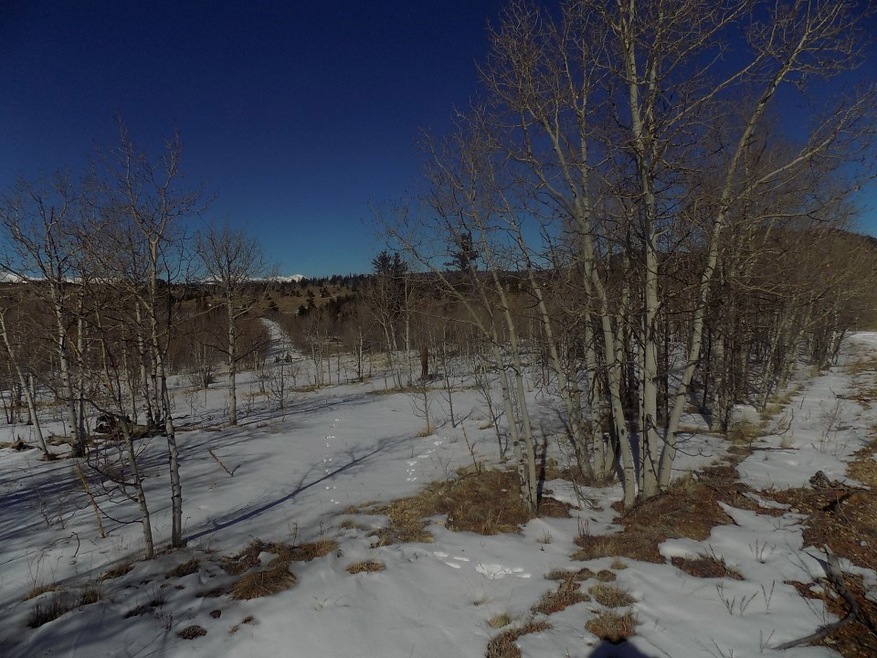
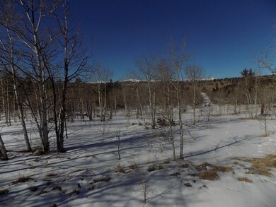
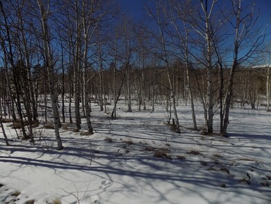
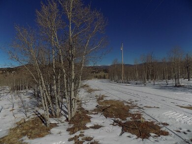
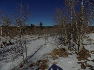
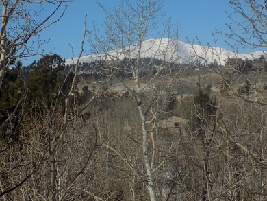
Trees - Yes. Power - Yes. Phone - Yes. TREED 3.6 ACRES WITH GENTILE SLOPE. BIG VIEWS AND EASY TO BUILD LOT WITH POWER. THIS LOT IS A MUST SEE ON CUL DE SAC. CAMP NOW AND THEN HAVE A GREAT LOT FOR A HOME. HARD TO FIND 3+ ACRES AT THIS PRICE. 117 BUF F-1
Last Agent to Sell the Property
Jefferson Real Estate, Inc. License #EA1324705 Listed on: 11/19/2018
Last Buyer's Agent
Jeremy Root
High Ridge Realty, LLC License #FA100077430
| Date | Buyer | Sale Price | Title Company |
|---|---|---|---|
| Greer Kr Donald Ray | $27,000 | Fidelity National Title | |
| Wood Carlene O | $13,900 | Fidelity National Title Ins |
| Date | Event | Price | List to Sale | Price per Sq Ft |
|---|---|---|---|---|
| 05/12/2019 05/12/19 | Sold | $27,000 | 0.0% | -- |
| 04/12/2019 04/12/19 | Pending | -- | -- | -- |
| 11/19/2018 11/19/18 | For Sale | $27,000 | -- | -- |
| Year | Tax Paid | Tax Assessment Tax Assessment Total Assessment is a certain percentage of the fair market value that is determined by local assessors to be the total taxable value of land and additions on the property. | Land | Improvement |
|---|---|---|---|---|
| 2025 | $742 | $12,480 | $12,480 | $0 |
| 2024 | $713 | $12,520 | $12,520 | $0 |
| 2023 | $713 | $13,013 | $13,013 | $0 |
| 2022 | $403 | $6,190 | $6,190 | $0 |
| 2021 | $396 | $6,190 | $6,190 | $0 |
| 2020 | $263 | $4,010 | $4,010 | $0 |
| 2019 | $256 | $4,010 | $4,010 | $0 |
| 2018 | $264 | $4,010 | $4,010 | $0 |
| 2017 | $228 | $4,060 | $4,060 | $0 |
| 2016 | $194 | $3,410 | $3,410 | $0 |
| 2015 | $197 | $3,410 | $3,410 | $0 |
| 2014 | $257 | $0 | $0 | $0 |
R
Seller's Agent in 2019
Richard Poveromo
Jefferson Real Estate, Inc.
(719) 839-1083
85 in this area
199 Total Sales
J
Buyer's Agent in 2019
Jeremy Root
High Ridge Realty, LLC
Source: Summit MLS
MLS Number: S1011587
APN: 3932
Disclaimer: Certain information contained herein is derived from information provided by parties other than Homes.com. All information provided is deemed reliable, but is not guaranteed to be accurate and should be independently verified.
![]() Copyright © 2026 SAR MLS. The information displayed herein was derived from sources believed to be accurate, but has not been verified by SAR MLS. Buyers are cautioned to verify all information to their own satisfaction. This information is exclusively for viewers’ personal, non-commercial use. Any republication or reproduction of the information herein without the express permission of the SAR MLS is strictly prohibited.
Copyright © 2026 SAR MLS. The information displayed herein was derived from sources believed to be accurate, but has not been verified by SAR MLS. Buyers are cautioned to verify all information to their own satisfaction. This information is exclusively for viewers’ personal, non-commercial use. Any republication or reproduction of the information herein without the express permission of the SAR MLS is strictly prohibited.
Ask me questions while you tour the home.
