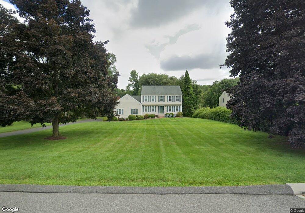
23 Dairy Farm Dr Brookfield, CT 06804
Estimated Value: $588,102 - $769,000
3
Beds
3
Baths
1,966
Sq Ft
$330/Sq Ft
Est. Value
About This Home
This home is located at 23 Dairy Farm Dr, Brookfield, CT 06804 and is currently estimated at $648,276, approximately $329 per square foot. 23 Dairy Farm Dr is a home located in Fairfield County with nearby schools including Center Elementary School, Whisconier Middle School, and Brookfield High School.
Ownership History
Date
Name
Owned For
Owner Type
Purchase Details
Closed on
Mar 4, 1997
Sold by
Stevens Roger and Stevens Kim
Bought by
Gardner Donald and Gardner Susan
Current Estimated Value
Purchase Details
Closed on
May 27, 1994
Sold by
Kimpel Andrew
Bought by
Stevens Roger and Stevens Kim
Purchase Details
Closed on
Nov 2, 1992
Sold by
Rollerer James and Roller Christa
Bought by
Kimpel Andrew and Kimpel Leslie
Create a Home Valuation Report for This Property
The Home Valuation Report is an in-depth analysis detailing your home's value as well as a comparison with similar homes in the area
Home Values in the Area
Average Home Value in this Area
Purchase History
| Date | Buyer | Sale Price | Title Company |
|---|---|---|---|
| Gardner Donald | $234,500 | -- | |
| Gardner Donald | $234,500 | -- | |
| Stevens Roger | $236,500 | -- | |
| Stevens Roger | $236,500 | -- | |
| Kimpel Andrew | $246,000 | -- | |
| Kimpel Andrew | $246,000 | -- |
Source: Public Records
Mortgage History
| Date | Status | Borrower | Loan Amount |
|---|---|---|---|
| Open | Kimpel Andrew | $408,000 | |
| Closed | Kimpel Andrew | $57,000 |
Source: Public Records
Tax History Compared to Growth
Tax History
| Year | Tax Paid | Tax Assessment Tax Assessment Total Assessment is a certain percentage of the fair market value that is determined by local assessors to be the total taxable value of land and additions on the property. | Land | Improvement |
|---|---|---|---|---|
| 2025 | $7,660 | $264,790 | $88,230 | $176,560 |
| 2024 | $7,388 | $264,790 | $88,230 | $176,560 |
| 2023 | $7,112 | $264,790 | $88,230 | $176,560 |
| 2022 | $6,853 | $264,790 | $88,230 | $176,560 |
| 2021 | $6,720 | $223,270 | $98,030 | $125,240 |
| 2020 | $6,620 | $223,270 | $98,030 | $125,240 |
| 2019 | $6,506 | $223,270 | $98,030 | $125,240 |
| 2018 | $6,327 | $223,270 | $98,030 | $125,240 |
| 2017 | $6,093 | $223,270 | $98,030 | $125,240 |
| 2016 | $6,631 | $251,160 | $111,920 | $139,240 |
| 2015 | $6,455 | $251,160 | $111,920 | $139,240 |
| 2014 | $6,455 | $251,160 | $111,920 | $139,240 |
Source: Public Records
Map
Nearby Homes
- 11 Patricia Ln
- 12 Nelson Ln
- 6 Patricia Ln
- 8 Walnut Ln Unit 8
- 23 Farrell Rd
- 16 Farrell Rd
- 10 Knollcrest Dr
- 32 Redwood Dr
- 2 Autumn's Way
- 17 Stony Brook Rd
- 1024 Brookside Ct Unit 1024
- 603 Brookside Ct Unit 603
- 601 Brookside Ct Unit 601
- 521 Copper Square Dr
- 8 Hawleyville Rd
- 6 Holly Ln
- 7 Mcneil Rd
- 7 Hawleyville Rd
- 6 Violette Rd
- 183 Mount Pleasant Rd
- 21 Dairy Farm Dr
- 25 Dairy Farm Dr
- 19 Dairy Farm Dr
- 14 Dairy Farm Dr
- 27 Dairy Farm Dr
- 18 Dairy Farm Dr
- 29 Dairy Farm Dr
- 17 Dairy Farm Dr
- 20 Dairy Farm Dr
- 31 Dairy Farm Dr
- 15 Dairy Farm Dr
- 10 Guernsey Rd
- 12 Dairy Farm Dr
- 12 Guernsey Rd
- 8 Guernsey Rd
- 14 Guernsey Rd
- 6 Guernsey Rd
- 4 Guernsey Rd
- 11 Guernsey Rd
- 2 Guernsey Rd