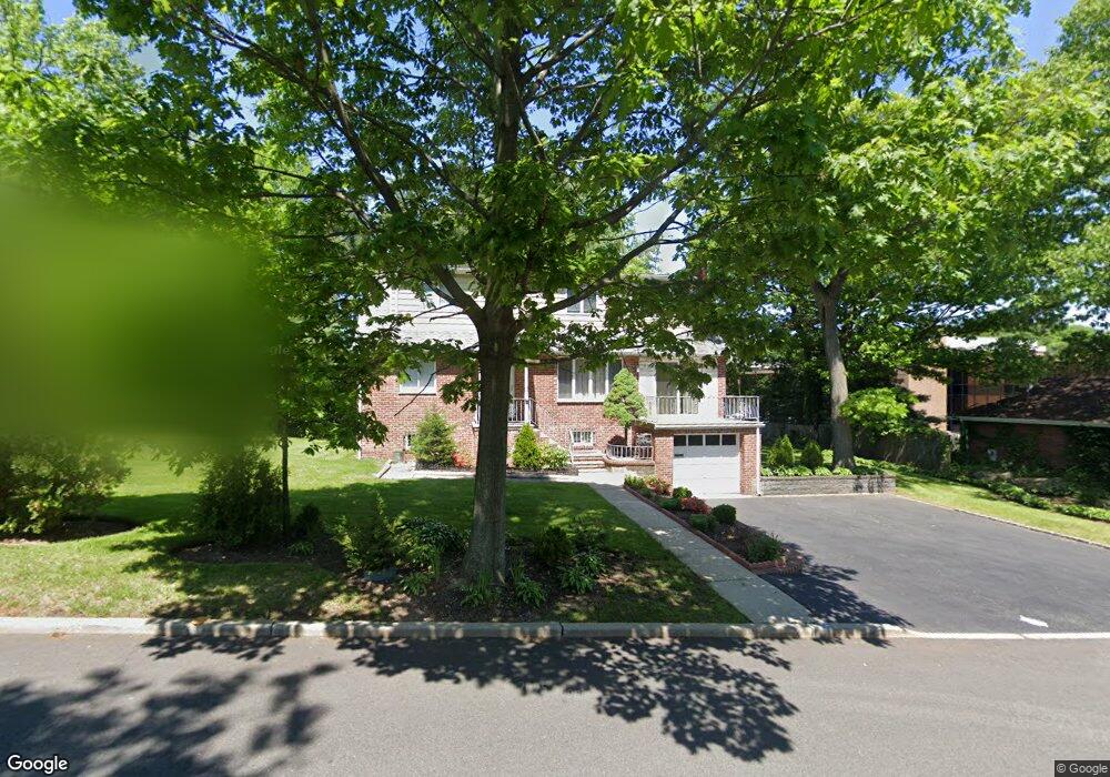
23 Demarest Ave Englewood Cliffs, NJ 07632
Estimated Value: $949,000 - $1,363,000
4
Beds
4
Baths
2,238
Sq Ft
$544/Sq Ft
Est. Value
About This Home
This home is located at 23 Demarest Ave, Englewood Cliffs, NJ 07632 and is currently estimated at $1,216,555, approximately $543 per square foot. 23 Demarest Ave is a home located in Bergen County with nearby schools including North Cliff Elementary School, Upper School Elementary School, and Dwight-Englewood School.
Ownership History
Date
Name
Owned For
Owner Type
Purchase Details
Closed on
Apr 13, 2021
Sold by
George Jr Sivulka
Bought by
Lee Inhan
Current Estimated Value
Home Financials for this Owner
Home Financials are based on the most recent Mortgage that was taken out on this home.
Original Mortgage
$548,250
Interest Rate
2.9%
Mortgage Type
New Conventional
Purchase Details
Closed on
Dec 19, 2008
Sold by
Sivulka George and Sivulka Helen
Bought by
Sivulka George and Sivulka Stephanie
Create a Home Valuation Report for This Property
The Home Valuation Report is an in-depth analysis detailing your home's value as well as a comparison with similar homes in the area
Home Values in the Area
Average Home Value in this Area
Purchase History
| Date | Buyer | Sale Price | Title Company |
|---|---|---|---|
| Lee Inhan | $750,000 | Blueland Title Agneyc Inc | |
| Sivulka George | -- | -- |
Source: Public Records
Mortgage History
| Date | Status | Borrower | Loan Amount |
|---|---|---|---|
| Previous Owner | Lee Inhan | $548,250 |
Source: Public Records
Tax History Compared to Growth
Tax History
| Year | Tax Paid | Tax Assessment Tax Assessment Total Assessment is a certain percentage of the fair market value that is determined by local assessors to be the total taxable value of land and additions on the property. | Land | Improvement |
|---|---|---|---|---|
| 2025 | $11,927 | $1,032,600 | $970,000 | $62,600 |
| 2024 | $11,782 | $1,032,600 | $970,000 | $62,600 |
| 2023 | $11,596 | $1,032,600 | $970,000 | $62,600 |
| 2022 | $11,596 | $1,032,600 | $970,000 | $62,600 |
| 2021 | $8,913 | $1,032,600 | $970,000 | $62,600 |
| 2020 | $11,885 | $1,032,600 | $970,000 | $62,600 |
| 2019 | $11,162 | $1,032,600 | $970,000 | $62,600 |
| 2018 | $10,770 | $1,032,600 | $970,000 | $62,600 |
| 2017 | $10,305 | $1,032,600 | $970,000 | $62,600 |
| 2016 | $10,109 | $1,032,600 | $970,000 | $62,600 |
| 2015 | $9,603 | $1,032,600 | $970,000 | $62,600 |
| 2014 | $8,984 | $1,032,600 | $970,000 | $62,600 |
Source: Public Records
Map
Nearby Homes
- 563 Floyd St
- 20 Demarest Ave
- 557 Floyd St
- 571 Floyd St
- 14 Demarest Ave
- 573 Floyd St
- 48 Clifton Terrace
- 33 Clifton Terrace
- 554 Floyd St
- 111 Demarest Ave
- 560 Floyd St
- 564 Floyd St
- 550 Sylvan Ave Unit LL2
- 550 Sylvan Ave Unit 200
- 550 Sylvan Ave Unit 205
- 550 Sylvan Ave Unit 203
- 550 Sylvan Ave Unit 207
- 550 Sylvan Ave Unit 112
- 550 Sylvan Ave Unit 208
- 550 Sylvan Ave Unit 111