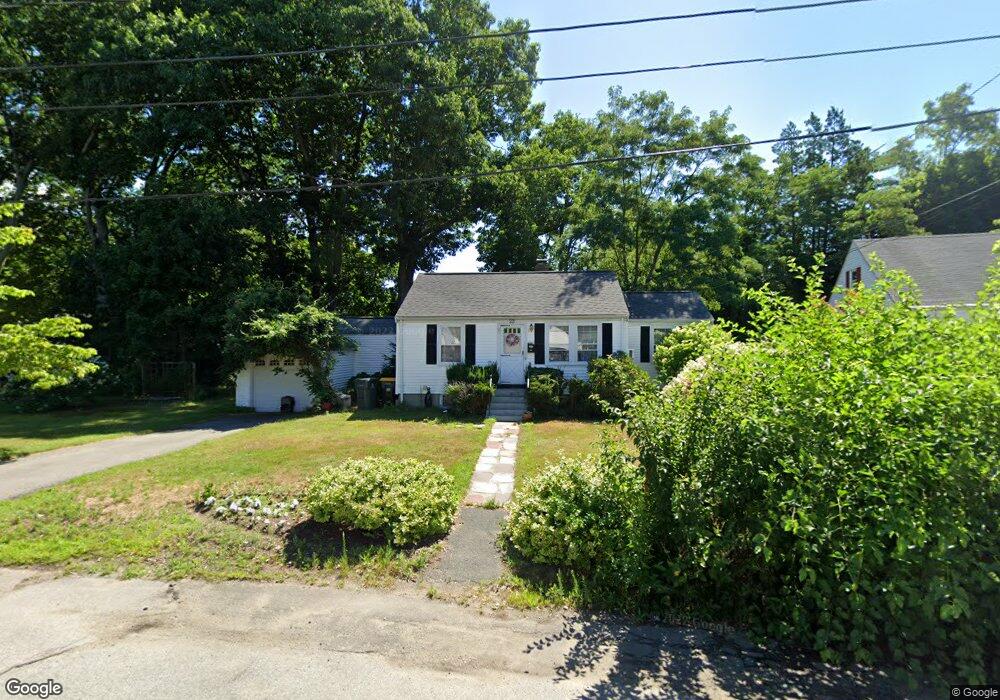
23 Eliot St Framingham, MA 01702
Estimated Value: $476,000 - $526,000
3
Beds
1
Bath
960
Sq Ft
$528/Sq Ft
Est. Value
About This Home
This home is located at 23 Eliot St, Framingham, MA 01702 and is currently estimated at $507,148, approximately $528 per square foot. 23 Eliot St is a home located in Middlesex County with nearby schools including Framingham High School, Christa McAuliffe Charter School, and Happy Hollow School.
Ownership History
Date
Name
Owned For
Owner Type
Purchase Details
Closed on
Oct 29, 2004
Sold by
Leblanc Chrisopher N
Bought by
Ojimba Cornelia and Elnitsky Serge
Current Estimated Value
Home Financials for this Owner
Home Financials are based on the most recent Mortgage that was taken out on this home.
Original Mortgage
$280,000
Interest Rate
5.74%
Mortgage Type
Purchase Money Mortgage
Purchase Details
Closed on
Dec 28, 1992
Sold by
Colex Rt and Dbt Corp
Bought by
Leblanc Christopher N
Purchase Details
Closed on
Dec 22, 1992
Sold by
Est Kanze Joseph G
Bought by
Colex Rt
Create a Home Valuation Report for This Property
The Home Valuation Report is an in-depth analysis detailing your home's value as well as a comparison with similar homes in the area
Home Values in the Area
Average Home Value in this Area
Purchase History
| Date | Buyer | Sale Price | Title Company |
|---|---|---|---|
| Ojimba Cornelia | $280,000 | -- | |
| Ojimba Cornelia | $280,000 | -- | |
| Leblanc Christopher N | $104,250 | -- | |
| Leblanc Christopher N | $104,250 | -- | |
| Colex Rt | $52,294 | -- | |
| Colex Rt | $52,294 | -- |
Source: Public Records
Mortgage History
| Date | Status | Borrower | Loan Amount |
|---|---|---|---|
| Open | Colex Rt | $236,085 | |
| Closed | Ojimba Cornelia | $280,000 | |
| Previous Owner | Colex Rt | $86,600 |
Source: Public Records
Tax History Compared to Growth
Tax History
| Year | Tax Paid | Tax Assessment Tax Assessment Total Assessment is a certain percentage of the fair market value that is determined by local assessors to be the total taxable value of land and additions on the property. | Land | Improvement |
|---|---|---|---|---|
| 2025 | $5,227 | $437,800 | $223,100 | $214,700 |
| 2024 | $5,136 | $412,200 | $199,900 | $212,300 |
| 2023 | $4,883 | $373,000 | $179,100 | $193,900 |
| 2022 | $4,591 | $334,100 | $162,700 | $171,400 |
| 2021 | $4,471 | $318,200 | $156,400 | $161,800 |
| 2020 | $4,388 | $292,900 | $136,000 | $156,900 |
| 2019 | $4,256 | $276,700 | $132,100 | $144,600 |
| 2018 | $4,176 | $255,900 | $125,000 | $130,900 |
| 2017 | $4,107 | $245,800 | $121,500 | $124,300 |
| 2016 | $3,872 | $222,800 | $117,600 | $105,200 |
| 2015 | $3,710 | $208,200 | $117,800 | $90,400 |
Source: Public Records
Map
Nearby Homes
- 369 Grant St
- 369 Grant St Unit 1
- 369 Grant St Unit 2
- 369 Grant St Unit 3
- 101 Bishop Dr Unit 101
- 88 Pond St Unit 88
- 143 Howe St
- 159 Bishop St
- 31 Palmer Rd
- 155 Bishop Dr
- 126 Bishop Dr
- 11 Robertson Rd
- 204 Hartford St
- 6 Clarks Hill Ln Unit 6
- 26 Willis St Unit 33
- 47 Clinton St
- 29 Aberdeen Rd
- 108 Warren Rd
- 18 Milton St
- 36 Nelson St