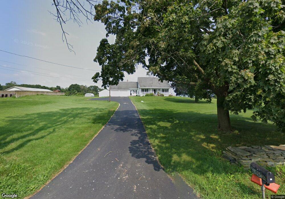
23 Ennis Rd Brooklyn, CT 06234
Brooklyn NeighborhoodEstimated Value: $338,000 - $457,000
3
Beds
3
Baths
1,806
Sq Ft
$225/Sq Ft
Est. Value
About This Home
This home is located at 23 Ennis Rd, Brooklyn, CT 06234 and is currently estimated at $406,904, approximately $225 per square foot. 23 Ennis Rd is a home located in Windham County with nearby schools including Brooklyn Elementary School, Brooklyn Middle School, and St. James Parochial School.
Ownership History
Date
Name
Owned For
Owner Type
Purchase Details
Closed on
Sep 19, 2011
Sold by
Ennis Charles R
Bought by
Ennis Theresa F
Current Estimated Value
Purchase Details
Closed on
May 11, 2010
Sold by
Ennis Charles R and Ennis Theresa F
Bought by
Ennis Charles R and Ennis Theresa F
Purchase Details
Closed on
Jul 14, 1967
Bought by
T F Ennis Testamentary T
Create a Home Valuation Report for This Property
The Home Valuation Report is an in-depth analysis detailing your home's value as well as a comparison with similar homes in the area
Home Values in the Area
Average Home Value in this Area
Purchase History
| Date | Buyer | Sale Price | Title Company |
|---|---|---|---|
| Ennis Theresa F | -- | -- | |
| Ennis Theresa F | -- | -- | |
| Ennis Charles R | -- | -- | |
| Ennis Charles R | -- | -- | |
| T F Ennis Testamentary T | -- | -- |
Source: Public Records
Tax History
| Year | Tax Paid | Tax Assessment Tax Assessment Total Assessment is a certain percentage of the fair market value that is determined by local assessors to be the total taxable value of land and additions on the property. | Land | Improvement |
|---|---|---|---|---|
| 2025 | $5,194 | $223,130 | $40,040 | $183,090 |
| 2024 | $4,363 | $147,700 | $30,200 | $117,500 |
| 2023 | $4,224 | $147,700 | $30,200 | $117,500 |
| 2022 | $4,059 | $147,700 | $30,200 | $117,500 |
| 2021 | $3,902 | $147,700 | $30,200 | $117,500 |
| 2020 | $3,456 | $119,500 | $37,200 | $82,300 |
| 2019 | $3,456 | $119,500 | $37,200 | $82,300 |
| 2018 | $3,357 | $119,500 | $37,200 | $82,300 |
| 2017 | $3,237 | $119,500 | $37,200 | $82,300 |
| 2016 | $3,148 | $119,500 | $37,200 | $82,300 |
| 2015 | $3,332 | $142,200 | $42,700 | $99,500 |
| 2014 | $3,332 | $142,200 | $42,700 | $99,500 |
Source: Public Records
Map
Nearby Homes
- 63 Gorman Rd
- 405 Providence Rd
- 14 South St
- 423 Providence Rd
- 454 Providence Rd
- 0 Allen Hill Rd Unit 24140370
- 7 River Walk Dr Unit 7
- 147 South St
- 00 Wolf Den Rd
- 38 Canterbury Rd
- 279 Gorman Rd
- 53 S Main St
- 0 Providence Rd Unit 24080985
- 35 S Main St
- 3 Pomfret Rd
- 10 Cote Dr
- 94 Hartford Rd
- 135 Adelaide St
- 37 Ruth St
- 46 Pomfret Landing Rd
- 289 Providence Rd
- 0 Church St Unit E228267
- 0 Church St Unit 24044932
- 0 Church St
- 00 Church St
- 0 Church St Unit 170487362
- 311 Providence Rd
- 7 Church St
- 314 Providence Rd
- 326 Providence Rd
- 12 Gorman Rd
- 21 Church St
- 66 Pheasant Ln
- 245 Providence Rd
- 148 Prince Hill Rd
- 23 Church St
- 56 Pheasant Ln
- 131 Prince Hill Rd
- 13 Maple Cir
- 70 Pheasant Ln
Your Personal Tour Guide
Ask me questions while you tour the home.