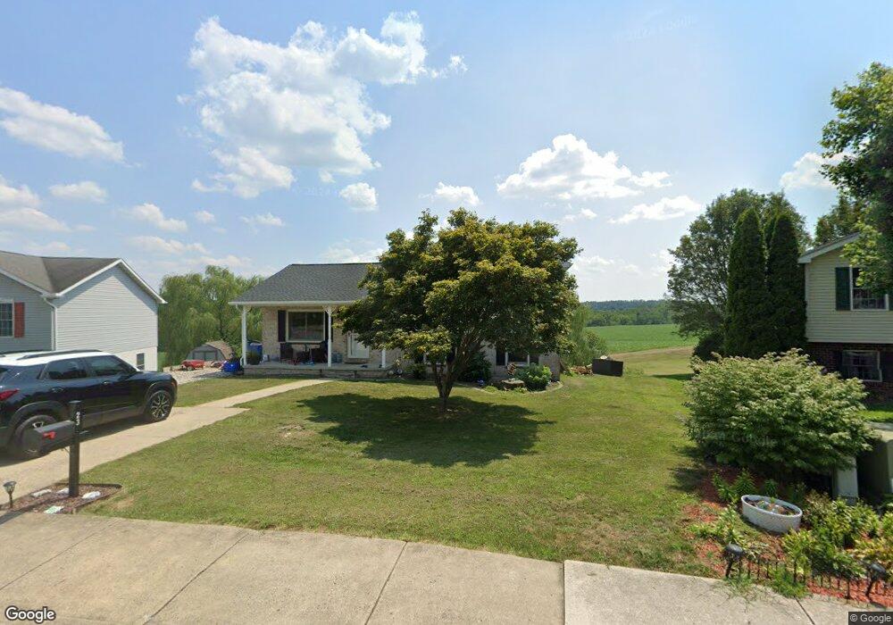
23 Gettysburg Ct Unit 70 Littlestown, PA 17340
Estimated Value: $305,000 - $325,000
3
Beds
2
Baths
1,569
Sq Ft
$203/Sq Ft
Est. Value
About This Home
This home is located at 23 Gettysburg Ct Unit 70, Littlestown, PA 17340 and is currently estimated at $318,431, approximately $202 per square foot. 23 Gettysburg Ct Unit 70 is a home located in Adams County with nearby schools including Rolling Acres El School, Maple Avenue Middle School, and Littlestown Senior High School.
Ownership History
Date
Name
Owned For
Owner Type
Purchase Details
Closed on
Jan 10, 2019
Sold by
Benedict Naomie R
Bought by
Benedict-Mcclelland N
Current Estimated Value
Purchase Details
Closed on
Feb 2, 2011
Sold by
Household Finance Consumer Discount Co
Bought by
Benedict Naomi R
Home Financials for this Owner
Home Financials are based on the most recent Mortgage that was taken out on this home.
Original Mortgage
$157,454
Interest Rate
4.84%
Mortgage Type
New Conventional
Create a Home Valuation Report for This Property
The Home Valuation Report is an in-depth analysis detailing your home's value as well as a comparison with similar homes in the area
Home Values in the Area
Average Home Value in this Area
Purchase History
| Date | Buyer | Sale Price | Title Company |
|---|---|---|---|
| Benedict-Mcclelland N | -- | -- | |
| Benedict Naomi R | $151,950 | -- |
Source: Public Records
Mortgage History
| Date | Status | Borrower | Loan Amount |
|---|---|---|---|
| Previous Owner | Benedict Naomi R | $157,454 |
Source: Public Records
Tax History Compared to Growth
Tax History
| Year | Tax Paid | Tax Assessment Tax Assessment Total Assessment is a certain percentage of the fair market value that is determined by local assessors to be the total taxable value of land and additions on the property. | Land | Improvement |
|---|---|---|---|---|
| 2025 | $5,434 | $236,400 | $66,000 | $170,400 |
| 2024 | $5,237 | $236,400 | $66,000 | $170,400 |
| 2023 | $5,093 | $236,400 | $66,000 | $170,400 |
| 2022 | $5,063 | $236,400 | $66,000 | $170,400 |
| 2021 | $4,855 | $236,400 | $66,000 | $170,400 |
| 2020 | $4,797 | $236,400 | $66,000 | $170,400 |
| 2019 | $4,654 | $236,400 | $66,000 | $170,400 |
| 2018 | $4,569 | $236,400 | $66,000 | $170,400 |
| 2017 | $4,451 | $236,400 | $66,000 | $170,400 |
| 2016 | -- | $236,400 | $66,000 | $170,400 |
| 2015 | -- | $236,400 | $66,000 | $170,400 |
| 2014 | -- | $236,400 | $66,000 | $170,400 |
Source: Public Records
Map
Nearby Homes
- 15 Yorktowne Ct Unit 97
- 117 Charles St
- 115 Charles St
- 129 W King St
- 61 E King St
- 22 Rita Marie Ave
- 211 E King St
- 52 Stayman Way Unit 81
- 140 Apple Grove Ln Unit 425
- 135 Apple Grove Ln Unit 438
- 535 Lumber St
- 559 Lumber St
- 440 N Queen St
- 449 Glenwyn Dr
- 1024 Frederick Pike Unit 6
- 567 Lumber St
- 161 Stoners Cir
- 41 Smith Cir
- 162 Newark St
- 5 Manor Cir Unit 103
- 29 Gettysburg Ct Unit 69
- 33 Gettysburg Ct Unit 68
- 10 Gettysburg Ct Unit 59
- 40 Mason Dixon Dr Unit 73
- 41 Gettysburg Ct Unit 67
- 40 Gettysburg Ct Unit 61
- 52 Mason Dixon Dr Unit 74
- 20 Mason Dixon Dr Unit 58
- 47 Gettysburg Ct Unit 66
- 58 Mason Dixon Dr Unit 75
- 46 Gettysburg Ct Unit 62
- 31 Mason Dixon Dr Unit 82
- 25 Mason Dixon Dr Unit 83
- 37 Mason Dixon Dr Unit 81
- 14 Mason Dixon Dr Unit 57
- 41 Mason Dixon Dr Unit 80
- 64 Mason Dixon Dr Unit 76
- 53 Gettysburg Ct Unit 65
- 51 Mason Dixon Dr Unit 79
- 17 Mason Dixon Dr Unit 84