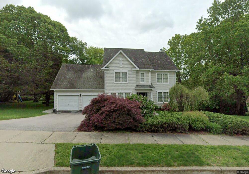
23 Hancock Dr Mystic, CT 06355
Old Mystic NeighborhoodEstimated Value: $589,000 - $773,000
4
Beds
3
Baths
2,540
Sq Ft
$264/Sq Ft
Est. Value
About This Home
This home is located at 23 Hancock Dr, Mystic, CT 06355 and is currently estimated at $671,194, approximately $264 per square foot. 23 Hancock Dr is a home located in New London County with nearby schools including Northeast Academy Arts Magnet School, Groton Middle School, and Robert E. Fitch High School.
Ownership History
Date
Name
Owned For
Owner Type
Purchase Details
Closed on
Apr 30, 1999
Sold by
Waroblak Michael T and Waroblak Laurel A
Bought by
Olendorf Thomas and Olendorf Stacey H
Current Estimated Value
Home Financials for this Owner
Home Financials are based on the most recent Mortgage that was taken out on this home.
Original Mortgage
$180,000
Interest Rate
6.95%
Mortgage Type
Purchase Money Mortgage
Purchase Details
Closed on
Nov 22, 1996
Sold by
Hancock Farms Dev Corp
Bought by
Waroblak Ii Michael T and Waroblak Laurel A
Home Financials for this Owner
Home Financials are based on the most recent Mortgage that was taken out on this home.
Original Mortgage
$203,400
Interest Rate
5.75%
Mortgage Type
Purchase Money Mortgage
Create a Home Valuation Report for This Property
The Home Valuation Report is an in-depth analysis detailing your home's value as well as a comparison with similar homes in the area
Home Values in the Area
Average Home Value in this Area
Purchase History
| Date | Buyer | Sale Price | Title Company |
|---|---|---|---|
| Olendorf Thomas | $235,000 | -- | |
| Waroblak Ii Michael T | $226,000 | -- |
Source: Public Records
Mortgage History
| Date | Status | Borrower | Loan Amount |
|---|---|---|---|
| Closed | Waroblak Ii Michael T | $180,000 | |
| Previous Owner | Waroblak Ii Michael T | $203,400 |
Source: Public Records
Tax History
| Year | Tax Paid | Tax Assessment Tax Assessment Total Assessment is a certain percentage of the fair market value that is determined by local assessors to be the total taxable value of land and additions on the property. | Land | Improvement |
|---|---|---|---|---|
| 2025 | $8,132 | $297,780 | $130,445 | $167,335 |
| 2024 | $7,617 | $297,780 | $130,445 | $167,335 |
| 2023 | $7,305 | $297,780 | $58,730 | $239,050 |
| 2022 | $7,251 | $297,780 | $58,730 | $239,050 |
| 2021 | $7,397 | $256,130 | $72,520 | $183,610 |
| 2020 | $7,318 | $256,130 | $72,520 | $183,610 |
| 2019 | $7,005 | $256,130 | $72,520 | $183,610 |
| 2018 | $6,933 | $256,130 | $72,520 | $183,610 |
| 2017 | $6,808 | $256,130 | $72,520 | $183,610 |
| 2016 | $6,477 | $262,430 | $89,600 | $172,830 |
| 2015 | $6,259 | $262,430 | $89,600 | $172,830 |
| 2014 | $6,083 | $262,430 | $89,600 | $172,830 |
Source: Public Records
Map
Nearby Homes
- 78 Cow Hill Rd
- 439 Pequot Ave
- 1198 River Rd
- 98 Oslo St
- 435 High St Unit 30
- 435 High St Unit 40
- 339 Indigo St
- 86 Fair Acres Cir
- 69 Starr St
- 42 Clift Ln
- 147 Pequot Ave
- 518 Noank Ledyard Rd
- 50 Benjamin Stanton Pentway
- 1 Marcel Rd
- 3 Water St Unit 305
- 32 E Main St
- 8 W Mystic Ave
- 16 Overlook Ave
- 215 Pequotsepos Rd
- 151 Ocean View Ave
- 37 Hancock Dr
- 7 Hancock Dr
- 134 Cow Hill Rd
- 28 Hancock Dr
- 49 Hancock Dr
- 116 Cow Hill Rd
- 44 Hancock Dr
- 180 Cow Hill Rd
- 180 Cow Hill Rd
- 180 Cow Hill Rd Unit 1
- 63 Hancock Dr
- 145 Cow Hill Rd
- 94 Cow Hill Rd
- 165 Cow Hill Rd
- 56 Hancock Dr
- 206 Cow Hill Rd
- 167 Cow Hill Rd
- 58 Cow Hill Rd
- 64 Hancock Dr
- 74 Cow Hill Rd
Your Personal Tour Guide
Ask me questions while you tour the home.