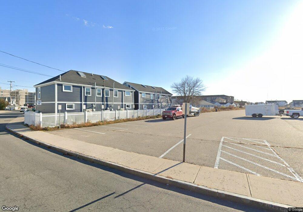
23 Island Path Unit C7 Hampton, NH 03842
Estimated Value: $610,000 - $803,000
3
Beds
2
Baths
1,536
Sq Ft
$456/Sq Ft
Est. Value
About This Home
This home is located at 23 Island Path Unit C7, Hampton, NH 03842 and is currently estimated at $700,491, approximately $456 per square foot. 23 Island Path Unit C7 is a home located in Rockingham County with nearby schools including Hampton Centre School, Adeline C. Marston Elementary School, and Hampton Academy.
Ownership History
Date
Name
Owned For
Owner Type
Purchase Details
Closed on
Aug 3, 2017
Sold by
Okeefe Michael T and Okeefe Donna M
Bought by
Okeefe Donna M
Current Estimated Value
Purchase Details
Closed on
Jun 3, 2004
Sold by
Sullivan John W and Sullivan Tracy
Bought by
Okeefe Michael T and Okeefe Donna M
Home Financials for this Owner
Home Financials are based on the most recent Mortgage that was taken out on this home.
Original Mortgage
$230,000
Interest Rate
5.94%
Mortgage Type
Purchase Money Mortgage
Create a Home Valuation Report for This Property
The Home Valuation Report is an in-depth analysis detailing your home's value as well as a comparison with similar homes in the area
Home Values in the Area
Average Home Value in this Area
Purchase History
We collect this data history from publicly available records. To have your information removed, we recommend requesting removal directly through your county’s website.
| Date | Buyer | Sale Price | Title Company |
|---|---|---|---|
| Okeefe Donna M | -- | -- | |
| Okeefe Michael T | $245,000 | -- |
Source: Public Records
Mortgage History
We collect this data history from publicly available records. To have your information removed, we recommend requesting removal directly through your county’s website.
| Date | Status | Borrower | Loan Amount |
|---|---|---|---|
| Previous Owner | Okeefe Michael T | $230,000 |
Source: Public Records
Tax History
| Year | Tax Paid | Tax Assessment Tax Assessment Total Assessment is a certain percentage of the fair market value that is determined by local assessors to be the total taxable value of land and additions on the property. | Land | Improvement |
|---|---|---|---|---|
| 2025 | $8,295 | $673,300 | $0 | $673,300 |
| 2024 | $8,295 | $673,300 | $0 | $673,300 |
| 2023 | $4,486 | $267,800 | $0 | $267,800 |
| 2022 | $4,242 | $267,800 | $0 | $267,800 |
| 2021 | $4,242 | $267,800 | $0 | $267,800 |
| 2020 | $4,266 | $267,800 | $0 | $267,800 |
| 2019 | $4,287 | $267,800 | $0 | $267,800 |
| 2018 | $4,034 | $237,000 | $0 | $237,000 |
| 2017 | $3,880 | $237,000 | $0 | $237,000 |
| 2016 | $3,811 | $237,000 | $0 | $237,000 |
| 2015 | $4,085 | $213,200 | $0 | $213,200 |
| 2014 | $3,904 | $213,200 | $0 | $213,200 |
Source: Public Records
Map
Nearby Homes
- 29 Nudd Ave Unit A
- 26 B St
- 275 Ocean Blvd Unit 303
- 275 Ocean Blvd Unit 503
- 27 Kentville Terrace
- 17 Kentville Terrace
- 6 Chase St
- 56 Nudd Ave
- 359 Ocean Blvd Unit 24
- 19 F St
- 377 Ocean Blvd Unit 16
- 12 Manchester St
- 155 Island Path Unit A
- 401A Ocean Blvd Unit 1
- 401A Ocean Blvd Unit 2
- 407 Ocean Blvd Unit B2
- 407 Ocean Blvd Unit B11
- 407 Ocean Blvd Unit A5
- 415 Ocean Blvd Unit 103
- 415 Ocean Blvd Unit 3E
- 21 Island Path
- 21 Island Path Unit ID1045445P
- 10 Jones Ave Unit 6
- 23 Island Path Unit D6
- 23 Island Path Unit B4
- 23 Island Path Unit B3
- 23 Island Path Unit A2
- 23 Island Path Unit A1
- 22 Island Path Unit 1
- 22 Island Path
- 15 Island Path Unit 8
- 15 Island Path Unit 7
- 15 Island Path Unit 6
- 15 Island Path Unit 5
- 15 Island Path Unit 4
- 15 Island Path Unit 3
- 15 Island Path Unit 2
- 15 Island Path Unit 1
- 8 Jones Ave
- 8 Jones Ave Unit SI ID1045445P
Your Personal Tour Guide
Ask me questions while you tour the home.