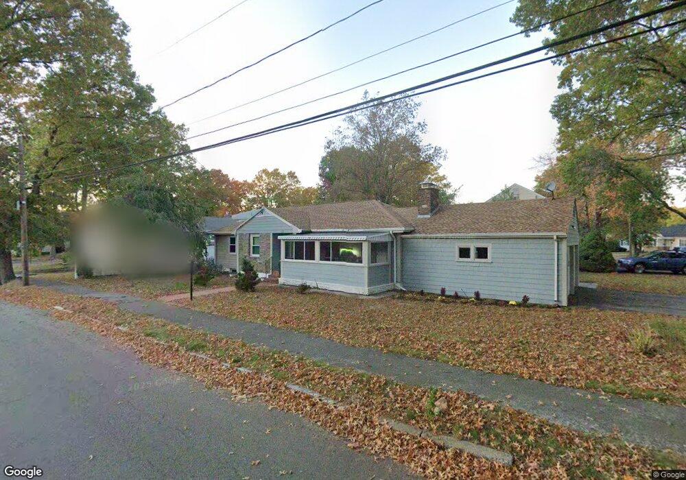
23 Joan Dr Quincy, MA 02169
Quincy Center NeighborhoodEstimated Value: $748,000 - $889,000
3
Beds
2
Baths
1,344
Sq Ft
$608/Sq Ft
Est. Value
About This Home
This home is located at 23 Joan Dr, Quincy, MA 02169 and is currently estimated at $816,781, approximately $607 per square foot. 23 Joan Dr is a home located in Norfolk County with nearby schools including Charles A. Bernazzani Elementary School, Central Middle School, and Quincy High School.
Ownership History
Date
Name
Owned For
Owner Type
Purchase Details
Closed on
Feb 8, 2024
Sold by
Alpha Grit Holdings Llc
Bought by
23 Joan Drive Llc
Current Estimated Value
Purchase Details
Closed on
Nov 19, 2009
Sold by
Greenburg Sumner E and Greenburg Minna
Bought by
Tom Henry and Tom Nancy
Create a Home Valuation Report for This Property
The Home Valuation Report is an in-depth analysis detailing your home's value as well as a comparison with similar homes in the area
Home Values in the Area
Average Home Value in this Area
Purchase History
| Date | Buyer | Sale Price | Title Company |
|---|---|---|---|
| 23 Joan Drive Llc | -- | None Available | |
| Tom Henry | $375,000 | -- | |
| Tom Henry | $375,000 | -- |
Source: Public Records
Tax History Compared to Growth
Tax History
| Year | Tax Paid | Tax Assessment Tax Assessment Total Assessment is a certain percentage of the fair market value that is determined by local assessors to be the total taxable value of land and additions on the property. | Land | Improvement |
|---|---|---|---|---|
| 2025 | $6,999 | $607,000 | $308,000 | $299,000 |
| 2024 | $6,644 | $589,500 | $293,400 | $296,100 |
| 2023 | $6,202 | $557,200 | $266,800 | $290,400 |
| 2022 | $6,402 | $534,400 | $242,600 | $291,800 |
| 2021 | $6,148 | $506,400 | $242,600 | $263,800 |
| 2020 | $5,940 | $477,900 | $231,000 | $246,900 |
| 2019 | $5,801 | $462,200 | $218,000 | $244,200 |
| 2018 | $5,867 | $439,800 | $218,000 | $221,800 |
| 2017 | $5,804 | $409,600 | $207,700 | $201,900 |
| 2016 | $5,527 | $384,900 | $197,800 | $187,100 |
| 2015 | $5,387 | $369,000 | $197,800 | $171,200 |
| 2014 | $5,210 | $350,600 | $188,400 | $162,200 |
Source: Public Records
Map
Nearby Homes
- 14 Priscilla Ln
- 89 Puritan Dr
- 312 Adams St
- 25 Carrolls Ln
- 9 Common St Unit 3
- 1 Cityview Ln Unit 204
- 1 Cityview Ln Unit 506
- 1 Cityview Ln Unit 303
- 57 Willow Ave
- 225 S Central Ave
- 41 Filbert St
- 83 Forbes Hill Rd
- 9 Cross St Unit 11
- 129 Grand View Ave
- 47 Connell St
- 118 Dimmock St
- 165 Old Colony Ave Unit A
- 46 Suomi Rd
- 46 Suomi Rd Unit 46
- 29 Oval Rd