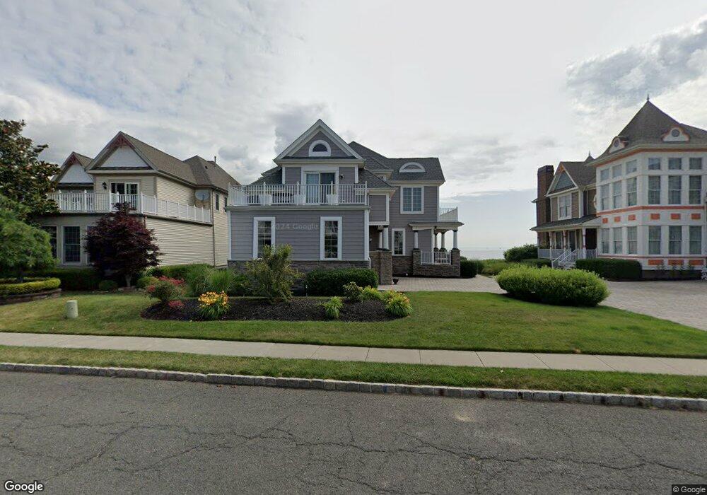
23 Lighthouse Dr Unit none South Amboy, NJ 08879
Estimated Value: $556,000 - $1,500,000
4
Beds
3
Baths
--
Sq Ft
7,100
Sq Ft Lot
About This Home
This home is located at 23 Lighthouse Dr Unit none, South Amboy, NJ 08879 and is currently estimated at $1,167,213. 23 Lighthouse Dr Unit none is a home located in Middlesex County with nearby schools including South Amboy Elementary School, South Amboy Middle/High School, and St. Mary Elementary School.
Ownership History
Date
Name
Owned For
Owner Type
Purchase Details
Closed on
Sep 9, 2020
Sold by
Gold Michael and Gold Joan
Bought by
Yu Huiwen and Dong Dawei
Current Estimated Value
Home Financials for this Owner
Home Financials are based on the most recent Mortgage that was taken out on this home.
Original Mortgage
$700,000
Interest Rate
2.5%
Mortgage Type
New Conventional
Purchase Details
Closed on
Apr 26, 2005
Sold by
Baker Residential Lp
Bought by
Gold Michael and Gold Joan
Home Financials for this Owner
Home Financials are based on the most recent Mortgage that was taken out on this home.
Original Mortgage
$800,000
Interest Rate
5.12%
Mortgage Type
Adjustable Rate Mortgage/ARM
Create a Home Valuation Report for This Property
The Home Valuation Report is an in-depth analysis detailing your home's value as well as a comparison with similar homes in the area
Home Values in the Area
Average Home Value in this Area
Purchase History
| Date | Buyer | Sale Price | Title Company |
|---|---|---|---|
| Yu Huiwen | $1,100,000 | None Listed On Document | |
| Gold Michael | $1,399,169 | -- | |
| -- | $1,399,200 | -- |
Source: Public Records
Mortgage History
| Date | Status | Borrower | Loan Amount |
|---|---|---|---|
| Previous Owner | Yu Huiwen | $700,000 | |
| Previous Owner | -- | $800,000 |
Source: Public Records
Tax History Compared to Growth
Tax History
| Year | Tax Paid | Tax Assessment Tax Assessment Total Assessment is a certain percentage of the fair market value that is determined by local assessors to be the total taxable value of land and additions on the property. | Land | Improvement |
|---|---|---|---|---|
| 2025 | $27,354 | $852,400 | $655,800 | $196,600 |
| 2024 | $26,322 | $852,400 | $655,800 | $196,600 |
| 2023 | $26,322 | $852,400 | $655,800 | $196,600 |
| 2022 | $25,009 | $852,400 | $655,800 | $196,600 |
| 2021 | $24,592 | $852,400 | $655,800 | $196,600 |
| 2020 | $24,012 | $852,400 | $655,800 | $196,600 |
| 2019 | $23,629 | $852,400 | $655,800 | $196,600 |
| 2018 | $23,432 | $852,400 | $655,800 | $196,600 |
| 2017 | $23,057 | $852,400 | $655,800 | $196,600 |
| 2016 | $22,478 | $852,400 | $655,800 | $196,600 |
| 2015 | $29,035 | $1,093,200 | $655,800 | $437,400 |
| 2014 | $28,041 | $1,093,200 | $655,800 | $437,400 |
Source: Public Records
Map
Nearby Homes
- 51 S Shore Dr
- 6 Osprey Dr
- 100 John T O Leary Blvd Unit 427
- 100 John T O Leary Blvd Unit 322
- 3 Great Beds Way
- 76 Raritan Reach Rd
- 92 S Shore Dr
- 111 John St
- 224 Gordon St
- 237 George St
- 223 Henry St
- 112 N Broadway Unit C
- 123 S Stevens Ave
- 151 N Broadway
- 322 George St
- 101 N Stevens Ave
- 109 Adamecs Way
- 251 Church St
- 209 1st St
- 125 Adamecs Way Unit 26
- 23 Lighthouse Dr
- 21 Lighthouse Dr
- 25 Lighthouse Dr
- 27 Lighthouse Dr
- 16 Sand Piper Dr
- 19 Lighthouse Dr
- 17 Lighthouse Dr
- 15 Osprey Dr
- 29 Lighthouse Dr
- 14 Sand Piper Dr
- 13 Osprey Dr
- 15 Lighthouse Dr
- 28 Lighthouse Dr
- 31 Lighthouse Dr
- 12 Sand Piper Dr
- 11 Osprey Dr
- 30 Lighthouse Dr
- 13 Lighthouse Dr
- 14 Osprey Dr
- 10 Sand Piper Dr