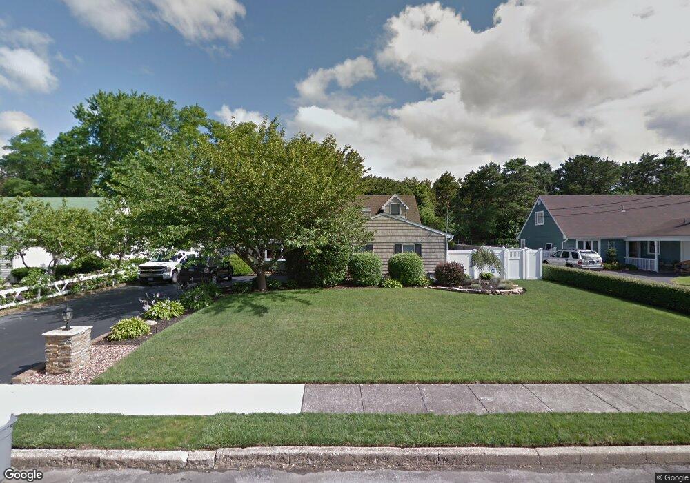
23 Mark Dr Holbrook, NY 11741
Estimated Value: $624,337 - $800,000
--
Bed
--
Bath
--
Sq Ft
0.25
Acres
About This Home
This home is located at 23 Mark Dr, Holbrook, NY 11741 and is currently estimated at $694,584. 23 Mark Dr is a home located in Suffolk County with nearby schools including Seneca Middle School and Sachem High School North.
Ownership History
Date
Name
Owned For
Owner Type
Purchase Details
Closed on
Jun 30, 2003
Sold by
Pacello Raymond and Pacello Vitina
Bought by
Bond Jason and Bond Michele
Current Estimated Value
Home Financials for this Owner
Home Financials are based on the most recent Mortgage that was taken out on this home.
Original Mortgage
$271,200
Outstanding Balance
$116,950
Interest Rate
5.45%
Mortgage Type
Purchase Money Mortgage
Estimated Equity
$577,634
Purchase Details
Closed on
Apr 11, 2002
Sold by
Pacello Raymond
Bought by
Pacello Raymond and Pacello Vitina
Purchase Details
Closed on
Sep 25, 2001
Sold by
Pacello Raymond and Pacello Vitina
Bought by
Pacello Raymond
Create a Home Valuation Report for This Property
The Home Valuation Report is an in-depth analysis detailing your home's value as well as a comparison with similar homes in the area
Home Values in the Area
Average Home Value in this Area
Purchase History
| Date | Buyer | Sale Price | Title Company |
|---|---|---|---|
| Bond Jason | $339,000 | Safe Harbor Title Agency Ltd | |
| Pacello Raymond | -- | -- | |
| Pacello Raymond | -- | -- |
Source: Public Records
Mortgage History
| Date | Status | Borrower | Loan Amount |
|---|---|---|---|
| Open | Bond Jason | $271,200 |
Source: Public Records
Tax History Compared to Growth
Tax History
| Year | Tax Paid | Tax Assessment Tax Assessment Total Assessment is a certain percentage of the fair market value that is determined by local assessors to be the total taxable value of land and additions on the property. | Land | Improvement |
|---|---|---|---|---|
| 2024 | $10,064 | $41,400 | $11,300 | $30,100 |
| 2023 | $10,064 | $41,400 | $11,300 | $30,100 |
| 2022 | $8,529 | $41,400 | $11,300 | $30,100 |
| 2021 | $8,529 | $41,400 | $11,300 | $30,100 |
| 2020 | $9,216 | $41,400 | $11,300 | $30,100 |
| 2019 | $9,216 | $0 | $0 | $0 |
| 2018 | -- | $41,400 | $11,300 | $30,100 |
| 2017 | $8,757 | $41,400 | $11,300 | $30,100 |
| 2016 | $8,364 | $41,400 | $11,300 | $30,100 |
| 2015 | -- | $41,400 | $11,300 | $30,100 |
| 2014 | -- | $41,400 | $11,300 | $30,100 |
Source: Public Records
Map
Nearby Homes
- 525 Grundy Ave
- 436 Raft Ave
- 40 Gettysburg Dr
- 64 Lincoln Ave
- 51 Lincoln Ave
- 1133 Lincoln Ave
- 11 Pearl St
- 206 Muriel St
- 215 Muriel St
- 3 Betsy Ross Dr
- 275 Kerry St
- 20 Betsy Ross Dr
- 27 Betsy Ross Dr
- 42 Ticonderoga Dr
- 39 Valley Forge Dr
- 70 Parkside St
- 12 Periwinkle Dr
- 37 Sunflower Dr
- 204 Helen St
- 60 Valley Forge Dr