Estimated Value: $1,240,000 - $1,513,000
4
Beds
3
Baths
3,397
Sq Ft
$403/Sq Ft
Est. Value
About This Home
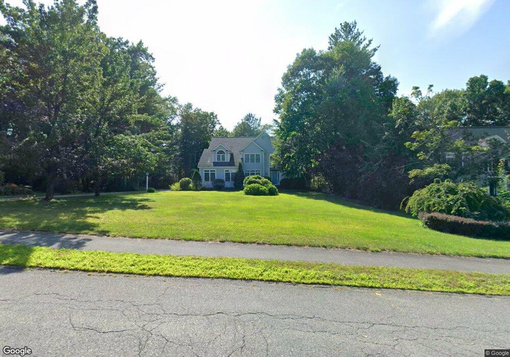
This home is located at 23 Marshall Path, Acton, MA 01720 and is currently estimated at $1,370,080, approximately $403 per square foot. 23 Marshall Path is a home located in Middlesex County with nearby schools including Acton-Boxborough Regional High School.
Ownership History
Date
Name
Owned For
Owner Type
Purchase Details
Closed on
Jan 5, 2001
Sold by
Rivkin Robert and Rivkin Jodi
Bought by
Rodwin Andrew and Theodores Denise
Current Estimated Value
Home Financials for this Owner
Home Financials are based on the most recent Mortgage that was taken out on this home.
Original Mortgage
$275,000
Interest Rate
7.69%
Mortgage Type
Purchase Money Mortgage
Purchase Details
Closed on
Mar 20, 1997
Sold by
R D Kanniard Homes Inc
Bought by
Rivkin Robert and Rivkin Jodi
Home Financials for this Owner
Home Financials are based on the most recent Mortgage that was taken out on this home.
Original Mortgage
$430,000
Interest Rate
7.68%
Mortgage Type
Purchase Money Mortgage
Create a Home Valuation Report for This Property
The Home Valuation Report is an in-depth analysis detailing your home's value as well as a comparison with similar homes in the area
Home Values in the Area
Average Home Value in this Area
Purchase History
| Date | Buyer | Sale Price | Title Company |
|---|---|---|---|
| Rodwin Andrew | $867,500 | -- | |
| Rivkin Robert | $590,000 | -- |
Source: Public Records
Mortgage History
| Date | Status | Borrower | Loan Amount |
|---|---|---|---|
| Open | Rivkin Robert | $220,000 | |
| Closed | Rivkin Robert | $275,000 | |
| Previous Owner | Rivkin Robert | $425,000 | |
| Previous Owner | Rivkin Robert | $430,000 |
Source: Public Records
Tax History
| Year | Tax Paid | Tax Assessment Tax Assessment Total Assessment is a certain percentage of the fair market value that is determined by local assessors to be the total taxable value of land and additions on the property. | Land | Improvement |
|---|---|---|---|---|
| 2025 | $23,648 | $1,378,900 | $0 | $1,378,900 |
| 2024 | $21,769 | $1,305,900 | $0 | $1,305,900 |
| 2023 | $20,201 | $1,150,400 | $0 | $1,150,400 |
| 2022 | $20,473 | $1,052,600 | $0 | $1,052,600 |
| 2021 | $17,323 | $856,300 | $0 | $856,300 |
| 2020 | $16,239 | $844,000 | $0 | $844,000 |
| 2019 | $16,929 | $874,000 | $0 | $874,000 |
| 2018 | $16,694 | $861,400 | $0 | $861,400 |
| 2017 | $16,418 | $861,400 | $0 | $861,400 |
| 2016 | $15,592 | $810,800 | $0 | $810,800 |
| 2015 | $15,526 | $815,000 | $0 | $815,000 |
| 2014 | $15,360 | $789,700 | $0 | $789,700 |
Source: Public Records
Map
Nearby Homes
- 927 Main St
- 875 Acton St
- 87 Canterbury Hill Rd
- 5 Samantha Way Unit 5
- 18 Quail Run Unit 18
- 516 Cross St
- 110 Spencer Brook Rd
- 420 Great Rd Unit B3
- 388 Great Rd Unit A9
- 388 Great Rd Unit B14
- 386 Great Rd Unit A8
- 10 Blue Heron Way Unit 10
- 10 Blue Heron Way
- 11 Walnut St
- 380A Great Rd Unit 301
- 380 Great Rd Unit B301
- 405 Great Elm Way
- 50 Acton Rd
- 237 Brown Bear Crossing Unit 237
- 238 Brown Bear Crossing Unit 238
- 25 Marshall Path
- 21 Marshall Path
- 12 Blueberry Path
- 22 Marshall Path
- 20 Marshall Path
- 28 Marshall Path
- 24 Marshall Path
- 16 Blueberry Path
- 2 Blueberry Path
- 2 Blueberry Path
- 18 Marshall Path
- 26 Marshall Path
- 5 Blueberry Path
- 11 Blueberry Path
- 13 Blueberry Path
- 20 Blueberry Path
- 16 Marshall Path
- 3 Blueberry Path
- 15 Blueberry Path
- 1 Blueberry Path
Your Personal Tour Guide
Ask me questions while you tour the home.