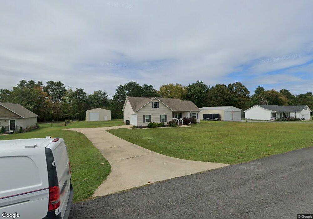
23 Michael Cir NE Fort Payne, AL 35967
Estimated Value: $289,469 - $302,000
--
Bed
2
Baths
1,436
Sq Ft
$206/Sq Ft
Est. Value
About This Home
This home is located at 23 Michael Cir NE, Fort Payne, AL 35967 and is currently estimated at $295,617, approximately $205 per square foot. 23 Michael Cir NE is a home located in DeKalb County with nearby schools including Wills Valley Elementary School, Williams Avenue Elementary School, and Fort Payne Middle School.
Ownership History
Date
Name
Owned For
Owner Type
Purchase Details
Closed on
Jun 21, 2021
Sold by
Norquist Thomas and Norquist Lisa
Bought by
Brooks Amy
Current Estimated Value
Home Financials for this Owner
Home Financials are based on the most recent Mortgage that was taken out on this home.
Original Mortgage
$190,909
Outstanding Balance
$172,844
Interest Rate
2.9%
Mortgage Type
New Conventional
Estimated Equity
$122,773
Purchase Details
Closed on
Dec 3, 2019
Sold by
Dunn Terry and Dunn Diana
Bought by
Norquist Thomas and Norquist Lisa
Purchase Details
Closed on
Jun 17, 2014
Sold by
Don Don
Bought by
Istwan Edward L and Istwan Debra G
Purchase Details
Closed on
Aug 13, 2013
Sold by
M & B Properties Llc
Bought by
Templeton Don
Home Financials for this Owner
Home Financials are based on the most recent Mortgage that was taken out on this home.
Original Mortgage
$103,120
Interest Rate
4.39%
Mortgage Type
Construction
Create a Home Valuation Report for This Property
The Home Valuation Report is an in-depth analysis detailing your home's value as well as a comparison with similar homes in the area
Home Values in the Area
Average Home Value in this Area
Purchase History
| Date | Buyer | Sale Price | Title Company |
|---|---|---|---|
| Brooks Amy | $189,000 | None Available | |
| Norquist Thomas | $165,000 | None Available | |
| Istwan Edward L | $137,000 | -- | |
| Templeton Don | $12,000 | -- |
Source: Public Records
Mortgage History
| Date | Status | Borrower | Loan Amount |
|---|---|---|---|
| Open | Brooks Amy | $190,909 | |
| Previous Owner | Templeton Don | $103,120 |
Source: Public Records
Tax History Compared to Growth
Tax History
| Year | Tax Paid | Tax Assessment Tax Assessment Total Assessment is a certain percentage of the fair market value that is determined by local assessors to be the total taxable value of land and additions on the property. | Land | Improvement |
|---|---|---|---|---|
| 2024 | $1,033 | $24,040 | $1,300 | $22,740 |
| 2023 | $1,033 | $20,920 | $0 | $0 |
| 2022 | $892 | $20,920 | $1,300 | $19,620 |
| 2021 | $1,381 | $30,680 | $2,600 | $28,080 |
| 2020 | $573 | $13,820 | $1,300 | $12,520 |
| 2019 | $573 | $13,820 | $1,300 | $12,520 |
| 2018 | $572 | $13,800 | $0 | $0 |
| 2017 | $609 | $14,620 | $0 | $0 |
| 2015 | $523 | $12,720 | $0 | $0 |
| 2014 | $54 | $1,200 | $0 | $0 |
Source: Public Records
Map
Nearby Homes
- 3645 Dean Rd NE
- 1 Pumpkin Center Rd NE
- 4102 Fischer Rd NE
- 1046 Susan Dr NE
- 6124 Oakhill Rd NE
- 2020 Pleasant View Rd NE
- 4200 Citadel Rock Rd
- 4235 Citadel Rock Rd
- 4210 Citadel Rock Rd
- 4250 Citadel Rock Rd
- 10.57 Citadel Rock Rd NE
- 2614 Aberdeen Ln NE
- 1512 Skyline Ave E
- 2115 County Road 166
- 416 Leath Dr NE
- 5903 Morrow Rd NE
- 401 38th St NE
- 55 Sola Cir NE
- 403 Oakview Ln NE
- 0.34 acres Shady Ln NE
- 23 Michael Cir
- 21 Michael Cir NE
- 25 Michael Cir NE
- 25 Michael Cir NE
- 21 Michael Cir NE
- 19 Michael Cir NE
- 22 Michael Cir NE
- 27 Michael Cir NE
- 35 Michael Cir NE
- 24 Michael Cir
- 20 Michael Cir
- 15 Michael Cir
- 13 Michael Cir
- 7 Michael Cir
- 32 Michael Cir
- 17 Michael Cir
- 0 Michael Cir Unit 327335
- 0 Michael Cir Unit 327334
- 0 Michael Cir Unit 327333
- 0 Michael Cir Unit 327332